Jericho in Oxford in Oxfordshire, England, United Kingdom — Northwestern Europe (the British Isles)
Welcome to Jericho
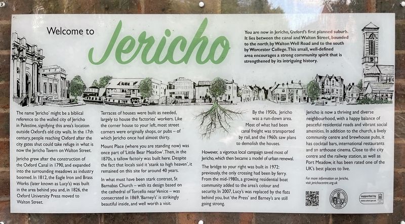
Photographed by Ray Gurganus, May 20, 2026
1. Welcome to Jericho Marker
The name 'Jericho' might be a biblical reference to the walled city of Jericho in Palestine, signifying this area's location outside Oxford's old city walls. In the 17th century, people reaching Oxford after the city gates shut could take refuge in what is now the Jericho Tavern on Walton Street.
Jericho grew after the construction of the Oxford Canal in 1790, and expanded into the surrounding meadows as industry boomed. In 1812, the Eagle Iron and Brass Works (later known as Lucy's) was built in the area behind you and, in 1826, the Oxford University Press moved to Walton Street.
Terraces of houses were built as needed, largely to house the factories' workers. Like the corner house to your left, most street corners were originally shops, or pubs - of which Jericho once had almost thirty.
Mount Place (where you are standing
this page online
In what must have been stark contrast, St Barnabas Church with its design based on the cathedral of Torcello near Venice-was consecrated in 1869. 'Barney's' is strikingly beautiful inside, and well worth a visit.
By the 1950s, Jericho was a run-down area. Most of what had been canal freight was transported by rail, and the 1960s saw plans to demolish the houses.
However, a vigorous local campaign saved most of Jericho, which then became a model of urban renewal.
The bridge to your right was built in 1972: previously, the only crossing had been by ferry. From the mid-1980s, a growing residential boat community added to the area's colour and security. In 2007, Lucy's was replaced by the flats behind you, but 'the Press' and Barney's are still going strong.
Jericho is now a thriving and diverse neighbourhood, with a happy balance of peaceful residential roads and vibrant social amenities. In addition to the church, a lively community centre and brewhouse pubs, it has cocktail bars, international restaurants and an arthouse cinema. Close to the city. centre and the railway station, as well as Port Meadow, it has been rated one of the UK's best places to live.
Topics. This historical marker is listed in this topic list: Settlements & Settlers.
Location. 51° 45.553′ N, 1° 16.231′ W. Marker is in Oxford, England, in Oxfordshire. It is in Jericho. It can be reached from Canal Street, on the left when traveling north. Touch for map. Marker is at or near this postal address: 23 Canal Street, Oxford, England OX2 6BZ, United Kingdom. Touch for directions.

Regionally, this marker is in the Greater South East. Globally, it is on the Atlantic Ocean, in the North Atlantic Region, in Europe, in Atlantic Europe, on one of the British Isles, in the Western World, and in the Anglosphere. Historically, it finds itself in what was once the Roman Empire.
Other nearby markers. At least 8 other markers are within walking distance of this marker: Welcome to the Rewley Road Swing Bridge (approx. 0.4 kilometers away); Beaumont Palace (approx. 0.7 kilometers away); Oxford War Memorial (approx. 0.7 kilometers away); Hythe Bridge Street (approx. 0.7 kilometers away); St Giles’ (approx. 0.8 kilometers away); Park End Street (approx. 0.8 kilometers away); Baptists of Oxford (approx. 0.8 kilometers away); William Wilkinson (approx. 0.8 kilometers away). Touch for a list and map of all markers in Oxford.
Credits. This page was last revised on September 29, 2026. It was originally submitted on September 27, 2026, by Ray Gurganus of Washington, District of Columbia. This page has been viewed 5 times since then. Photo 1. submitted on September 27, 2026, by Ray Gurganus of Washington, District of Columbia. • Andrew Ruppenstein was the editor who published this page.
Editor’s want-list for this marker. photo of the marker within its surroundings • Can you help?
