Newport in Newport County, Rhode Island — The American Northeast (New England)
Joseph Record House
415 Thames Street
| — | Southern Thames Historic District | — |
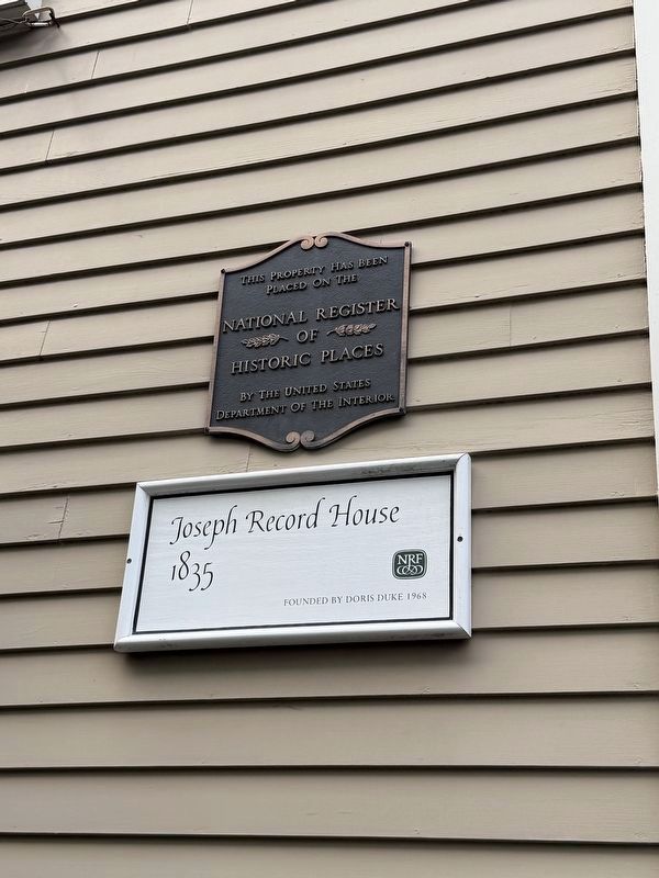
placed on the
National Register
of
Historic Places
by the United States
Department of the Interior
Joseph Record House
1835
NRF
Founded by Doris Duke 1968
Erected by Newport Restoration Foundation.
Topics. This historical marker is listed in this topic list: Architecture. A significant historical year for this entry is 1835.
Location. 41° 28.916′ N, 71° 18.873′ W. Marker is in Newport, Rhode Island, in Newport County. It is on Thames Street. Touch for map. Marker is at or near this postal address: 415 Thames St, Newport RI 02840, United States of America. Touch for directions.

Regionally, this marker is on Narragansett Bay and in Newport and Aquidneck Island. It is also in the American Northeast, in New England, and on the Eastern Seaboard. Globally, it is in the North Atlantic Region, North America, the Western Hemisphere, the Western World, and the Anglosphere. Historically, it finds itself in what was once one of the original Thirteen Colonies.
Other nearby markers. At least 8 other markers are within walking distance of this marker: Clarke Burdick House (a few
this page online
Also see . . . National Register nomination form. The house is a contributing structure to the Southern Thames Historic District, and is named the C.H. Burdick House. The form was prepared by Catherine W. Zipf, with William McKenzie Woodward and Pamela Kennedy, for Salve Regina University and the Rhode Island Historical Preservation & Heritage Commission in May 2008. The statement of historical significance for the district begins on page 6:
The Southern Thames Historic District is set in the port city of Newport on a west sloping, harborside location. It includes a large neighborhood divided into a grid of narrow lots by two major north-south arteries, Thames Street and Spring Street, and by many cross streets running east-west upthe hill from the waterfront.
Historically a mostly working-class Irish neighborhood (though dating back in its origins to the 17th century), the Southern Thames area flourished and expanded between 1850 and 1920, experienced a stable period in the mid-20th century, until once again it became a desirable neighborhood in the 1980s. Physically, the area's building stock is overwhelmingly late-19th-century compact, unassuming, cohesive. The district is divided into three areas: a residential area, the Thames Street commercial corridor, and the waterfront.
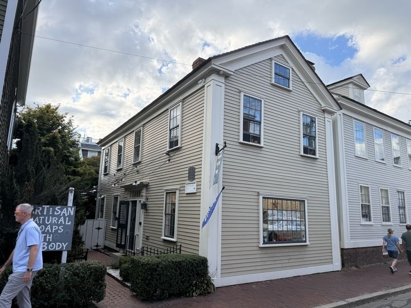
An architectural description of the specific house is found on page 120 (Item 415):
C.H. Burdick House (ca 1845): A 2 1/2-story Greek Revival house set gable end to the street with a stone foundation, 3-bay center-entrance south-facing façade, pilaster-framed principal entrance with sidelights and transom light capped by a projecting lintel, symmetrical 2-bay east elevation facing Thames Street, pilaster strips at the corners, 6-over-6 windows, and center chimney on the ridgeline. Burdick was a partner in Cranston & Burdick, one of Newport's prominent 19th-century construction firms; Burdick lived at 353 Spring Street (q.v.); this may well have been an income-producing property.(Submitted on September 27, 2026, by Devry Becker Jones of Washington, District of Columbia.)
Credits. This page was last revised on September 27, 2026. It was originally submitted on September 27, 2026, by Devry Becker Jones of Washington, District of Columbia. This page has been viewed 6 times since then. Photos: 1, 2. submitted on September 27, 2026, by Devry Becker Jones of Washington, District of Columbia.
