New Brighton in Ramsey County, Minnesota — The American Midwest (Upper Plains)
New Brighton World War I Memorial
Veterans of World War I
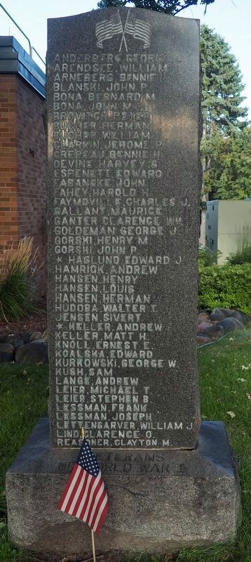
Photographed by McGhiever, August 23, 2025
1. New Brighton World War I Memorial obverse
Anderberg, George L. • Arendsee, William • Arneberg, Bennie • Blanski, John P. • Bona, Bernard M. • Bona, John M. • Brovitch, Peter • Bucher, William • Clarkin, Jerome P. • Crepeau, Bennie H. • Devine, Harvey S. • Espenett, Edward • Fabanske, John • Fahey, Harold H. • Faymoville, Charles J. • Gallant, Maurice • Ganter, Clarence Wm. • Goldeman, George J. • Gorski, Henry M. • Gorski, John P. • *Haglund, Edward J. • Hamrick, Andrew • Hansen, Henry • Hansen, Louis • Hansen, Herman • Hudoba, Walter T. • Jensen, Sivert • *Keller, Andrew • Keller, Matt H. • Knoll, Ernest E. • Koalska, Edward • Kurkowski, George W. • Kush, Sam • Lange, Andrew • Leier, Michael T. • Leier, Stephen B. • Lessman, Frank • Lessman, Joseph • Lettengarver, William J. • Lind, Clarence O. • Reasoner, Clayton M. • Linder, Arthur • Linder, Leroy • Loriewski, Frank • Malaske, Frank • Malinofski, Fred H. • Malinofski, William F.C. • *Millam, Cresswell L. • Moga, John • Molitor, Frank W. • Olchefski, Anton I. • Olson, David • *Olson, Walter • Perron, Elmer F. • Podlasek, Stanley J. • Rasmussen, Severin A. • Rehbein, Edward A. • Reasoner, Shirley W. • Richardson, Carroll H. • *Schafman, Walter Wm. • Shaub, Otto E. • Searles, Coy B. • Sinna, Andrew • Skiba, Albert • Skiba, Martin A. • Soika, Martin • Sommerfeldt, William E. • Steinke, William • Sztuk, John F. • Sztuk, Joseph • Swanson, Anton W. • Szymczak, Frank J. • Tima, Alexander P. • Toner, Hugh D. • Toner, William H. • Treat, James R. • Volkmann, Raymond • Walum, Einar • Weaver, Russell H. • Winiecke, Joseph • Zamor, Felix • Zamor, John J. • Devine, Clarence D. • Rybak, Stanley
Erected 1926.
Topics. This memorial is listed in this topic list: War, World I.
Location. 45° 3.781′ N, 93° 11.576′ W. Memorial is in New Brighton, Minnesota,
this page online

Regionally, this memorial is in the Twin Cities Metropolitan Area. It is also in the American Midwest, in the Corn Belt, and in the Great River Road Region. Globally, it is in North America, the Western Hemisphere, the Western World, and the Anglosphere. Historically, it finds itself in what was once Rupert’s Land, the territory of the Mississippian Culture, and the Louisiana Purchase.
Other nearby markers. At least 8 other markers are within 5 miles of this marker, measured as the crow flies: Moore Lake: A trip through time (approx. 3 miles away); Planting for Clean Water (approx. 3 miles away); Bicycle Paths (approx. 3.6 miles away); Riedel Farmhouse (approx. 4.4 miles away); Northeast Park Neighborhood (approx. 4.4 miles away); The Quarry (approx. 4.4 miles away); New Bridge Planning Process and Design
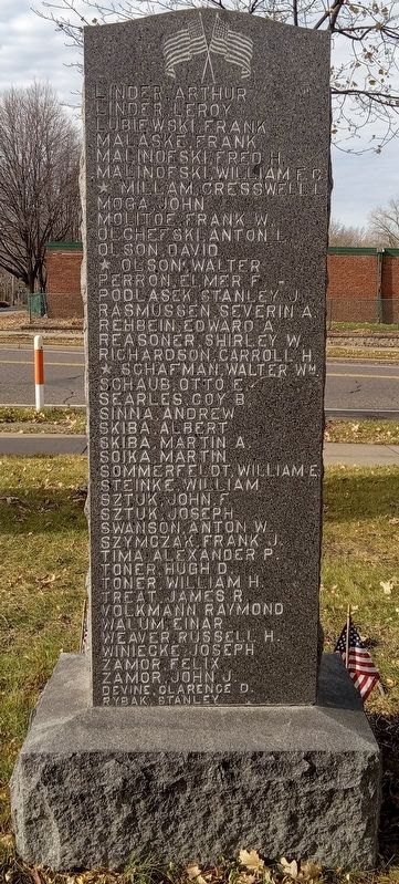
Photographed by McGhiever, November 22, 2023
2. New Brighton World War I Memorial reverse
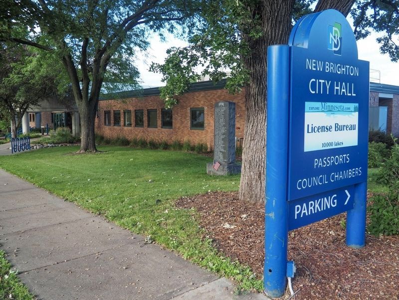
Photographed by McGhiever, August 23, 2025
3. New Brighton World War I Memorial at the southwest corner of New Brighton City Hall
Credits. This page was last revised on September 27, 2026. It was originally submitted on September 27, 2026, by McGhiever of Minneapolis, Minnesota. This page has been viewed 3 times since then. Photos: 1, 2, 3. submitted on September 27, 2026, by McGhiever of Minneapolis, Minnesota.
