Kyneton in Macedon Ranges Shire, Victoria, Australia — Oceania
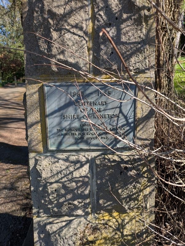
Centenary of the Shire of Kyneton
Photographed by Dean Barton-Ancliffe, August 31, 2026
1. Centenary of the Shire of Kyneton Marker
Centenary
of the
Shire of Kyneton
Unveiled by
The Honourable R.J. Hamer E.D. M.L.C.
Minister for Local Government
30th August 1965.
Erected 1965.
Topics. This historical marker is listed in this topic list: Political Subdivisions. A significant historical date for this entry is August 30, 1865.
Location. 37° 15.266′ S, 144° 27.129′ E. Marker is in Kyneton, Victoria, in Macedon Ranges Shire. It is at the intersection of Mollison Street (Route C318) and McKenna Memorial Drive, on the left when traveling north on Mollison Street. Touch for map. Marker is at or near this postal address: 17 Mollison Street, Kyneton VIC 3444, Australia. Touch for directions.

Regionally, it is in Oceania, in Australasia, in the Pacific Ocean, in South Pacific, on the Pacific Rim, in the Western World, and in the Anglosphere. Historically, it finds itself in what was once a British colony.
Other nearby markers. At least 8 other markers are within walking distance of this marker: McKenna Memorial Drive (a few steps from this marker); Kyneton Botanical Gardens (within shouting distance of this marker); Greetings to Taungurung Country - Northern Marker
this page online
Also see . . . Shire of Kyneton. Wikipedia
The Shire of Kyneton was a local government area about 85 kilometres (53 mi) northwest of Melbourne, the state capital of Victoria, Australia. The shire covered an area of 725.2 square kilometres (280.0 sq mi), and existed from 1859 until 1995.(Submitted on September 27, 2026, by Dean Barton-Ancliffe of Rowville, Victoria.)
Kyneton was incorporated as a road district on 8 February 1859, and became a shire on 18 January 1865. Martin McKenna, a brewer, miner, pastoralist and politician, was the first president of the Shire of Kyneton.
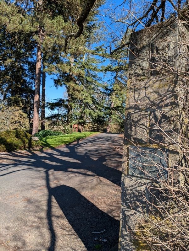
On 5 February 1913 and 9 October 1921, it annexed parts of the Shires of Bacchus Marsh and Ballan respectively, while on 1 October 1915, it absorbed the Borough of Malmsbury, which had been created on 19 October 1861 with an area of 17.05 squarekilometres (6.58 sq mi).Photographed by Dean Barton-Ancliffe, August 31, 20262. Centenary Marker at the entrance to the Kyneton Botanic Gardens
On 19 January 1995, the Shire of Kyneton was abolished, and along with the Shires of Gisborne, Newham and Woodend and Romsey, was merged into the newly created Shire of Macedon Ranges. A small part of the shire was also transferred to the newly created Hepburn Shire.
Credits. This page was last revised on November 5, 2026. It was originally submitted on September 27, 2026, by Dean Barton-Ancliffe of Rowville, Victoria. This page has been viewed 8 times since then. Photos: 1, 2. submitted on September 27, 2026, by Dean Barton-Ancliffe of Rowville, Victoria. • Andrew Ruppenstein was the editor who published this page.
