Binnenstad in Delft, South Holland, Netherlands — Northwestern Europe
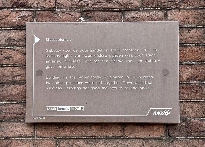
Stadsboterhuis
⎯⎯⎯
“Municipal Butter House”
Photographed by Andrew Ruppenstein, September 3, 2026
1. Stadsboterhuis / Municipal Butter House Marker

Gebouw voor de boterhandel. In 1765 ontstaan door de samenvoeging van twee oudere panden waarvoor stadsarchitect Nicolaas Terburgh een nieuwe voor- en achter- ontwierp.
Erected by Maak kennis in Delft, ANWB, VVV. (Marker Number 63955/001.)
Topics. This historical marker is listed in these topic lists: Architecture • Industry & Commerce. A significant historical year for this entry is 1765.
Location. 52° 0.665′ N, 4° 21.492′ E. Marker is in Delft, Zuid-Holland (South Holland). It is in Binnenstad. It is on Markt, on the left when traveling north. Touch for map. Marker is at or near this postal address: Markt 17, Delft, Zuid-Holland 2611 DX, Netherlands. Touch for directions.

Regionally, it is in Europe, the European Union, Atlantic Europe, the Benelux Low Countries, the Schengen Area, Western Europe, and the Western World. Historically, it finds itself in what was once the Roman Empire and specifically also the
this page online
Other nearby markers. At least 8 other markers are within walking distance of this marker: Huis “Het Tonnetgen” (within shouting distance of this marker); Gezicht op Delft… / The View of Delft… (within shouting distance of this marker); Stadhuis / Town Hall (within shouting distance of this marker); Vleeshal / Meathall (within shouting distance of this marker); Antoni van Leeuwenhoek (about 90 meters away, measured in a direct line); Meisjeshuis / Orphanage for Girls (about 90 meters away); Heilige Geestkapel / Holy Ghost Chapel (about 120 meters away); Deze gevelsteen / This Gable Stone (about 120 meters away). Touch for a list and map of all markers in Delft.
Also see . . . Delftse mysteries: Hoe komt het Stadsboterhuis aan zijn naam? (Indebuurt Delft, 1 June 2018). Excerpt (in translation):
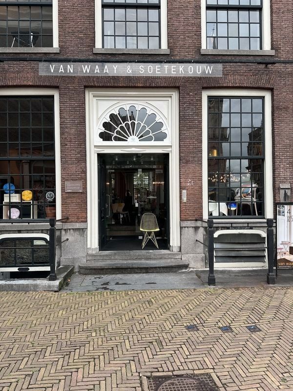
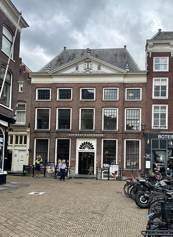
Delft Butter: It might sound strange now, but Delft was once famous—both at home and abroad—for its butter. This butter was produced in what is now Midden-Delfland and the Harnaschpolder. Many dairy farms were located there, producing excellent butter and cheese. A description of Delft from 1828 states: “Delft(Submitted on September 29, 2026.)lies in a very fertile region known as Delftland, renowned everywhere for the excellent butter it produces.”Photographed by Andrew Ruppenstein, September 3, 20262. Stadsboterhuis / “Municipal Butter House” Marker - wide viewThe marker is visible here to the left of the door.
Only genuine Delft butter could be sold at the Stadsboterhuis (City Butter House). The city authorities strictly ensured that it was not mixed with other butter. Butter not produced in the Delft area had to be traded behind the butter house on the Boterbrug (Butter Bridge)—which explains exactly how it got its name.
Photographed by Andrew Ruppenstein, September 3, 2026
3. Stadsboterhuis / “Municipal Butter House”
Photographed by Andrew Ruppenstein, September 3, 2026
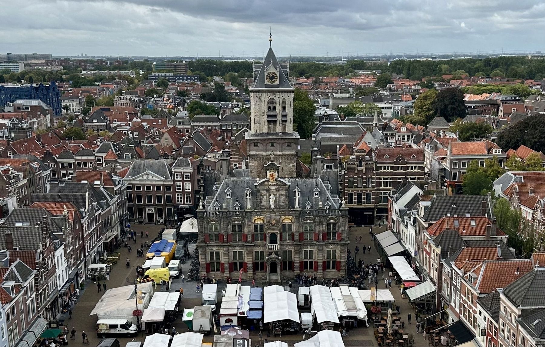
4. Stadsboterhuis - wider view
Taken from the tower of the Nieuwe Kerk, looking west with a view of part of the Delft market square, the city hall (front and center), and the Stadsboterhuis (to left of and behind the city hall).
Credits. This page was last revised on September 29, 2026. It was originally submitted on September 29, 2026, by Andrew Ruppenstein of Lamorinda, California. This page has been viewed 10 times since then. Photos: 1, 2, 3, 4. submitted on September 29, 2026, by Andrew Ruppenstein of Lamorinda, California.
