St Katharine's & Wapping in Tower Hamlets in Greater London, England, United Kingdom — Northwestern Europe (the British Isles)
Pushing Back the River
Discover the Palace Story
Photographed by Ian Lefkowitz, September 11, 2026
1. Pushing Back the River Marker

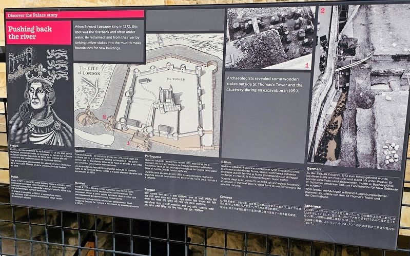
When Edward I became king in 1272, this spot was the riverbank and often under water. He reclaimed land from the river by sinking timber stakes into the mud to make foundations for new buildings.
Archaeologists revealed some wooden stakes outside St Thomas’s Tower and the causeway during an excavation in 1959.
En 1272, au couronnement du roi Édouard 1er, ce site était la rive du fleuve et souvent inondé. Le roi gagna du terrain sur le fleuve en faisant planter des pilotis de bois dans la boue afin de construire des fondations pour de nouveaux bâtiments. Des archéologues découvrirent des pilotis en bois à l’extérieur de la tour Saint-Thomas et de la chaussée lors de fouilles en 1959.
Cuando Eduardo I se convirtió en rey en 1272, este lugar era la ribera del río, y a menudo, estaba sumergido. El rey ganó terreno al río hundiendo estacas de haya en el lodo y así crear los cimientos para nuevas edificaciones. Los arqueólogos descubrieron estacas de madera fuera de la Torre de Santo Tomás y el paso elevado durante una excavación de la torre en 1959.
Quando Eduardo I se tornou
this page online
Quando Eduardo I divenne sovrano nel 1272, in questo punto si trovava la sponda del fiume, spesso sommerso da quest’ultimo. Edoardo sottrasse questo terreno immergendo nel fango pali di faggio e creando le fondamenta per i nuovi edifici. Durante degli scavi condotti nel 1959, gli archeologi trovarono alcuni pali di legno all’esterno della torre di San Tommaso e del sentiero rialzato.
[Deutsch:]
Zu der Zeit, als Eduard I. 1272 zum König gekrönt wurde, lag diese Stelle am Fluss und stand oft unter Wasser. Er konnte dem Fluss Ufer abgewinnen, indem er Buchenpfähle im Schlamm versenken ließ, um Fundamente für neue Gebäude zu schaffen. 1959 fanden Archäologen während Ausgrabungsarbeiten mehrere Holzpfähle vor dem St Thomas’s Tower und der Dammstraße.
Kiedy w 1272 r. Edward I został królem, miejsce to było często
Photographed by Ian Lefkowitz, September 11, 2026
2. Pushing Back the River Marker
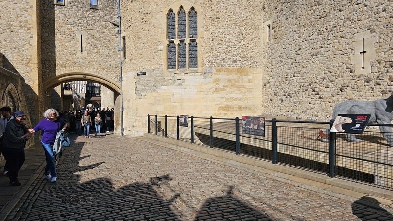
The marker is located within the Tower of London, adjacent to Wakefield Tower. It is the marker on the left in this photograph.
Когда в 1272 г. Эдуард I стал королём, это место было отмелью реки и часто оказывалось затопленным. Он заказывания фундаменты под новые здания в грязи для закладывания фундамента, вбивая сваи в грунт. В 1959 г. археологи обнаружили несколько деревянных свай снаружи Башни Св. Томаса и мостовой во время раскопок в 1959 г.
প্রথম এডওয়ার্ড যখন 1272 এ রাজা হয়েছিলেন, এই জায়গাটি ছিল নদীর তীরে এবং প্রায়ই জলের তলায় ডুবে যেত। রাজা নদীর তলায় জমিতে বীচ কাঠের খুঁটি পুঁতিয়ে মাটি ভরাট করে নতুন ভবন নির্মাণের কাজ শুরু করার ভিত্তি স্থাপন করেন। কাজের নাম গাজের এবং হুরিয়ে নদী থেকে জমি উদ্ধার করেছিলেন।
প্রত্নতাত্ত্বিকরা 1959 এ একটি খনকার্যের সময় সেন্ট টমাস টাওয়ারের বাইরে এক জলের উপর নির্মিত পাথ কিছু গাছের এবং খুঁটি পেয়েছিলেন।
1272年爱德华一世即位后,此处变成河堤,经常处于水面之下。国王下令填河拓地,将山毛榉桩打入淤泥中,作为地基修建新建筑。
1959年,考古学家在挖掘中于圣汤玛斯之塔外发现了一些木桩和堤道。
1272年にエドワード一世が王位に就いたころ、この場所は河岸にありしばしば水没していました。国王は川床にブナ材の杭を打ち込んで埋め立てを行い、新しい建物の基礎工事を行いました。
1959年の発掘により、セント・トマス・タワーの外の木杭と土手道が見つかりました。
(Captions)
Archaeologists revealed some wooden stakes outside St Thomas’s Tower and the causeway during an excavation in 1959.
© Oxford Archaeology
প্রথম এডওয়ার্ড যখন 1272 এ রাজা হয়েছিলেন, এই জায়গাটি ছিল নদীর তীরে এবং প্রায়ই জলের তলায় ডুবে যেত। রাজা নদীর তলায় জমিতে বীচ কাঠের খুঁটি পুঁতিয়ে মাটি ভরাট করে নতুন ভবন নির্মাণের কাজ শুরু করার ভিত্তি স্থাপন করেন। কাজের নাম গাজের এবং হুরিয়ে নদী থেকে জমি উদ্ধার করেছিলেন।
প্রত্নতাত্ত্বিকরা 1959 এ একটি খনকার্যের সময় সেন্ট টমাস টাওয়ারের বাইরে এক জলের উপর নির্মিত পাথ কিছু গাছের এবং খুঁটি পেয়েছিলেন।
1272年爱德华一世即位后,此处变成河堤,经常处于水面之下。国王下令填河拓地,将山毛榉桩打入淤泥中,作为地基修建新建筑。
1959年,考古学家在挖掘中于圣汤玛斯之塔外发现了一些木桩和堤道。
1272年にエドワード一世が王位に就いたころ、この場所は河岸にありしばしば水没していました。国王は川床にブナ材の杭を打ち込んで埋め立てを行い、新しい建物の基礎工事を行いました。
1959年の発掘により、セント・トマス・タワーの外の木杭と土手道が見つかりました。
Erected by Historic Royal Palaces.
Topics. This historical marker is listed in these topic lists: Architecture • Forts and Castles. A significant historical year for this entry is 1272.
Location. 51° 30.451′ N, 0° 4.593′ W. Marker is in Tower Hamlets, England, in Greater London. It is in St Katharine's & Wapping. It can be reached from the intersection of Tower Bridge Approach and Tower Hill, on the left when traveling north. Touch for map. Marker is in this post office area: Tower Hamlets, England EC3N 4DT, United Kingdom. Touch for directions.

Regionally, this marker is in London and in the Greater South East. Globally, it is on the Atlantic Ocean, in the North Atlantic Region, in Europe, in Atlantic Europe, on one of the British Isles, in the Western World, and in the Anglosphere. Historically, it finds itself in what was once the Roman Empire.
Other nearby markers. At least 8 other markers are within walking distance of this marker: Royal Beasts (here, next to this marker); Traitors' Gate (a few steps from this marker); Iron 24 pounder Guns (a few steps from this marker); Iron 36 pounder Guns (within shouting distance of this marker); Iron 32 pounder Gun (within shouting distance of this marker); St Thomas's Tower (within shouting distance of this marker); a different marker also named Iron 32 pounder Gun (within shouting distance of this marker); Iron 12 pounder Gun (within shouting distance of this marker). Touch for a list and map of all markers in Tower Hamlets.
Other markers no longer nearby. The Lost Palace (was a few steps from this marker but has been replaced with another marker now near it); A Royal River View (was within shouting distance of this marker but has been replaced with another marker now near it).
Credits. This page was last revised on September 29, 2026. It was originally submitted on September 29, 2026, by Ian Lefkowitz of New York, New York. This page has been viewed 6 times since then. Photos: 1, 2. submitted on September 29, 2026, by Ian Lefkowitz of New York, New York. • Andrew Ruppenstein was the editor who published this page.
