Ouderkerk aan de Amstel in Ouder-Amstel, North Holland, Netherlands — Northwestern Europe
Amstelkerk
Photographed by Andrew Ruppenstein, September 1, 2026
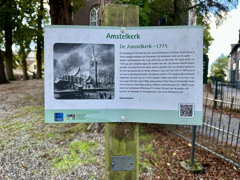
1. Amstelkerk Marker

De Amstelkerk (1775) heeft de vorm van een Grieks kruis. Ontwerp: Jacob Eduard de Witte, stadsbouwmeester van Amsterdam. De kerkheuvel is één van de oudste plekken van Amstelland. Het is de vierde kerk op deze plek. Het eerste kerkje (ca. 1100) was een tufstenen kapel. De tweede was van 13e eeuwse kloostermoppen gemaakt. De derde kerk (14e eeuw) werd in gotische stijl van baksteen gebouwd. Die kerk was gewijd aan de Heilige Urbanus I, paus van 222-230. In 1585 ging de kerk over in protestantse handen. Het gebouw werd in 1773 wegens bouwvalligheid afgebroken. De toren was al in 1674 ingestort tijdens een storm. In de kerk is een mooi orgel: Het Flaes-orgel (1885), gebouwd door Pieter Flaes uit Amsterdam Naast de kerk staan de voormalige pastorie (1890) en diaconiehuisjes (ca. 1880). Vroeger stond hier buitenplaats Wiltenburg (17e eeuw). De poort van de pastorie, het hekwerk, de theekoepel en de wagenschuur zijn uit de Wiltenburg-tijd.
Rijksmonument
The Amstelkerk (1775) is shaped like a Greek cross. It was designed by Jacob Eduard de Witte, the city architect
this page online
National Monument
Erected by Gemeente Ouder Amstel, Historisch Kwartier Ouderkerk.
Topics. This historical marker is listed in this topic list: Religion & Religious Structures. A significant historical year for this entry is 1775.
Location. 52° 17.759′ N,
Photographed by Andrew Ruppenstein
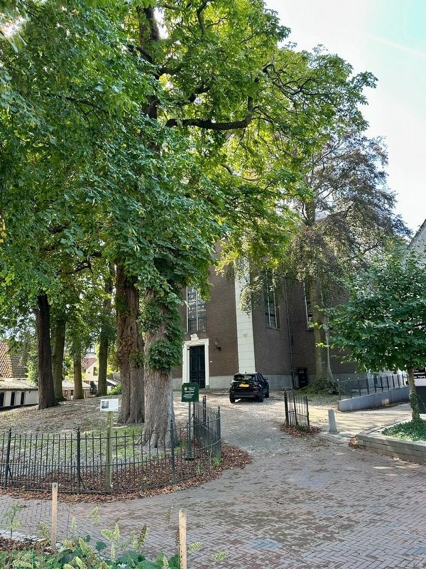
2. Amstelkerk Marker - wide view, with the church in the background

Regionally, it is in Europe, the European Union, Atlantic Europe, the Benelux Low Countries, the Schengen Area, Western Europe, and the Western World. Historically, it finds itself in what was once the Holy Roman Empire.
Other nearby markers. At least 8 other markers are within walking distance of this marker: Witte huis / White House (within shouting distance of this marker); D’Corendrager / “The Grain Carrier” (within shouting distance of this marker); Museum Amstelland (within shouting distance of this marker); Huis met de kettingen / House with the Chains (within shouting distance of this marker); Bakkerij Out / Out Bakery (about 90 meters away, measured in a direct line); Ouderkerk sinds het jaar 1000 / Ouderkerk Since the Year 1000 (about 90 meters away); Kerkbrug/Korte brug / “Church Bridge”/“Short Bridge”
Sergé Technau, courtesy Rijksdienst voor het Cultureel Erfgoed via Wikimedia Commons (CC ), 2005
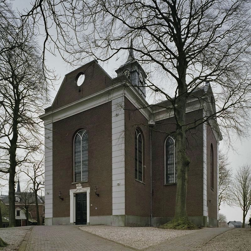
3. Amstelkerk - view of church entrance (street-side)
Also see . . .
1. De Amstelkerk (Youtube, 2:08, in Dutch with English subtitles). (Submitted on September 29, 2026.)
2. Amstelkerk (Historisch Kwartier Ouderkerk, in Dutch). Excerpt (in translation):
The Amstelkerk, the fourth church to stand on this site, is a listed national monument. It was built between 1773 and 1775 after the third church had fallen into such disrepair—its tower having already collapsed in 1674—that the decision was made to demolish it. A new church was constructed using Amsterdam funds, based on a design by Jacob Eduard de Witte, the city architect. Its floor plan follows the Greek cross layout—a common choice in the eighteenth century—and the style is simple, austere Neoclassical, featuring a sparsely decorated interior.(Submitted on September 29, 2026.)
The church is topped by a handsome tower housing a bell frame with a bell cast by Cornelius van Ammeroy in 1603 (118.1 cm in diameter) and a mechanical tower clock dating from around 1880. The organ, built by the Amsterdam-based makers P. Flaes and D. Brünjes, was inaugurated in 1865. It has since undergone numerous improvements, repairs, and restorations, most recently by Flentrop in 2013. Incidentally, the Amstelkerk’s original organ came from the Walloon Church in Haarlem and can still be seen today in the Reformed Church in Holysloot.
During the French period, the church played a role in communications originating from Paris. Messages were relayed to Amsterdam via Lille, Brussels, and Antwerp using the Chappe telegraph—a semaphore or optical telegraph named after its inventor, Claude Chappe. Such a device was installed on the Amstelkerk from 1811 to 1813. Museum Amstelland houses an 1812 watercolor by H. Kruimel depicting the Chappe telegraph.
Credits. This page was last revised on September 29, 2026. It was originally submitted on September 29, 2026, by Andrew Ruppenstein of Lamorinda, California. This page has been viewed 10 times since then. Photos: 1, 2, 3. submitted on September 29, 2026, by Andrew Ruppenstein of Lamorinda, California.
