Zappio in Athina in Kentrikos Tomeas Athinon, Attica, Greece — Ελλάδα (Southeastern Europe, Balkan Peninsula)
Hadrian’s Arch
Η Πύλη του Αδριανού
Photographed by James Hulse, September 19, 2026
1. Hadrian’s Arch Marker

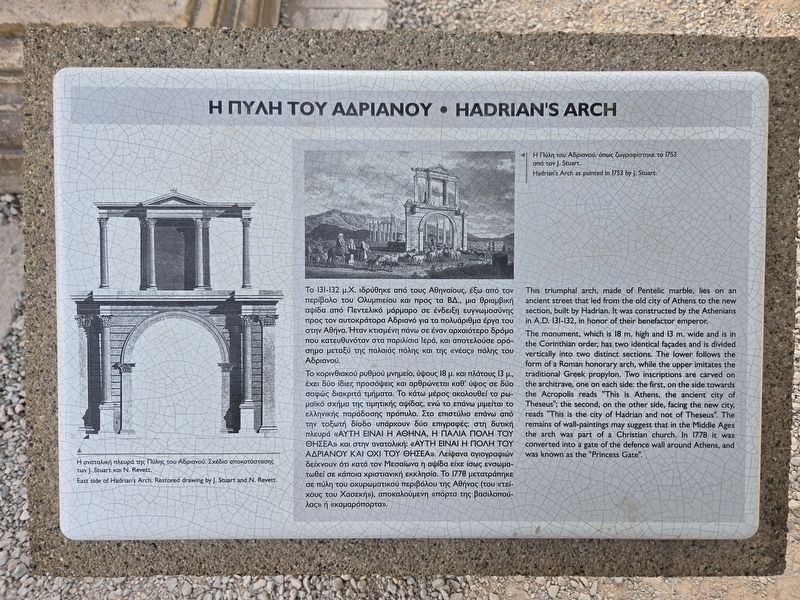
Το 131–132 μ.Χ. ιδρύθηκε από τους Αθηναίους, έξω από τον περίβολο του Ολυμπιείου και προς τα ΒΔ., μια θριαμβική αψίδα από Πεντελικό μάρμαρο σε ένδειξη ευγνωμοσύνης προς τον αυτοκράτορα Αδριανό για τα πολυάριθμα έργα του στην Αθήνα. Ήταν κτισμένη πάνω σε έναν αρχαιότερο δρόμο που κατευθυνόταν στα παρόχθια ιερά, και αποτελούσε ορόσημο μεταξύ της παλαιάς πόλης και της «νέας» πόλης του Αδριανού.
Το κορινθιακού ρυθμού μνημείο, ύψους 18 μ. και πλάτους 13 μ., έχει δύο ίδιες προσόψεις και αρθρώνεται καθ’ ύψος σε δύο σαφώς διακριτά τμήματα. Το κάτω μέρος ακολουθεί το ρωμαϊκό σχήμα της τιμητικής αψίδας, ενώ το επάνω μιμείται το ελληνικής παράδοσης πρόπυλο. Στο επιστύλιο επάνω από την τοξωτή δίοδο υπάρχουν δύο επιγραφές: στη δυτική πλευρά «ΑΥΤΗ ΕΙΝΑΙ Η ΑΘΗΝΑ, Η ΠΑΛΑΙΑ ΠΟΛΗ ΤΟΥ ΘΗΣΕΑ» και στην ανατολική «ΑΥΤΗ ΕΙΝΑΙ Η ΠΟΛΗ ΤΟΥ ΑΔΡΙΑΝΟΥ ΚΑΙ ΟΧΙ ΤΟΥ ΘΗΣΕΑ». Λείψανα αγιογραφιών δείχνουν ότι κατά τον Μεσαίωνα η αψίδα είχε ενσωματωθεί σε κάποια χριστιανική εκκλησία. Το 1778 μετατράπηκε σε πύλη του οχυρωματικού περιβόλου της Αθήνας (του «τείχους του Χασεκή»), αποκαλούμενη «πόρτα της βασιλοπούλας» ή «καμαρόπορτα».
Η ανατολική πλευρά της Πύλης του Αδριανού. Σχέδιο αποκατάστασης των J. Stuart και N. Revett.
Η Πύλη του Αδριανού, όπως ζωγραφίστηκε το 1753 από τον J. Stuart.
This
this page online
The monument, which is 18 m high and 13 m wide and is in the Corinthian order, has two identical façades and is divided vertically into two distinct sections. The lower follows the form of a Roman honorary arch, while the upper imitates the traditional Greek propylon. Two inscriptions are carved on the architrave, one on each side: the first, on the side towards the Acropolis, reads ‘This is Athens, the ancient city of Theseus’; the second, on the other side, facing the new city, reads ‘This is the city of Hadrian and not of Theseus’. The remains of wall paintings may suggest that in the Middle Ages the arch was part of a Christian church. In 1778 it was converted into a gate of the defence wall around Athens and was known as the ‘Princess Gate’.
East side of Hadrian’s Arch. Restored drawing by J. Stuart and N. Revett.
Hadrian’s Arch as painted in 1753 by J. Stuart.
Topics. This historical marker is listed in this topic list: Forts and Castles. A significant historical year for this entry is 1778.
Location. 37° 58.214′ N, 23° 43.925′ E. Marker is in Athina, Attica, in Kentrikos Tomeas Athinon. It is in Zappio. It is on Leoforos Vasilisis Amalias 0.1 kilometers south of Leoforos Vasilissis Olgas, on the right when traveling north. Touch for map. Marker is at or near this postal address: Leof Vasilisis Amalias 50, Athina, Attica 105 57, Greece. Touch for directions.

Regionally, it is in Europe, the European Union, the Balkans, the Schengen Area, a coastal Mediterranean country, and the Western World. Historically, it finds itself in what was once the Byzantine Empire, the Ottoman Empire, and specifically the Roman Empire.
Other nearby markers. At least 8 other markers are within walking distance of this marker: Λόρδος Βύρων / Lord Byron (about 180 meters away, measured in a direct line); Πέρσυ Σέλλεϋ / Percy Bysshe Shelley (about 180 meters away); a different marker also named Λόρδος Βύρων / Lord Byron (about 180 meters away); Μνημείο Λυσικράτη (about 180 meters away); The Ancient Street of the Tripods - The Lysikrates Choregic Monument (about 180 meters away); a different marker also named Μνημείο Λυσικράτη (about 210 meters away); The archaeological excavation (approx. 0.4 kilometers away); The Erechtheion (approx. half a kilometer away). Touch for a list and map of all markers in Athina.
Photographed by James Hulse, September 19, 2026
2. Hadrian’s Arch Marker
Photographed by James Hulse, September 19, 2026
3. Hadrian’s Arch Marker
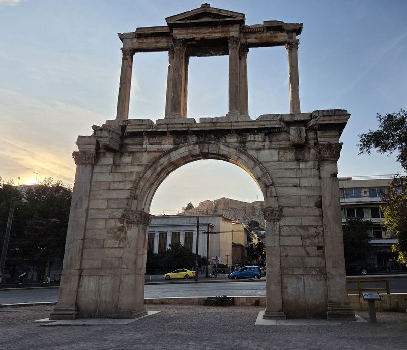
The view of the arch looking west with the Acropolis in the background under the arch.
Photographed by James Hulse, September 19, 2026
4. Hadrian’s Arch Marker
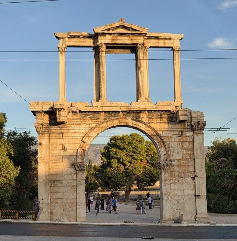
The view of the arch from across the street looking east.
Credits. This page was last revised on October 2, 2026. It was originally submitted on September 30, 2026, by James Hulse of Medina, Texas. This page has been viewed 8 times since then. Photos: 1, 2, 3, 4. submitted on October 1, 2026, by James Hulse of Medina, Texas.
