Raeford in Hoke County, North Carolina — The American South (South Atlantic)
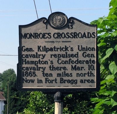
Monroe’s Crossroads
Erected 1954 by North Carolina Archives Conservation and Highway Department. (Marker Number I-43.)
Topics and series. This historical marker is listed in this topic list: War, US Civil. In addition, it is included in the North Carolina Division of Archives and History series list. A significant historical date for this entry is March 10, 1923.
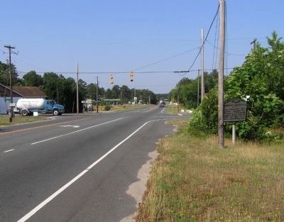
Location. 34° 59.786′ N, 79° 13.554′ W. Marker is in Raeford, North Carolina, in Hoke County. Marker is at the intersection of Fayetteville Road (U.S. 401) and Vass Road (County Road 1300), on the right when traveling west on Fayetteville Road. Touch for map. Marker is in this post office area: Raeford NC 28376, United States of America. Touch for directions.
Other nearby markers. At least 8 other markers are within 12 miles of this marker, measured as the crow flies. Veterans Monument (approx. 1.1 miles away); Edenborough Medical College (approx. 1.6 miles away); Sherman's March (approx. 4 miles away); McPhaul’s Mill (approx. 7.7 miles away); State Sanatorium (approx. 8.1 miles away); Temperance Hall (approx. 11.2 miles away); John Charles McNeill (approx. 11.2 miles away); Gerald Johnson (approx. 11.2 miles away). Touch for a list and map of all markers in Raeford.
Also see . . .
1. Monroe's Crossroads Civil War Battle, Archeology and Public Education, Southeast Archaeological Ctr. Archeology and Public Education at the Site of the Civil War Battle at Monroe's Crossroads, Hoke County, North Carolina (Submitted on May 28, 2010, by PaulwC3 of Northern, Virginia.)
2. The Civil War Battle at Monroe's Crossroads, Fort Bragg, North Carolina: A Historical Archeological. (Submitted on May 28, 2010, by PaulwC3 of Northern, Virginia.)
Credits. This page was last revised on June 16, 2016. It was originally submitted on May 28, 2010, by PaulwC3 of Northern, Virginia. This page has been viewed 1,680 times since then and 47 times this year. Photos: 1, 2. submitted on May 28, 2010, by PaulwC3 of Northern, Virginia.
Editor’s want-list for this marker. Photos of battlefield "Crossroads is located a few miles south of Normandy Dropzone on the border of Coleman Impact Area. Individuals or groups interested in a visit to the site must first coordinate access with Range Control (423-6772) and/or our Cultural Resources Program Office." • Can you help?

