Gouda, South Holland, Netherlands — Northwestern Europe
Pieter Hugesztoren
⎯⎯⎯
Pieter Hugesz Tower
Photographed by Andrew Ruppenstein, September 2, 2026
1. Pieter Hugesztoren / Pieter Hugesz Tower Marker

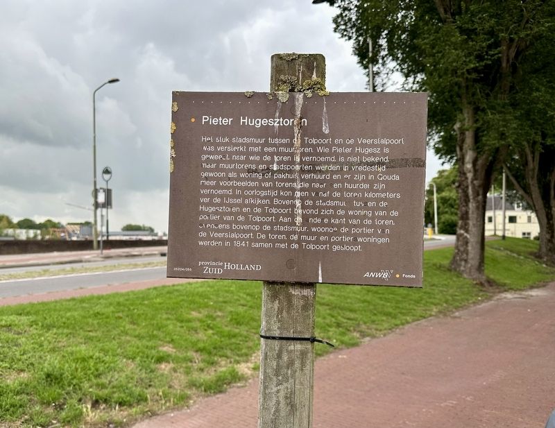
Het stuk stadsmuur tussen Tolpoort en de Veerstalpoort was versterkt met een muurtoren. Wie Pieter Hugesz is geweest, naar wie de toren is vernoemd, is niet bekend, maar muurtorens en stadspoorten werden in vredestijd gewoon als woning of pakhuis verhuurd en er zijn in Gouda meer voorbeelden van torens die naar en huurder zijn vernoemd. In oorlogstijd kon men vanaf de toren kilometers ver de IJssel afkijken. Bovenop de stadsmuur tussen de Hugesztoren en de Tolpoort bevond zich de woning van de portier van de Tolpoort. Aan de andere kant van de toren, eveneens bovenop de stadsmuur, woonde de portier van de Veerstalpoort. De toren, de muur en portierswoningen werden in 1841 samen met de Tolpoort gesloopt.
Pieter Hugesz Tower
The section of the city wall between the Tolpoort and the Veerstalpoort was reinforced with a wall tower. The identity of Pieter Hugesz—after whom the tower was named—is unknown; however, wall towers and city gates were commonly rented out as dwellings or warehouses during peacetime, and there are other examples in Gouda of towers
this page online
Erected by Provincie Zuid Holland, ANWB, VVV. (Marker Number 35204/055.)
Topics. This historical marker is listed in this topic list: Forts and Castles. A significant historical year for this entry is 1841.
Location. 52° 0.422′ N, 4° 42.784′ E. Marker is in Gouda, Zuid-Holland (South Holland). It is on Veerstal, on the left when traveling west. Touch for map. Marker is at or near this postal address: Veerstal 8, Gouda, Zuid-Holland 2801 RB, Netherlands. Touch for directions.

Regionally, it is in Europe, the European Union, Atlantic Europe, the Benelux Low Countries, the Schengen Area, Western Europe, and the Western World. Historically, it finds itself in what was once the Roman Empire
Photographed by Andrew Ruppenstein
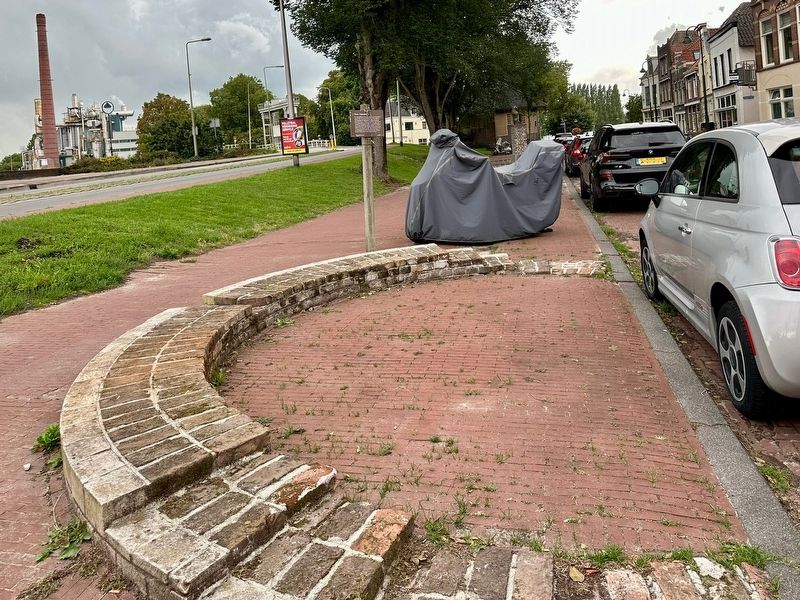
2. Pieter Hugesztoren / Pieter Hugesz Tower remains and marker
Other nearby markers. At least 8 other markers are within walking distance of this marker: Veerstalpoort of Waterpoort / Veerstal Gate or Water Gate (a few steps from this marker); De Sterke Samsom (within shouting distance of this marker); Nieuwe Veerstal en bolwerk de Punt / New Veerstal and the 'De Punt' Bastion (within shouting distance of this marker); Mallegatsluis / Mallegat Lock (about 120 meters away, measured in a direct line); Voormalig postkantoor / Former Post Office (about 180 meters away); Kaaspakhuizen / Cheese Warehouses (about 210 meters away); Erasmus: Westhaven (about 210 meters away); Woonhuis van Arie Blanken / Residence of Arie Blanken (about 210 meters away). Touch for a list and map of all markers in Gouda.
Also see . . . Gouda - De verdedigingswerken (Wim Denslagen, 2001, dbnl, in Dutch). Extended article on Gouda’s historical defenses. The part is the Pieter Hugesztoren is excerpted and translated here:
West of the Tolhuispoort (Toll House Gate), the city wall extended as far as the Pieter Hugesz Tower—named after one of the tenants and likely built in 1429 (Scheygrond, Straten, 1981, 394). Archaeological research in 1992 uncovered a section of the city wall between the gate and the tower, located approximately 4 meters from the Tolhuis itself. The size of the bricks suggests a fourteenth-century date (Archaeological Depot in Gouda, inventory number 9206).(Submitted on September 30, 2026.)
The Pieter Hugesz Tower was a round, crenellated tower also known as the ‘Couden Toorne’ (in 1497) or the ‘Schutterstoren’ (Marksmen’s Tower) (Hulshof, Veerstalgebied, 1993, 33). Its foundations were partially excavated in 1998, revealing that the tower was constructed of brick and reinforced on the exterior with natural stone. A tapering niche containing a loophole formed by two blocks of natural stone was discovered within the foundation. The excavation also uncovered the foundation of the city wall to the west of the tower; this section had collapsed in 1490 and was subsequently repaired. The Pieter Hugesz Tower was modernized in 1497 following the renovation of the city wall (Nieuwsbrief Monumentenzorg, 1999, issue 16).
Credits. This page was last revised on September 30, 2026. It was originally submitted on September 30, 2026, by Andrew Ruppenstein of Lamorinda, California. This page has been viewed 4 times since then. Photos: 1, 2. submitted on September 30, 2026, by Andrew Ruppenstein of Lamorinda, California.
