Little Venice in Mikonos in Mykonos, The Aegean, Greece — Ελλάδα (Southeastern Europe, Balkan Peninsula)
Παραπορτιανή
⎯⎯⎯
Paraportiani
Photographed by James Hulse, September 21, 2026
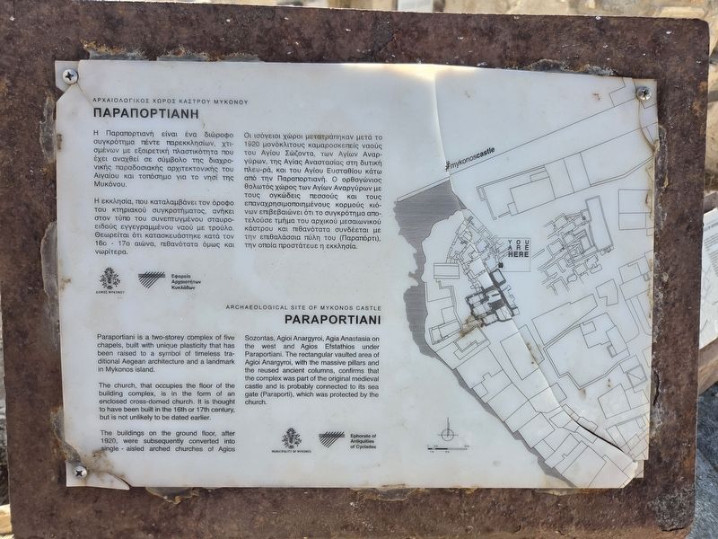
1. Παραπορτιανή / Paraportiani Marker

Αρχαιολογικός Χώρος Κάστρου Μυκόνου
Η Παραπορτιανή είναι ένα διώροφο συγκρότημα πέντε παρεκκλησίων, χτισμένων με εξαιρετική πλαστικότητα που έχει αναχθεί σε σύμβολο της διαχρονικής παραδοσιακής αρχιτεκτονικής του Αιγαίου και τοπόσημο για το νησί της Μυκόνου.
Η εκκλησία, που καταλαμβάνει τον όροφο του κτηριακού συγκροτήματος, ανήκει στον τύπο του συνεπτυγμένου σταυροειδούς εγγεγραμμένου ναού με τρούλο. Θεωρείται ότι κατασκευάστηκε κατά τον 16ο–17ο αιώνα, πιθανότατα όμως και νωρίτερα.
Οι ισόγειοι χώροι μετατράπηκαν μετά το 1920 σε μονόκλιτους καμαροσκεπείς ναούς του Αγίου Σώζοντα, των Αγίων Αναργύρων, της Αγίας Αναστασίας στη δυτική πλευρά και του Αγίου Ευσταθίου κάτω από την Παραπορτιανή. Ο ορθογώνιος θολωτός χώρος των Αγίων Αναργύρων με τους ογκώδεις πεσσούς και τους επαναχρησιμοποιημένους κορμούς κιόνων επιβεβαιώνει ότι το συγκρότημα αποτελούσε τμήμα του αρχικού μεσαιωνικού κάστρου και πιθανότατα συνδέεται με την επιθαλάσσια πύλη του (Παραπόρτι), την οποία προστάτευε η εκκλησία.
Archaeological Site of Mykonos Castle
Paraportiani is a two-storey complex of five chapels, built with unique plasticity that has been raised to a symbol of timeless traditional Aegean architecture and a landmark on Mykonos island.
The church, which occupies the upper floor of the building complex, is in the form of an enclosed cross-domed church. It is thought to have been built in the 16th or 17th century, but it is not unlikely to date earlier.
The buildings on the ground floor, after 1920, were subsequently converted into single-aisled, barrel-vaulted churches of Agios Sozontas, Agioi Anargyroi, Agia Anastasia on the west and Agios Efstathios under Paraportiani. The rectangular vaulted area of Agioi Anargyroi, with the massive pillars and the reused ancient columns, confirms that the complex was part of the original medieval castle and
this page online
Erected by Municipality of Mykonos and Ephorate of Antiquities of Cyclades.
Topics. This historical marker is listed in this topic list: Religion & Religious Structures. A significant historical year for this entry is 1920.
Location. 37° 26.836′ N, 25° 19.543′ E. Marker is in Mikonos, The Aegean, in Mykonos. It is in Little Venice. It is on Agion Anargiron. Touch for map. Marker is at or near this postal address: Ag Anargiron 3, Mikonos, The Aegean 846 00, Greece. Touch for directions.

Regionally, it is in Europe, the European Union, the Schengen Area, a coastal Mediterranean country, and the Western World. Historically, it finds itself in what was once the Byzantine Empire, the Ottoman Empire, and specifically the Roman Empire.
Other nearby markers. At least 8 other markers are within 8 kilometers of this marker, measured as the crow flies: Κάστρο Μυκόνου / Castle of Mykonos (here, next to this marker); Church of Saint Nicholas of Kadena (about 120 meters away, measured in a direct line); The Transfiguration of Christ (about 120 meters away); Εν πολέμω / Fallen in War (about 210 meters away); The Lions of the Naxians (approx. 7.2 kilometers away); Agora of the Italians (approx. 7.3 kilometers away); The Poros Temple (approx. 7.4 kilometers away); Temple of the Athenians (approx. 7.4 kilometers away). Touch for a list and map of all markers in Mikonos.
Photographed by James Hulse
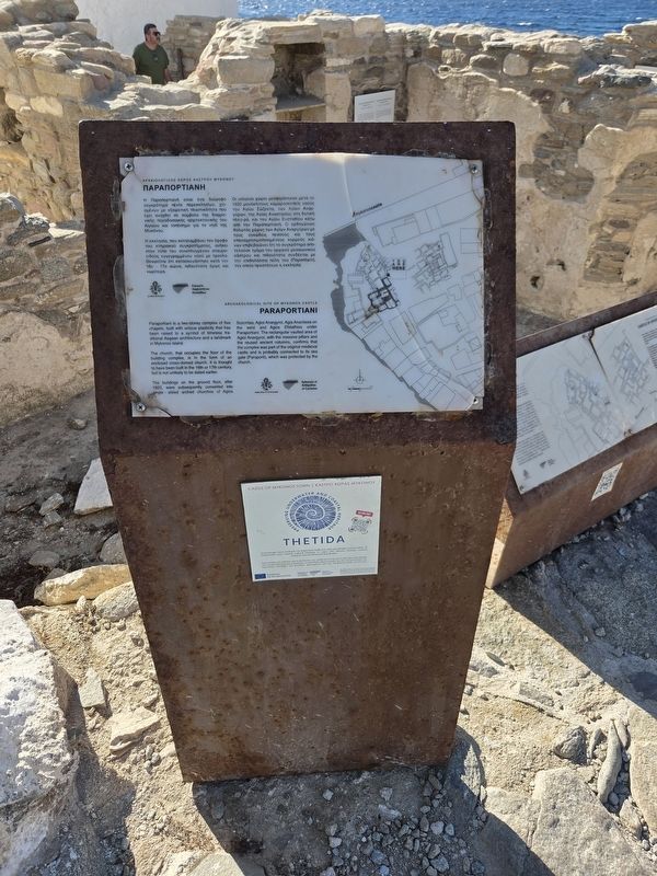
2. Παραπορτιανή / Paraportiani Marker
Photographed by James Hulse, September 21, 2026
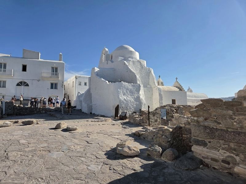
3. Παραπορτιανή / Paraportiani Marker (Left Side)
The north side view of the church with the marker towards the middle.
Photographed by James Hulse, September 21, 2026
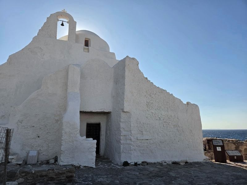
4. Παραπορτιανή / Paraportiani Marker
The eastern view of the church, with the markers at the far right and the dome visible above.
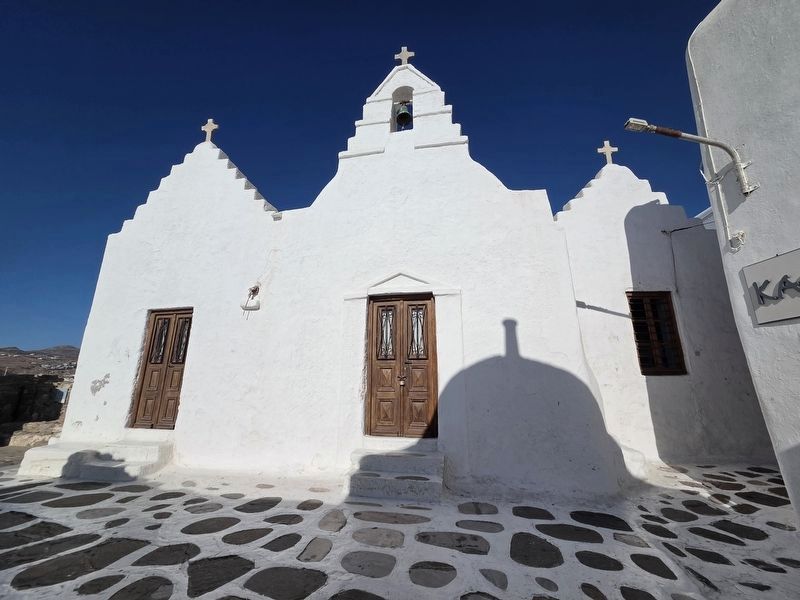
Photographed by James Hulse, September 21, 2026
5. Παραπορτιανή / Paraportiani Marker
The front western view of the Holy Church of Panagia Paraportiani.
Credits. This page was last revised on October 4, 2026. It was originally submitted on October 1, 2026, by James Hulse of Medina, Texas. This page has been viewed 6 times since then. Photos: 1, 2, 3, 4, 5. submitted on October 2, 2026, by James Hulse of Medina, Texas.
