Hopewell Township in Mercer County, New Jersey — The American Northeast (Mid-Atlantic)
Hart’s Corner Schoolhouse
Photographed by Richard Peterson, September 30, 2026
1. Hart's Corner Schoolhouse Marker
30 Years A Neighborhood Classroom
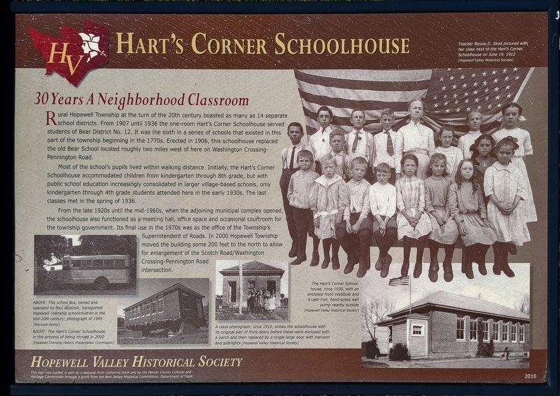
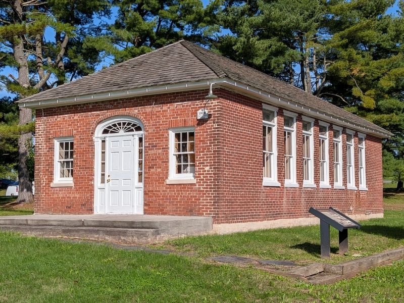
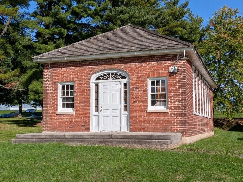
Rural Hopewell Township at the turn of the 20th century boasted as many as 14 separate school districts. From 1907 until 1936 the one-room Hart's Corner Schoolhouse served students of Bear District No. 12. It was the sixth in a series of schools that existed in this part of the township beginning in the 1770s. Erected in 1906, this schoolhouse replaced the old Bear School located roughly two miles west of here on Washington Crossing-Pennington Road.
Most of the school’s pupils lived within walking distance. Initially, the Hart’s Corner Schoolhouse accommodated children from kindergarten through 8th grade, but with public school education increasingly consolidated in larger village-based schools, only kindergarten through 4th grade students attended here in the early 1930s. The last classes met in the spring of 1936.
From the late 1920s until the mid-1960s, when the adjoining municipal complex opened, the schoolhouse also functioned as a meeting hall, office space and occasional courtroom for the township government. Its final use in the 1970s was as the office of the Township's
this page online
Photo captions, clockwise from upper right
– Teacher Bessie D. Sked pictured with her class next to the Hart’s Corner Schoolhouse on June 19, 1912 [Hopewell Valley Historical Society]
– The Hart’s Corner School-house, circa 1930, with an enclosed front vestibule and a cast-iron, hand-press well pump nearby outside [Hopewell Valley Historical Society]
– A class photograph, circa 1910, shows the schoolhouse with its original pair of front doors before these were enclosed with a porch and then replaced by a single large door with transom and sidelights [Hopewell Valley Historical Society]
– RIGHT: The Hart’s Corner Schoolhouse in the process of being moved in 2000 [Hopewell Township Historic Preservation Commission]
– ABOVE: This school bus, owned and operated by Paul Astalosh, transported Hopewell Township schoolchildren in the mid-20th century; photograph of 1949 [Warznak family]
Hopewell Valley Historical Society
This sign was funded
Photographed by Richard Peterson, September 30, 2026
2. Hart’s Corner Schoolhouse, Marker
Erected 2018 by Hopewell Valley Historical Society.
Topics. This historical marker is listed in this topic list: Education. A significant historical year for this entry is 1906.
Location. 40° 18.575′ N, 74° 48.793′ W. Marker is in Hopewell Township, New Jersey, in Mercer County. It is at the intersection of Scotch Road and Washington Crossing Pennington Road, on the left when traveling north on Scotch Road. Touch for map. Marker is in this post office area: Pennington NJ 08534, United States of America. Touch for directions.

Regionally, this marker is in Central Jersey and in Greater Princeton. It is also in the American Northeast and in the Mid-Atlantic. Globally, it is in North America, the Western Hemisphere, the Western World, and the Anglosphere. Historically, it finds itself in what was once New Netherland and also one of the original Thirteen Colonies.
Other nearby markers. At least 8 other markers are within 2 miles of this marker,
Photographed by Richard Peterson, September 30, 2026
3. Hart’s Corner Schoolhouse
Credits. This page was last revised on October 5, 2026. It was originally submitted on October 1, 2026, by Richard Peterson of East Windsor, New Jersey. This page has been viewed 12 times since then. Photos: 1, 2, 3. submitted on October 1, 2026, by Richard Peterson of East Windsor, New Jersey. • Andrew Ruppenstein was the editor who published this page.
