Boston in Lincolnshire, England, United Kingdom — Northwestern Europe (the British Isles)
Boston: A Short Introduction
Photographed by Ray Gurganus, 2026
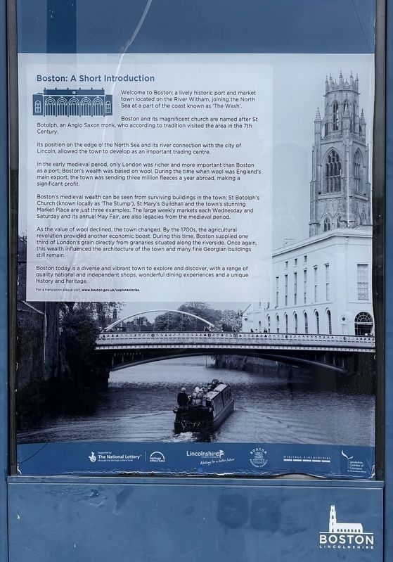
1. Boston: A Short Introduction Marker
Boston and its magnificent church are named after St Botolph, an Anglo Saxon monk, who according to tradition visited the area in the 7th Century.
Its position on the edge of the North Sea and its river connection with the city of Lincoln, allowed the town to develop as an important trading centre.
In the early medieval period, only London was richer and more important than Boston as a port; Boston's wealth was based on wool. During the time when wool was England's main export, the town was sending three million fleeces a year abroad, making a significant profit.
Boston's medieval wealth can be seen from surviving buildings in the town; St Botolph's Church (known locally as 'The Stump'), St Mary's Guildhall and the town's stunning Market Place are just three examples. The large weekly markets each Wednesday and Saturday and its annual May Fair, are also legacies from the medieval period.
As the value of wool declined, the town changed. By the 1700s, the agricultural
this page online
Boston today is a diverse and vibrant town to explore and discover, with a range of quality national and independent shops, wonderful dining experiences and a unique history and heritage.
Erected by Boston Borough Council.
Topics. This historical marker is listed in this topic list: Settlements & Settlers.
Location. 52° 58.659′ N, 0° 1.874′ W. Marker is in Boston, England, in Lincolnshire. It is on Station Approach, on the left when traveling north. The marker is part of a larger informational sign just short of the southern end of the Boston railway station. Touch for map. Marker is at or near this postal address: Station Approach, Boston, England, United Kingdom. Touch for directions.

Regionally, this marker is in the Midlands. Globally, it is on the Atlantic Ocean, in the North Atlantic Region, in Europe,
Photographed by John Valentine and Sons, Ltd., circa 1925
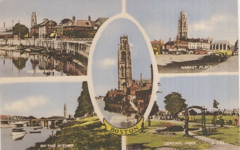
2. Boston - general views postcard
Other nearby markers. At least 5 other markers are within walking distance of this marker: The Puritan Vision (approx. 0.4 kilometers away); The Reverend John Cotton and Boston's American Legacy (approx. half a kilometer away); Strait Bargate (approx. 0.6 kilometers away); Central Park (approx. 0.7 kilometers away); Wide Bargate (approx. 0.8 kilometers away).
Credits. This page was last revised on October 5, 2026. It was originally submitted on October 2, 2026, by Ray Gurganus of Washington, District of Columbia. This page has been viewed 5 times since then. Photos: 1. submitted on October 2, 2026, by Ray Gurganus of Washington, District of Columbia. 2. submitted on October 5, 2026, by Andrew Ruppenstein of Lamorinda, California. • Andrew Ruppenstein was the editor who published this page.
Editor’s want-list for this marker. photo of the marker within its surroundings • Can you help?
