Keystone in Pennington County, South Dakota — The American Midwest (Upper Plains)
Halley's Store Icehouse
Photographed by William Fischer, Jr., September 17, 2026
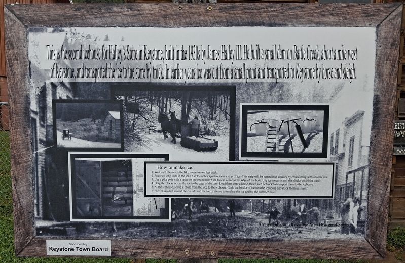
1. Halley's Store Icehouse Marker
This is the second icehouse for Halley's Store in Keystone, built in the 1930s by James Halley III. He built a small dam on Battle Creek, about a mile west of Keystone, and transported the ice to the store by truck. In earlier years ice was cut from a small pond and transported to Keystone by horse and sleigh.
How to make ice.
1. Wait until the ice on the lake is one to two feet thick.
2. Saw two long lines in the ice 12 to 15 inches apart to form a strip of ice. This strip will be turned into squares by crosscutting with another saw.
3. Use a pike pole with a spike on the end to move the blocks of ice to the edge of the hole. Use ice tongs to pull the blocks out of the water.
4. Drag the blocks across the ice to the edge of the lake. Load them onto a horse drawn sled or truck to transport them to the icehouse.
5. At the icehouse, set up a chute from the sled to the icehouse. Slide the blocks of ice into the icehouse and stack them in layers.
6. Shovel sawdust around the outside and the top of the ice to insulate the ice against the summer heat.
Erected 2005 by Keystone Area Historical Society. (Marker Number
this page online
Topics. This historical marker is listed in these topic lists: Industry & Commerce • Settlements & Settlers.
Location. 43° 53.778′ N, 103° 25.163′ W. Marker is in Keystone, South Dakota, in Pennington County. It is on Mitchell Street west of 1st Street (State Highway 40), on the right when traveling west. Touch for map. Marker is at or near this postal address: 403 Mitchell Street, Keystone SD 57751, United States of America. Touch for directions.

Regionally, this marker is in West River, in the Badlands, and in Greater Rapid City. It is also in the American Black Hills, in the Lewis & Clark Corridor, on the prairies, and on the Northern Plains. Globally, it is in North America, the Western Hemisphere, the Western World, and the Anglosphere. Historically, it finds itself in what was once Rupert’s Land and also the Louisiana Purchase.
Other nearby markers. At least 8 other markers are within walking distance of this marker: Keystone Trading Company/Halley's Store (a few steps from this marker); Keystone Battle Creek Cultural Center (within shouting distance
Photographed by William Fischer, Jr., September 17, 2026
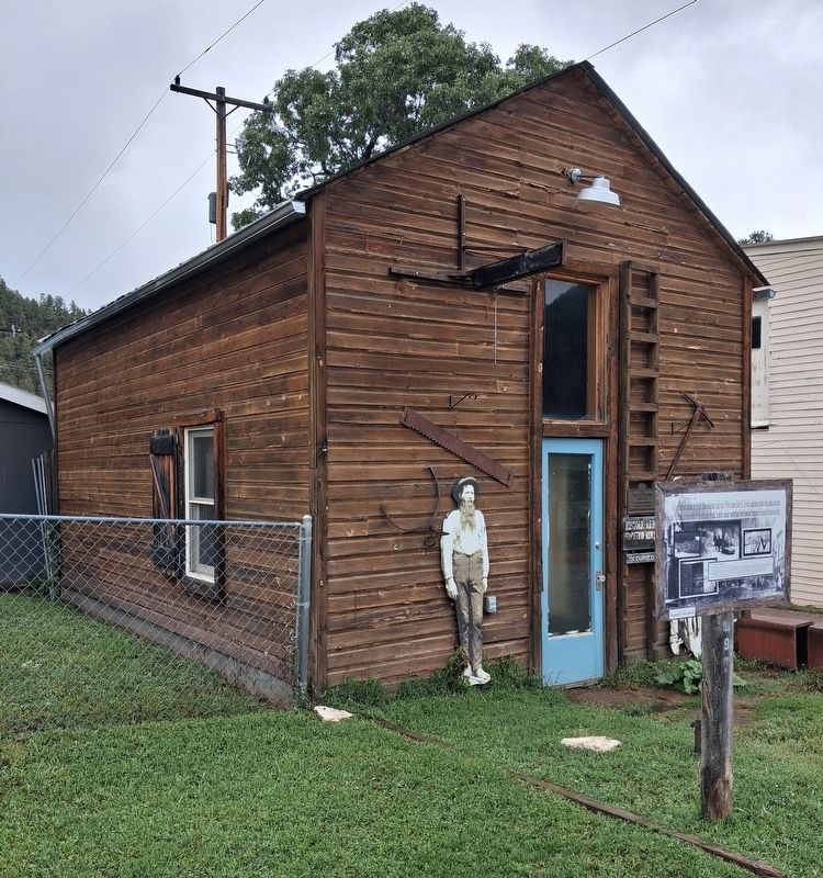
2. Halley's Store Icehouse and Marker
Also see . . . Historic Keystone Walking Tour. (Submitted on October 2, 2026, by William Fischer, Jr. of Reynoldsburg, Ohio.)
Credits. This page was last revised on October 3, 2026. It was originally submitted on October 2, 2026, by William Fischer, Jr. of Reynoldsburg, Ohio. This page has been viewed 6 times since then. Photos: 1, 2. submitted on October 2, 2026, by William Fischer, Jr. of Reynoldsburg, Ohio.
