THE HISTORICAL
MARKER DATABASE
“Bite-Size Bits of Local, National, and Global History”
Mount Forest in Wellington North in Wellington County, Ontario — Central Canada (North America)
 

Mount Forest Heritage Building 187 Main Street South

1878

— Daniel Cummins Hotel Proprieter —


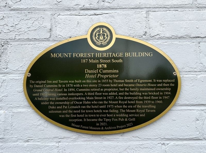
Mount Forest Heritage Building 187 Main Street South Marker image. Click for full size.
Photographed by Tim Boyd, September 25, 2026
1. Mount Forest Heritage Building 187 Main Street South Marker
Inscription. The original Inn and Tavern was built on this site in 1855 by Thomas Smith of Egremont. It was replaced by Daniel Cummins Sr in 1878 with a two storey 23 room hotel and became Ontario House and then the Grand Central Hotel. In 1894, Cummins retired as proprietor, but the family maintained ownership until 1924 hiring various innkeepers. A third floor was added, and the building was bricked in 1904. A balcony was installed overlooking Main Street in 1927. A fire destroyed the third floor in 1947 under the ownership of Oscar Hahn who ran the Mount Royal hotel from 1939 to 1960. Duke and Pat Lemaich ran the hotel until 1975 when the era of the travelling salesman and the need for town hotels was fading. The Mount Royal Tavern was the first hotel in town to ever host a wedding service and reception. It became the Tipsy Fox Pub & Grill in 2021.
 
Erected 2023 by Mount Forest Museum & Archives.
 
Topics. This historical marker is listed in these topic lists: Architecture • Industry & Commerce. A significant historical year for this entry is 1878.
 
Location. 43° 58.848′ N, 80° 44.064′ W. Marker is in Wellington North, Ontario,
Paid Advertisement
Click or scan to see
this page online
in Wellington County. It is in Mount Forest. It is on Main Street South (Highway 6) 0.1 kilometers north of King Street West, on the left when traveling north. Touch for map. Marker is at or near this postal address: 187 Highway 6, Wellington North ON N0G 2L2, Canada. Touch for directions.

Regionally, this marker is in the Huron-Perth-Waterloo-Wellington Area and in Southwestern Ontario. It is also in Central Canada. Globally, it is in North America, the Western Hemisphere, the Western World, and the Anglosphere. Historically, it finds itself in what was once a British colony, the Viceroyalty of New France, the Haudenosaunee (Iroquois) Confederacy, and Rupert’s Land.

Other nearby markers. At least 8 other markers are within walking distance of this marker: Mount Forest Heritage Building 191 Main Street South (within shouting distance of this marker); Mount Forest Heritage Building 190 Main Street (within shouting distance of this marker); Mount Forest Heritage Building 162 Main Street (within shouting distance of this marker); Mount Forest Heritage Building 149 Main Street South (within shouting distance of this
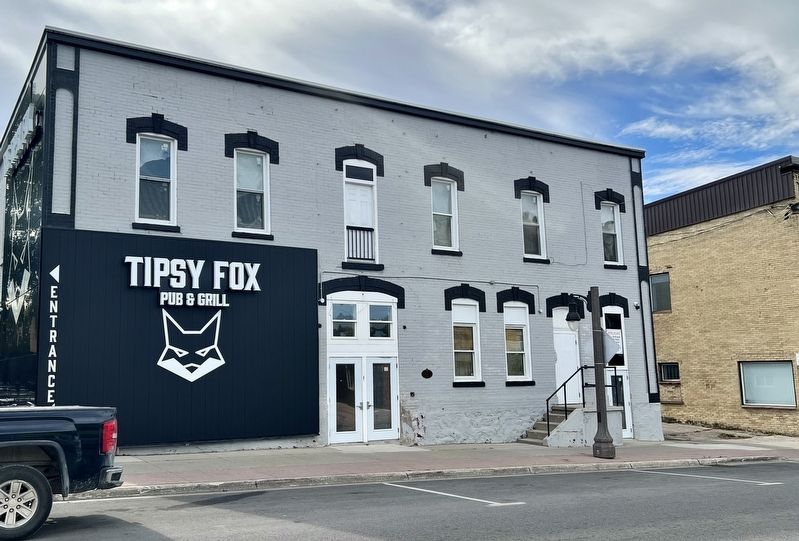
Mount Forest Heritage Building 187 Main Street South Marker image. Click for full size.
Photographed by Tim Boyd, September 25, 2026
2. Mount Forest Heritage Building 187 Main Street South Marker
Centre of the building
marker); Mount Forest Heritage Building 153 Main Street South (within shouting distance of this marker); Mount Forest Heritage Building 130 Main Street South (about 90 meters away, measured in a direct line); Mount Forest Heritage Building 114 Main Street South (about 90 meters away); Lieut. S. Lewis Honey, V.C; D.C.M; M.M. (about 90 meters away). Touch for a list and map of all markers in Wellington North.
 
 
Credits. This page was last revised on October 4, 2026. It was originally submitted on October 2, 2026, by Tim Boyd of Hamilton, Ontario. This page has been viewed 5 times since then. Photos:   1, 2. submitted on October 2, 2026, by Tim Boyd of Hamilton, Ontario. • Andrew Ruppenstein was the editor who published this page.

m=312684

CeraNet Cloud Computing sponsors the Historical Marker Database.
This website earns income from purchases you make after using our links to Amazon.com. We appreciate your support.
Paid Advertisement
Oct. 12, 2026