Wall in Pennington County, South Dakota — The American Midwest (Upper Plains)
St. Patrick's Parish Bell Tower
Photographed by William Fischer, Jr., September 19, 2026
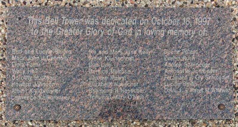
1. St. Patrick's Parish Bell Tower Marker
This Bell Tower was dedicated on October 18, 1997
to the Greater Glory of God in loving memory of:
Bud and Lucyle Bloora • Msgr John J. Connolly • Elsie Feller • Wally Hall
Dorothy Hustead • Howard Johnson • Albert Kaikbrenner
Lawrence Kalkbrenner • Ike and Mary Jane Kelly • Frank Kleinschmit
Dan Lyle • Bernice Meirose • Jerome Melvin • Elizabeth Naescher
Raymond H. Naescher • Tom and Mary O'Neill • Duane Peters
Evelyn Rush • Adolph Schroeder • Antonette Schroeder
Ferdinand & Lily Schroeder • Lucille Smith • David L & Hazel M Whitwer
Erected 1997 by St. Patrick's Parish.
Topics. This historical marker is listed in this topic list: Religion & Religious Structures. A significant historical date for this entry is October 18, 1997.
Location. 43° 59.438′ N, 102° 14.438′ W. Marker is in Wall, South Dakota, in Pennington County. It is at the intersection of Norris Street and 7th Street, on the left when traveling north on Norris Street. Touch for map. Marker is at or near this postal address: 701 Norris Street, Wall SD 57790, United States of America. Touch for directions.

Regionally, this marker is in West River, in the Badlands,
this page online
Other nearby markers. At least 8 other markers are within 11 miles of this marker, measured as the crow flies: The Carrol McDonald Post No. 246 World War Memorial (approx. ¼ mile away); Veterans Memorial (approx. ¼ mile away); High Security (approx. 5.7 miles away); Mako sica/Les mauvaises terres/The Badlands (approx. 7.4 miles away); The Big Badlands (approx. 8.4 miles away); Born of Volcanos (approx. 8.4 miles away); Jungle on a Seabed (approx. 10.4 miles away); Purple Heart Memorial Highway (approx. 10.9 miles away). Touch for a list and map of all markers in Wall.
Photographed by William Fischer, Jr., September 19, 2026
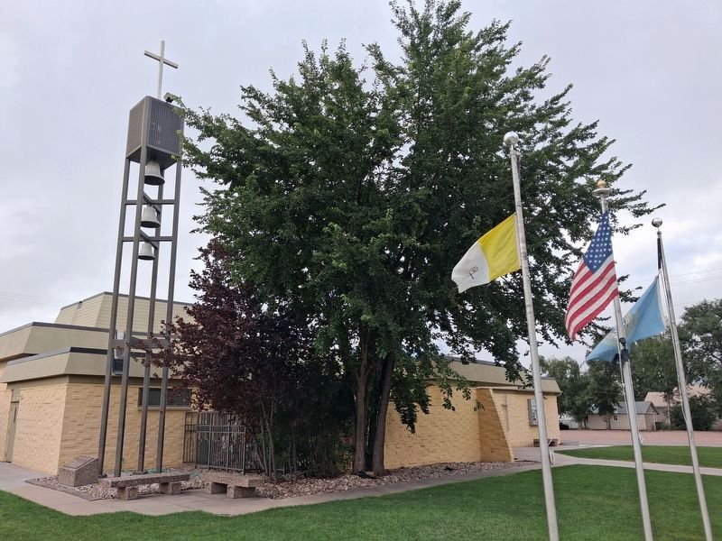
2. St. Patrick's Parish Bell Tower and Marker
Marker at bell tower base
Credits. This page was last revised on October 3, 2026. It was originally submitted on October 3, 2026, by William Fischer, Jr. of Reynoldsburg, Ohio. This page has been viewed 6 times since then. Photos: 1, 2. submitted on October 3, 2026, by William Fischer, Jr. of Reynoldsburg, Ohio.
