Ehrenbreitstein in Koblenz, Rhineland-Palatinate, Germany — Central Europe
Brunnendenkmal
⎯⎯⎯
Fountain Monument
Photographed by James Hulse, October 3, 2026
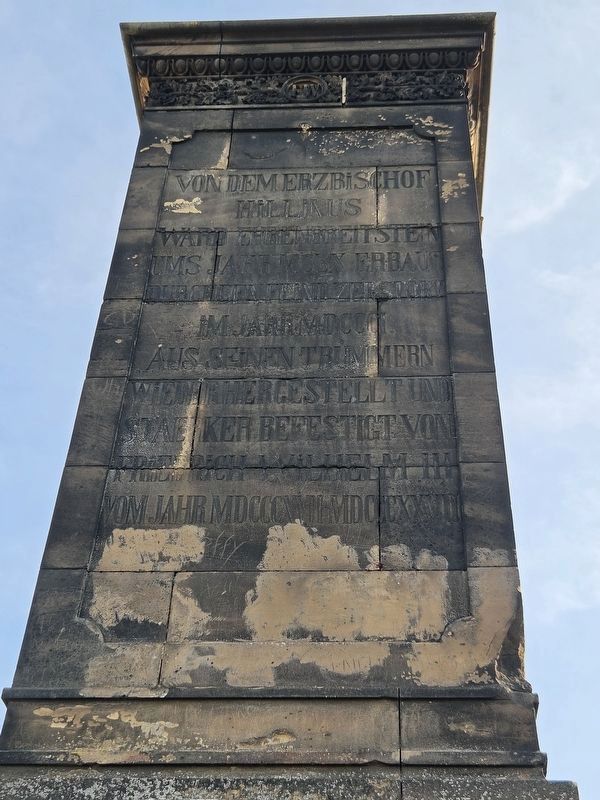
1. Brunnendenkmal / Fountain Monument

Von dem Erzbischof Hillinus ward Ehrenbreitstein ums Jahr MCLX erbaut, durch den Feind zerstört im Jahr MDCCCI. Aus seinen Trümmern wiederhergestellt und stärker befestigt von Friedrich Wilhelm III. vom Jahr MDCCCXVII bis MDCCCXXVIII.
Fountain Monument
Ehrenbreitstein was built by Archbishop Hillinus around 1160 and destroyed by the enemy in 1801. It was rebuilt from its ruins and more strongly fortified by Frederick William III from 1817 to 1828.
Erected 1844 by Prussia.
Topics. This historical marker and monument is listed in this topic list: Military.
Location. 50° 21.87′ N, 7° 36.8′ E. Marker is in Koblenz, Rheinland-Pfalz (Rhineland-Palatinate). It is in Ehrenbreitstein. It is on Greiffenklaustraße 2 kilometers west of Friesenstraße. The monument is located on the grounds of the Ehrenbreitstein Fortress. Touch for map. Marker is in this post office area: Koblenz RP 56077, Germany. Touch for directions.

Regionally, this marker and monument is in the German Rhineland, in the Upper Middle Rhine Valley, and in the Moselle Valley. Globally, it is in Europe, the European Union, Atlantic Europe, Central Europe, the Schengen Area, Western Europe, and the Western World. Historically, it finds itself in what was once the Roman Empire, the Holy Roman Empire, and the former West Germany.
Other nearby markers. At least 8 other markers are within walking distance of this marker: Preußische Festung Coblenz und Ehrenbreitstein / Prussian Fortress of Coblenz and Ehrenbreitstein (here, next to this marker);
this page online
More about this marker. The monument stands atop Ehrenbreitstein Fortress. Admission is required to enter the fortress and visit the monument.
Photographed by James Hulse, October 3, 2026
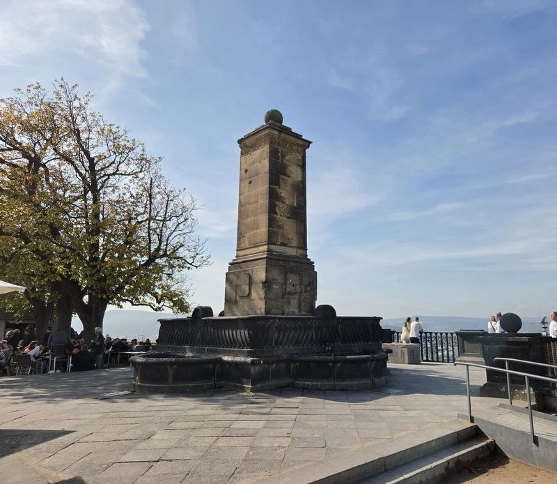
2. Brunnendenkmal / Fountain Monument
The marker text face the Rhine River.
Photographed by James Hulse, October 3, 2026
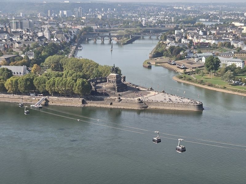
3. Brunnendenkmal / Fountain Monument
The view from the monument of the Rhine River and the city of Koblenz.
Photographed by James Hulse, October 3, 2026
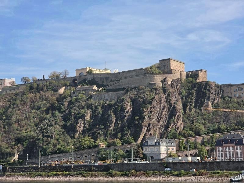
4. Ehrenbreitstein Fortress
The monument is visible along the upper left wall of Ehrenbreitstein Fortress in this view from Koblenz, across the Rhine River.
Credits. This page was last revised on October 13, 2026. It was originally submitted on October 4, 2026, by James Hulse of Medina, Texas. This page has been viewed 11 times since then. Photos: 1, 2, 3, 4. submitted on October 4, 2026, by James Hulse of Medina, Texas.
