Keystone in Pennington County, South Dakota — The American Midwest (Upper Plains)
First Congregational Church
Photographed by William Fischer, Jr., September 21, 2026
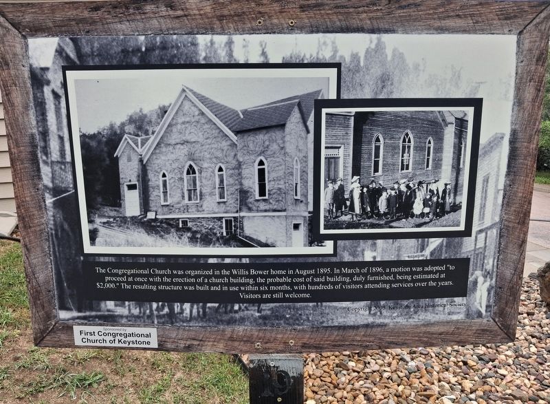
1. First Congregational Church Marker
The Congregational Church was organized in the Willis Bower home in August 1895. In March of 1896, a motion was adopted "to proceed at once with the erection of a church building, the probable cost of said building, duly furnished, being estimated at $2,000." The resulting structure was built and in use within six months, with hundreds of visitors attending services over the years. Visitors are still welcome.
[Uncaptioned early photos of the building and children (with boys in knickers)]
Erected 2005 by Keystone Area Historical Society. (Marker Number 19.)
Topics. This historical marker is listed in these topic lists: Religion & Religious Structures • Settlements & Settlers. A significant historical month for this entry is March 1896.
Location. 43° 53.677′ N, 103° 25.174′ W. Marker is in Keystone, South Dakota, in Pennington County. It is at the intersection of Blair Street and 2nd Street, on the right when traveling west on Blair Street. Touch for map. Marker is at or near this postal address: 402 Blair Street, Keystone SD 57751, United States of America. Touch for directions.

Regionally, this marker is in West River,
this page online
Other nearby markers. At least 8 other markers are within walking distance of this marker: Bill Durst (a few steps from this marker); Keystone School (about 300 feet away, measured in a direct line); 40th Anniversary of "The Flood" (about 300 feet away); Charles Upham and the Upham Saloon (about 300 feet away); Hayes-Hopkins Supply Company (about 400 feet away); Henry Loomis House (about 400 feet away); Site of the McDonald Hotel (about 400 feet away); Big Thunder Gold Mine (about 400 feet away). Touch for a list and map of all markers in Keystone.
Also see . . . Historic Keystone Walking Tour. (Submitted on October 4, 2026, by William Fischer, Jr. of Reynoldsburg, Ohio.)
Photographed by William Fischer, Jr., September 21, 2026
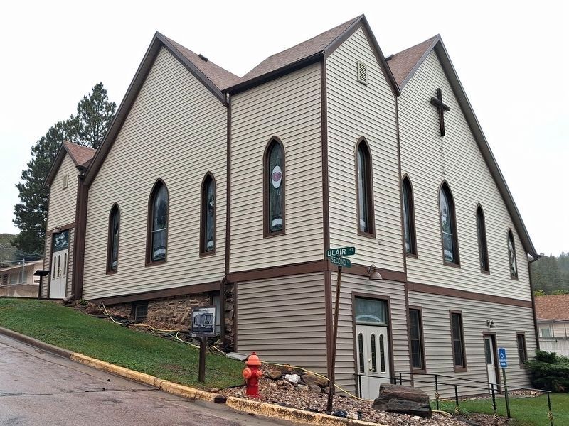
2. First Congregational Church and Marker
Credits. This page was last revised on October 4, 2026. It was originally submitted on October 4, 2026, by William Fischer, Jr. of Reynoldsburg, Ohio. This page has been viewed 4 times since then. Photos: 1, 2. submitted on October 4, 2026, by William Fischer, Jr. of Reynoldsburg, Ohio.
