Custer in Custer County, South Dakota — The American Midwest (Upper Plains)
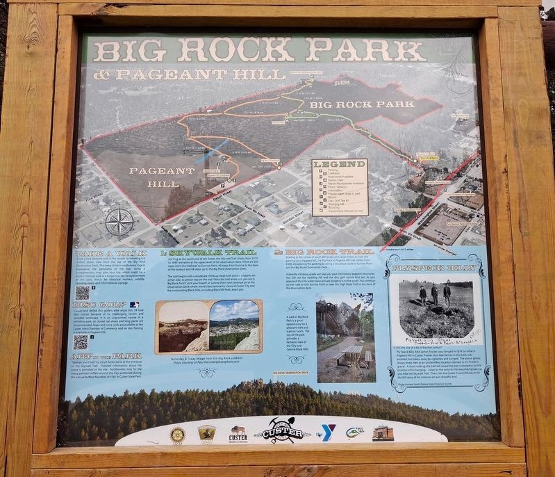
Big Rock Park & Pageant Hill
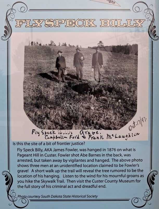
Flyspeck Billy
Photographed by William Fischer, Jr., September 22, 2026
1. Big Rock Park & Pageant Hill Marker Excerpt
[Primarily recreational information except]
Flyspeck Billy
[Photo inscribed]
Fly Speck Bill's Grave
Oct.17/97.
Campbell- Ford & Frank McLaughlin
Is this the site of a bit of frontier justice?
Fly Speck Billy, AKA James Fowler, was hanged in 1876 on what is Pageant Hill in Custer. Fowler shot Abe Barnes in the back, was arrested, but taken away by vigilantes and hanged. The above photo shows three men at an unidentified location claimed to be Fowler's grave! A short walk up the trail will reveal the tree rumored to be the location of his hanging. Listen to the wind for his mournful groans as you hike the Skywalk Trail. Then visit the Custer County Museum for the full story of his criminal act and dreadful end.
Photo courtesy South Dakota State Historical Society
Erected by City of Custer and Concerned Organizations.
Topics. This historical marker is listed in these topic lists: Disasters • Settlements & Settlers. A significant historical year for this entry is 1876.
Location. 43° 45.879′ N, 103° 35.861′ W. Marker is in Custer, South Dakota, in Custer County. It is at the intersection of French Creek
this page online

Regionally, this marker is in West River and in Greater Rapid City. It is also in the American Black Hills, in the Lewis & Clark Corridor, on the prairies, and on the Northern Plains. Globally, it is in North America, the Western Hemisphere, the Western World, and the Anglosphere. Historically, it finds itself in what was once Rupert’s Land and also the Louisiana Purchase.
Other nearby markers. At least 8 other markers are within walking distance of this marker: Chief Sitting Bull (here, next to this marker); George Armstrong Custer (here, next to this marker); Welcome to the Harbach Trailhead (about 300 feet away, measured in a direct line); General George A. Custer (about 400 feet away); a different marker also named Big Rock Park & Pageant Hill (about 400 feet away); Custer Veterans Memorial (about 500 feet away); L. Cpl. Cody Glenn Engen
Photographed by William Fischer, Jr., September 22, 2026
2. Big Rock Park & Pageant Hill Marker
Photographed by William Fischer, Jr., September 22, 2026
3. Big Rock Park & Pageant Hill Marker
Credits. This page was last revised on October 5, 2026. It was originally submitted on October 5, 2026, by William Fischer, Jr. of Reynoldsburg, Ohio. This page has been viewed 2 times since then. Photos: 1, 2, 3. submitted on October 5, 2026, by William Fischer, Jr. of Reynoldsburg, Ohio.
