Altstadt in Dinkelsbühl in Ansbach, Bavaria, Germany — Central Europe
Stauferstele
Photographed by James Hulse
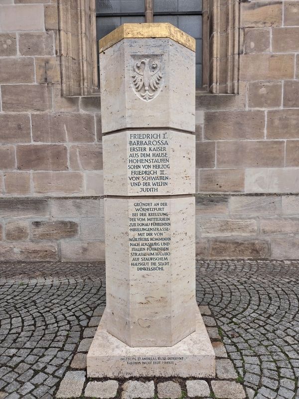
1. Stauferstele Marker

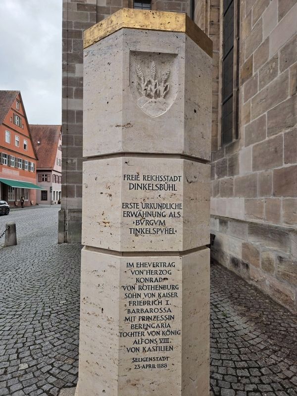
Freie Reichsstadt Dinkelsbühl. Erste urkundliche Erwähnung als „Bvrgvm Tinkelspyhel“ im Ehevertrag von Herzog Konrad von Rothenburg, Sohn von Kaiser Friedrich I. Barbarossa, mit Prinzessin Berengaria, Tochter von König Alfons VIII. von Kastilien. Seligenstadt, 23. April 1188.
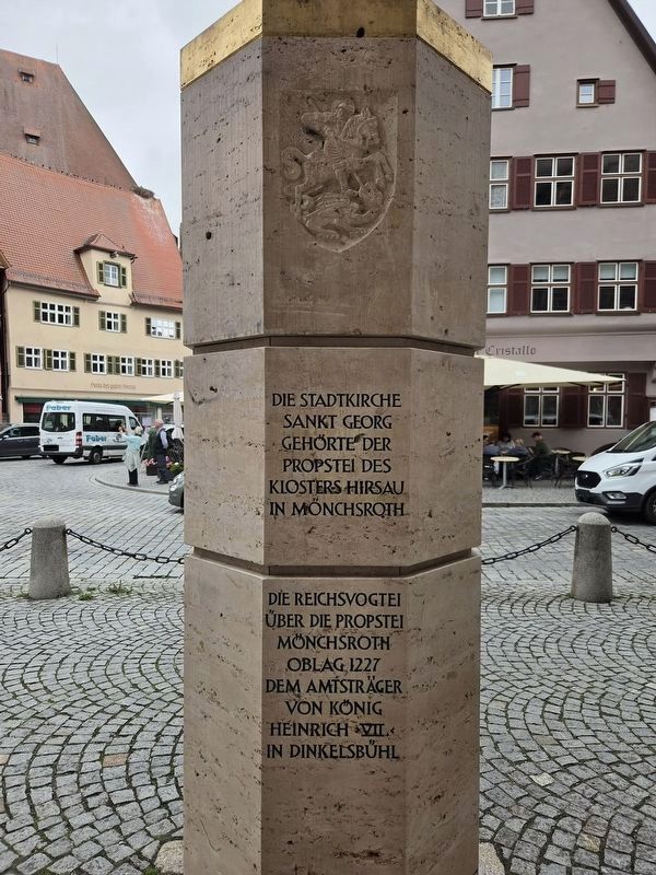
Die Stadtkirche Sankt Georg gehörte der Propstei des Klosters Hirsau in Mönchsroth. Die Reichsvogtei über die Propstei Mönchsroth oblag 1227 dem Amtsträger von König Heinrich VII. in Dinkelsbühl.
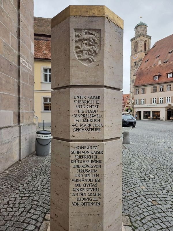
Unter Kaiser Friedrich II. entrichtet die Stadt „Dinckelsbvel“ 1241 jährlich 40 Mark Silber Reichssteuer. Konrad IV., Sohn von Kaiser Friedrich II., deutscher König und König von Jerusalem und Sizilien, verpfändet 1251 die „Civitas Dinkelspvhel“ an den Grafen Ludwig III. von Oettingen.
Frederick I Barbarossa, the first emperor of the House of Hohenstaufen, son of Duke Frederick II of Swabia and Judith of the House of Welf, founded Dinkelsbühl around 1170–1180 on Hohenstaufen family land at the ford across the Wörnitz. Here, the “Nibelungen Road” from the Middle Rhine to the Danube crossed the road from Würzburg to Augsburg and Italy.
Free Imperial City of Dinkelsbühl. First documented mention as “Bvrgvm Tinkelspyhel” in the marriage contract
this page online
The town church of St. George belonged to the Mönchsroth priory of Hirsau Abbey. In 1227, responsibility for the imperial guardianship over Mönchsroth Priory rested with King Henry VII’s official in Dinkelsbühl.
Under Emperor Frederick II, the town of “Dinckelsbvel” paid an annual imperial tax of 40 marks of silver in 1241. In 1251, Conrad IV, son of Emperor Frederick II, King of Germany, Jerusalem and Sicily, pledged the “Civitas Dinkelspvhel” to Count Ludwig III of Oettingen.
Erected 2013 by Ingeborg and Andreas Raab and made by Markus Wolf.
Topics. This historical marker is listed in this topic list: Settlements & Settlers. A significant historical date for this entry is April 23, 1170.
Location. 49° 4.126′ N, 10° 19.217′ E. Marker is in Dinkelsbühl, Bayern (Bavaria), in Ansbach. It is in Altstadt. It is at the intersection of Nördlinger Straße and Ledermarkt, on the left when traveling west on Nördlinger Straße. Touch for map. Marker is at or near this postal address: Nördlinger Str 2, Dinkelsbühl BY 91550, Germany. Touch for directions.

Regionally, this marker is in German Franconia and on the Romantic Road. Globally, it is in Europe, the European Union, Atlantic Europe, Central Europe, the Schengen Area, Western Europe, and the Western World. Historically, it finds itself in what was once the Holy Roman Empire and also the former West Germany.
Other nearby markers. At least 8 other markers are within walking distance of this marker: Johann Christoph Friedrich von Schmid
Photographed by James Hulse
2. Stauferstele Marker
Photographed by James Hulse
3. Stauferstele Marker
Photographed by James Hulse
4. Stauferstele Marker
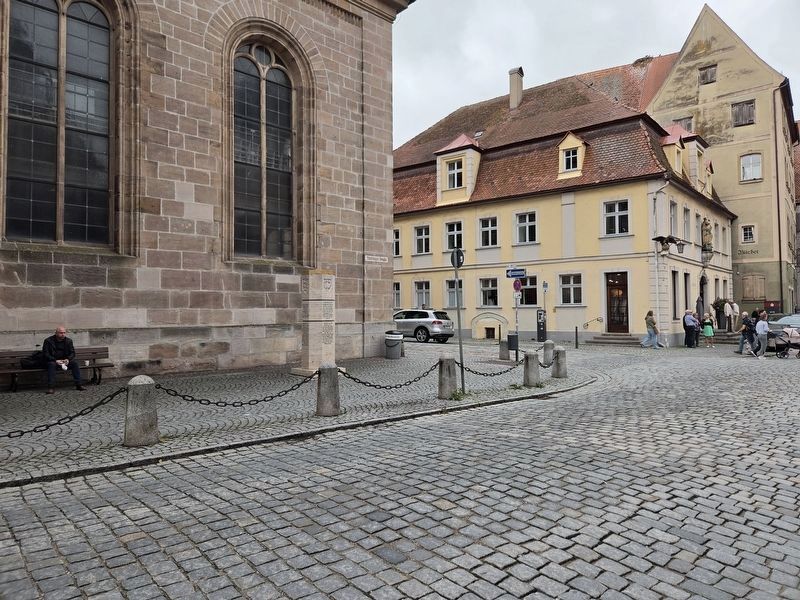
Photographed by James Hulse, September 14, 2026
5. Stauferstele Marker
Credits. This page was last revised on October 8, 2026. It was originally submitted on October 7, 2026, by James Hulse of Medina, Texas. This page has been viewed 4 times since then. Photos: 1, 2, 3, 4, 5. submitted on October 8, 2026, by James Hulse of Medina, Texas.
