Altstadt in Dinkelsbühl in Ansbach, Bavaria, Germany — Central Europe
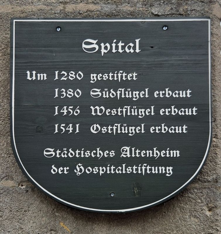
Spital
⎯⎯⎯
Hospital
Photographed by James Hulse, September 14, 2026
1. Spital / Hospital Marker

Um 1280 gestiftet
1380 Südflügel erbaut
1456 Westflügel erbaut
1541 Ostflügel erbaut
Städtisches Altenheim der Hospitalstiftung
Hospital
Founded around 1280.
1380: South wing built.
1456: West wing built.
1541: East wing built.
Municipal home for the elderly belonging to the Hospital Foundation.
Topics. This historical marker is listed in this topic list: Notable Buildings. A significant historical year for this entry is 1280.
Location. 49° 4.277′ N, 10° 19.122′ E. Marker is in Dinkelsbühl, Bayern (Bavaria), in Ansbach. It is in Altstadt. It is at the intersection of Dr.-Martin-Luther-Straße and Pfluggasse, on the right when traveling north on Dr.-Martin-Luther-Straße. Touch for map. Marker is at or near this postal address: Dr.-Martin-Luther-Straße 6, Dinkelsbühl BY 91550, Germany. Touch for directions.

Regionally, this marker is in German Franconia and on the Romantic Road. Globally, it is in Europe, the European Union, Atlantic Europe, Central Europe, the Schengen Area, Western Europe, and the Western World. Historically, it finds itself in what was once the
this page online
Other nearby markers. At least 8 other markers are within walking distance of this marker: A different marker also named Spital / Hospital (here, next to this marker); a different marker also named Spital / Hospital (a few steps from this marker); a different marker also named Spital / Hospital (within shouting distance of this marker); Die Gerichtstafeln in den Dinkelsbühler Stadttoren (within shouting distance of this marker); Rothenburger Tor / Rothenburg Gate (within shouting distance of this marker); Gedenkweg zum Dreißigjährigen Krieg in Dinkelsbühl / Thirty Years’ War Memorial Trail in Dinkelsbühl (about 120 meters away, measured in a direct line); Der Krieg verwüstet die Pfalz / War devastates the Palatinate (about 120 meters away); Der Kaiser hat den Sieg vor Augen / The emperor has victory in sight (about 120 meters away). Touch for a list and map of all markers in Dinkelsbühl.
Photographed by James Hulse, September 14, 2026
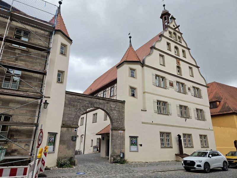
2. Spital / Hospital Marker
The marker is located on the left side of the archway to the courtyard.
Credits. This page was last revised on October 8, 2026. It was originally submitted on October 7, 2026, by James Hulse of Medina, Texas. This page has been viewed 3 times since then. Photos: 1, 2. submitted on October 8, 2026, by James Hulse of Medina, Texas.
