Bethel in Cheatham County, Tennessee — The American South (East South Central)
Operations Underwater
Photographed by Darren Jefferson Clay, October 4, 2026
1. Operations Underwater Marker
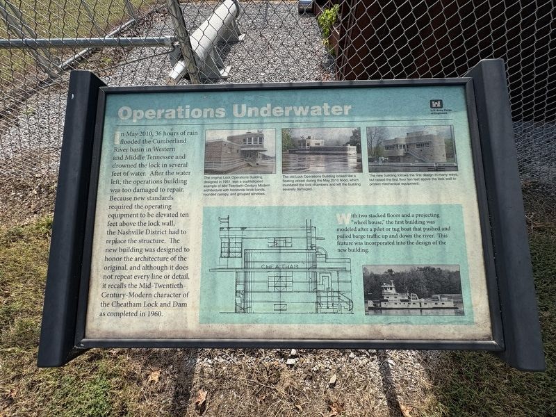
In May 2010, 36 hours of rain flooded the Cumberland River basin in Western and Middle Tennessee and drowned the lock in several feet of water. After the water left, the operations building was too damaged to repair. Because new standards required the operating equipment to be elevated ten feet above the lock wall, the Nashville District had to replace the structure. The new building was designed to honor the architecture of the original, and although it does not repeat every line or detail, it recalls the Mid-Twentieth- Century-Modern character of the Cheatham Lock and Dam as completed in 1960.
With two stacked floors and a projecting "wheel house," the first building was modeled after a pilot or tug boat that pushed and pulled barge traffic up and down the river. This feature was incorporated into the design of the new building.
Photo captions:
The original Lock Operations Building, designed in 1951, was sophisticated example of Mid-Twentieth-Century Modern architecture with horizontal brick bands, rounded canopy, and grouped windows.
The old Lock Operations Building looked like a floating vessel during the May 2010 flood, which inundated the lock chambers and left the building severely damaged.
The new building follows the first design in many ways, but raised the first floor ten feet above the lock wall to protect mechanical equipment.
Erected by U.S.
this page online
Topics. This historical marker is listed in this topic list: Notable Buildings. A significant historical month for this entry is May 2010.
Location. 36° 19.537′ N, 87° 13.592′ W. Marker is in Bethel, Tennessee, in Cheatham County. It is on Cheatham Dam Road, in the median. Touch for map. Marker is at or near this postal address: 1800 Cheatham Dam Rd, Charlotte TN 37036, United States of America. Touch for directions.

Regionally, this marker is in Middle Tennessee, in the Highland Rim, and in Greater Nashville. It is also in the American South and specifically in the Upper South. Globally, it is in North America, the Western Hemisphere, the Western World, and the Anglosphere. Historically, it finds itself in what was once the territory of the Mississippian Culture, one of the Confederate States of America, and the Antebellum South.
Other nearby markers. At least 8 other markers are within 8 miles of this marker, measured as the crow flies: The Cheatham Lock and Dam (here, next to this marker); Old Neptune School (approx. 2 miles away); Neptune (approx. 3.2 miles away); Clifton Forebears are Buried in Old Church Cemetery to Southeast

Photographed by Darren Jefferson Clay, October 4, 2026
2. Operations Underwater Marker (on the right side of the photo)
Credits. This page was last revised on October 11, 2026. It was originally submitted on October 7, 2026, by Darren Jefferson Clay of Duluth, Georgia. This page has been viewed 7 times since then. Photos: 1, 2. submitted on October 9, 2026, by Darren Jefferson Clay of Duluth, Georgia. • James Hulse was the editor who published this page.
