Ellsworth Air Force Base in Pennington County, South Dakota — The American Midwest (Upper Plains)
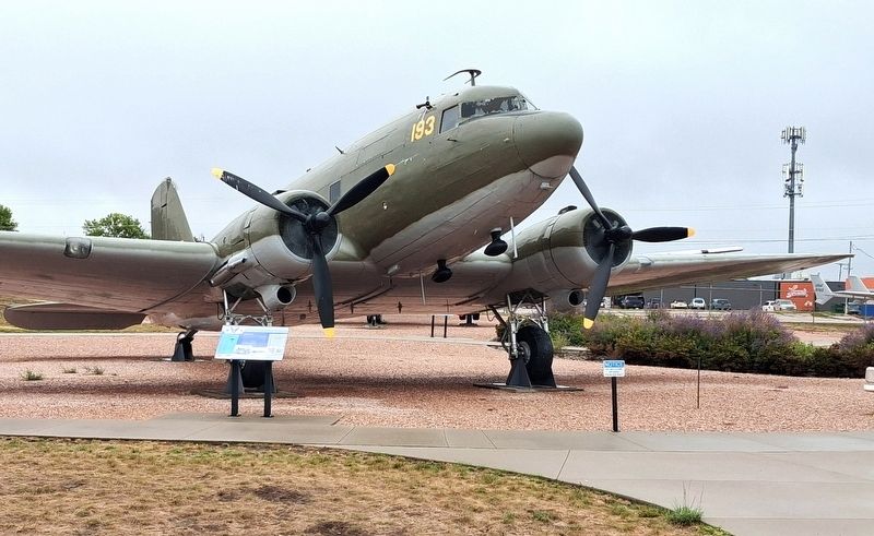
C-47 Skytrain
Flying the Hump

Photographed by William Fischer, Jr., September 20, 2026
1. C-47 Skytrain Marker
During WWII, C-47s like this one flew over the Himalayas to supply Americans and Chinese fighting the Japanese. For three years, daily flights across the world's highest mountain range were the only way to deliver fuel and ammunition to Allied forces in China. Lighter than other transport planes, Skytrains could fly fairly high. But they couldn't clear the tallest peaks, so their crews threaded through the maze of rocky, snow-covered passes. The operation's commander said, "After the Hump, [we] knew that we could fly anything anywhere anytime."
IS THAT AN ATOMIC FLY ON THE SIDE?
That's the logo of a joint U.S. and Mexican program to combat larval flies that were feeding on cattle and sheep in the 1970s. Skytrains dropped flies that had been exposed to atomic radiation, sterilizing them. The sterilized flies mated with healthy flies, producing no offspring, and eventually the flies died off.
Planes flew precise patterns to cover affected areas completely with sterile flies. Irradiated flies are the stuff of science fiction, but the program worked.
The heavier C-46 Commando was the workhorse of the Hump,
this page online
The Royal Air Force also few C-47s over the Hump. Its British nickname was the Dakota.
DATA CARD
Top Speed mph · 230
Crew · 2-4
Range · Continental
Payload · 6,000 lbs. of cargo
Erected by South Dakota Air and Space Museum.
Topics and series. This historical marker is listed in these topic lists: Air & Space • War, Korean • War, Vietnam • War, World II. In addition, it is included in the South Dakota Air and Space Museum series list.
Location. 44° 8.019′ N, 103° 4.321′ W. Marker is in Ellsworth Air Force Base, South Dakota, in Pennington County. Marker and aircraft are on static display at the South Dakota Air and Space Museum. Touch for map. Marker is at or near this postal address: 2890 Davis Drive, Ellsworth AFB SD 57706, United States of America. Touch for directions.

Regionally, this marker is in West River, in the Badlands, and in Greater Rapid City. It is also in the American Lewis & Clark Corridor, on the prairies, and on the Northern Plains. Globally, it is in North
Photographed by William Fischer, Jr., September 20, 2026
2. C-47 Skytrain and Marker
Other nearby markers. At least 8 other markers are within walking distance of this marker: A-26A/B-26K Counter Invader (a few steps from this marker); T-33A Shooting Star (within shouting distance of this marker); C-131D Samaritan (within shouting distance of this marker); UH-1F Iroquois (within shouting distance of this marker); F-101B Voodoo (within shouting distance of this marker); F-84F Thunderstreak (within shouting distance of this marker); F-86H Sabre (within shouting distance of this marker); EB-57B Canberra (within shouting distance of this marker). Touch for a list and map of all markers in Ellsworth Air Force Base.
Regarding C-47 Skytrain. Although an official field museum of the US Air Force Heritage Program and is adjacent to Ellsworth AFB main gate, the museum does not require access onto the base.

Photographed by William Fischer, Jr., September 20, 2026
3. C-47 Skytrain
Credits. This page was last revised on October 7, 2026. It was originally submitted on October 7, 2026, by William Fischer, Jr. of Reynoldsburg, Ohio. This page has been viewed 6 times since then. Photos: 1, 2, 3. submitted on October 7, 2026, by William Fischer, Jr. of Reynoldsburg, Ohio.
