Dinkelsbühl in Ansbach, Bavaria, Germany — Central Europe
Rothenburger Tor
⎯⎯⎯
Rothenburg Gate
Photographed by James Hulse, September 14, 2026
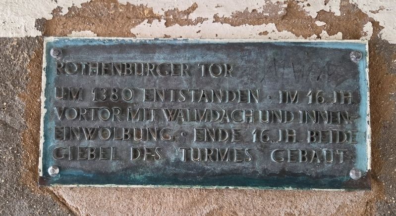
1. Rothenburger Tor / Rothenburg Gate Marker

Um 1380 entstanden. Im 16. Jh. Vortor mit Walmdach und Inneneinwölbung. Ende 16. Jh. beide Giebel des Turmes gebaut.
Rothenburg Gate
Built around 1380. In the 16th century, an outer gate with a hipped roof and an interior vault was added. Both gables of the tower were built at the end of the 16th century.
Topics. This historical marker is listed in this topic list: Forts and Castles. A significant historical year for this entry is 1380.
Location. 49° 4.311′ N, 10° 19.117′ E. Marker is in Dinkelsbühl, Bayern (Bavaria), in Ansbach. It can be reached from the intersection of Dr.-Martin-Luther-Straße and Ob. Schmiedgasse, on the left when traveling north. Touch for map. Marker is at or near this postal address: Dr.-Martin-Luther-Straße 25, Dinkelsbühl BY 91550, Germany. Touch for directions.

Regionally, this marker is in German Franconia and on the Romantic Road. Globally, it is in Europe, the European Union, Atlantic Europe, Central Europe, the Schengen Area, Western Europe, and the Western World. Historically, it finds itself in what was once the Holy Roman Empire
this page online
Other nearby markers. At least 8 other markers are within walking distance of this marker: Die Gerichtstafeln in den Dinkelsbühler Stadttoren (here, next to this marker); Spital / Hospital (a few steps from this marker); a different marker also named Spital / Hospital (within shouting distance of this marker); a different marker also named Spital / Hospital (within shouting distance of this marker); a different marker also named Spital / Hospital (within shouting distance of this marker); Frankreich bringt sich in Stellung / France positions itself (about 90 meters away, measured in a direct line); Der Kaiser hat den Sieg vor Augen / The emperor has victory in sight (about 90 meters away); Dänemark greift ein – Wallenstein als Gegengewicht / Denmark intervenes – Wallenstein as a counterwe (about 90 meters away). Touch for a list and map of all markers in Dinkelsbühl.

Photographed by James Hulse, September 14, 2026
2. Rothenburger Tor / Rothenburg Gate Marker
The view of the marker in the tunnel walkway.
Photographed by James Hulse
3. Rothenburger Tor / Rothenburg Gate Marker
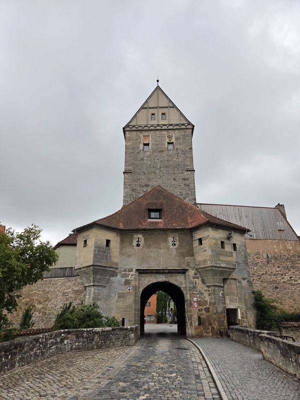
The view of the tower from outside the city wall.
Credits. This page was last revised on October 9, 2026. It was originally submitted on October 8, 2026, by James Hulse of Medina, Texas. This page has been viewed 4 times since then. Photos: 1, 2, 3. submitted on October 9, 2026, by James Hulse of Medina, Texas.
