Radwang in Dinkelsbühl in Ansbach, Bavaria, Germany — Central Europe
Die Stadtmühle Dinkelsbühl
⎯⎯⎯
The Dinkelsbühl Town Mill

Photographed by James Hulse, September 14, 2026
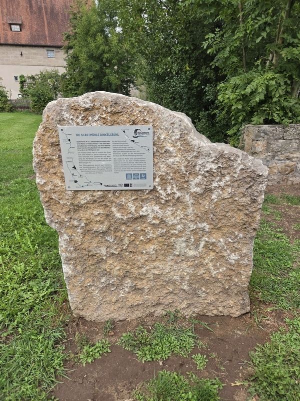
1. Die Stadtmühle Dinkelsbühl / The Dinkelsbühl Town Mill Marker

Spätestens im 13. Jahrhundert entsteht hier eine Mühle in Holzbauweise – mit zwei Wassergräben zur Verteidigung. Für ihren Betrieb staut man den Stadtgraben vor dem Wörnitztor und an der Wethgasse auf.
Ein Privileg Kaiser Karls IV. erlaubt der Stadt 1378, zwei Mühlen zu „bauen und setzen“. Um 1400 verbindet eine Stadtmauer mit Wehrgang das Nördlinger Tor mit der Mühle, die als Getreidemühle und Sägewerk nun Teil der Wehranlagen ist.
Das Mühlengebäude besitzt zwei Ecktürme aus Sandsteinquadern. Der Fachwerkgiebel weicht um 1600 einem Steingiebel. Mit drei Speichergeschossen erreicht der Dachstuhl eine Höhe von 12 Metern.
Als die Reichsstadt Dinkelsbühl unter bayerische Hoheit kommt, verkauft die Kriegs- und Domänenkammer die Stadtmühle 1808 samt Nebengebäuden für 8.900 Rheinische Gulden an den Meistbietenden. Der lässt den Mühlhofwehrgang abreißen.
1864 erhält die Mühle eine Dampfmaschine. 1923 brennt sie ab, doch wiederaufgebaut bleibt sie bis 1970 in Betrieb. 1984 kommt sie zurück in Stadtbesitz. Ab 2011 beteiligt sich die Deutsche Stiftung Denkmalschutz an ihrer Sanierung. Große
this page online
Mühlenroute Tauber · Wörnitz · Altmühl
LAG Region an der Romantischen Straße
Gefördert durch das Bayerische Staatsministerium für Ernährung, Landwirtschaft und Forsten und den Europäischen Landwirtschaftsfonds für die Entwicklung des Ländlichen Raums (ELER).
The Dinkelsbühl Town Mill
A timber mill was established here by the 13th century at the latest, with two water-filled ditches providing protection. To operate it, the town moat was dammed near the Wörnitz Gate and Wethgasse.
In 1378, a privilege granted by Emperor Charles IV allowed the town to “build and establish” two mills. Around 1400, a defensive town wall and wall walk connected the Nördlingen Gate with the mill. The grain mill and sawmill thus became part of the town’s fortifications.
The mill building has two corner towers constructed from sandstone blocks. Around 1600, its timber-framed gable was replaced by a stone gable. With three storage floors, the roof structure reaches a height of 12 metres.
After the Free Imperial City of Dinkelsbühl came under Bavarian
Photographed by James Hulse, September 14, 2026
2. Die Stadtmühle Dinkelsbühl / The Dinkelsbühl Town Mill Marker
The mill received a steam engine in 1864. It burned down in 1923 but was rebuilt and remained in operation until 1970. It returned to municipal ownership in 1984. Beginning in 2011, the German Foundation for Monument Protection participated in its restoration, preserving large portions of its technical equipment from the 1920s.
Tauber · Wörnitz · Altmühl Mill Route
LAG Region on the Romantic Road
Supported by the Bavarian State Ministry of Food, Agriculture and Forestry and the European Agricultural Fund for Rural Development (EAFRD).
Topics. This historical marker is listed in this topic list: Notable Buildings. A significant historical year for this entry is 1378.
Location. 49° 3.935′ N, 10° 19.519′ E. Marker is in Dinkelsbühl, Bayern (Bavaria), in Ansbach. It is in Radwang. It is at the intersection of Nördlinger Straße and Am Brühl, on the right when traveling north on Nördlinger Straße. Touch for map. Marker is
Photographed by James Hulse, September 14, 2026
3. Die Stadtmühle Dinkelsbühl / The Dinkelsbühl Town Mill Marker
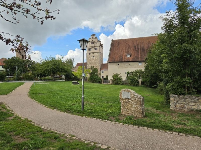
The view of the marker with the Town Mill in the background.

Regionally, this marker is in German Franconia and on the Romantic Road. Globally, it is in Europe, the European Union, Atlantic Europe, Central Europe, the Schengen Area, Western Europe, and the Western World. Historically, it finds itself in what was once the Holy Roman Empire and also the former West Germany.
Other nearby markers. At least 8 other markers are within walking distance of this marker: Die Kämpfe flammen wieder auf / The Fighting Flares Up Again (a few steps from this marker); Stadtmühle / Town Mill (within shouting distance of this marker); Nördlinger Tor / Nördlingen Gate (within shouting distance of this marker); Ausgezehrt und ausgepresst / Exhausted and Drained (approx. 0.4 kilometers away); Prager Fenstersturz / The Defenestration of Prague (approx. 0.4 kilometers away); Sarah Levite (approx. 0.4 kilometers away); Moritz Hamburger (approx. half a kilometer away); Klara Gutmann (approx. half a kilometer away). Touch for a list and map of all markers in Dinkelsbühl.
Credits. This page was last revised on October 9, 2026. It was originally submitted on October 9, 2026, by James Hulse of Medina, Texas. This page has been viewed 4 times since then. Photos: 1, 2, 3. submitted on October 9, 2026, by James Hulse of Medina, Texas.
