Chesterfield in Chesterfield County, Virginia — The American South (Mid-Atlantic)
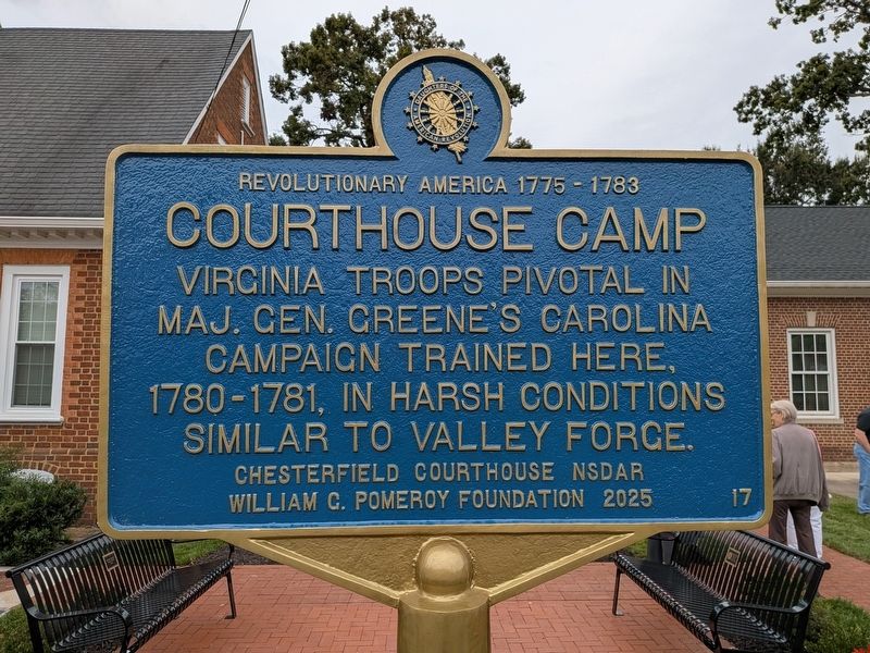
Courthouse Camp
| — | Revolutionary America 1775-1783 | — |
Photographed by Evan Dwyer, October 10, 2026
1. Courthouse Camp Marker
Erected 2026 by William G. Pomeroy Foundation, Chesterfield Courthouse NSDAR. (Marker Number 17.)
Topics and series. This historical marker is listed in these topic lists: Patriots & Patriotism • War, US Revolutionary. In addition, it is included in the Revolutionary America 1775-1783 (NSDAR & WGPF), and the William G. Pomeroy Foundation series lists. A significant historical year for this entry is 1780.
Location. 37° 22.59′ N, 77° 30.374′ W. Marker is in Chesterfield, Virginia, in Chesterfield County. It is on Wagners Way 0.1 miles north of Iron Bridge Road (Route 10), on the left when traveling north. Marker is in the municipal complex at Chesterfield Court House, next to the Oliver Rudy Law Building. Touch for map. Marker is at or near this postal address: 9910 Wagners Way, Chesterfield VA 23832, United States of America. Touch for directions.

Regionally, this marker is in the Piedmont, in Central Virginia, and in the Richmond Metropolitan Area. It is also in the American
this page online
Other nearby markers. At least 8 other markers are within walking distance of this marker: Confederate Memorial (within shouting distance of this marker); World War I in Chesterfield County (within shouting distance of this marker); Employee Service Recognition (within shouting distance of this marker); a different marker also named Chesterfield Court House (within shouting distance of this marker); Veterans Memorial Wall (within shouting distance of this marker); Chesterfield County Courthouse (about 300 feet away, measured in a direct line); 1917 Courthouse (about 300 feet away); Apostles of Religious Liberty (about 300 feet away). Touch for a list and map of all markers in Chesterfield.
Another marker is no longer nearby. Chesterfield Court House
Photographed by Evan Dwyer, October 10, 2026
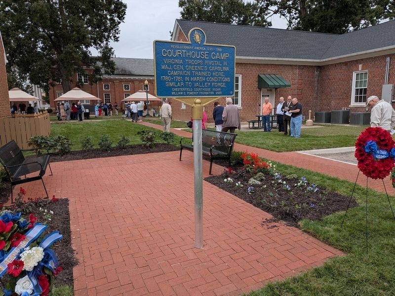
2. Courthouse Camp Marker
The Chesterfield Barracks Memorial Walkway is just beyond, running from the parking lot into the courthouse square.
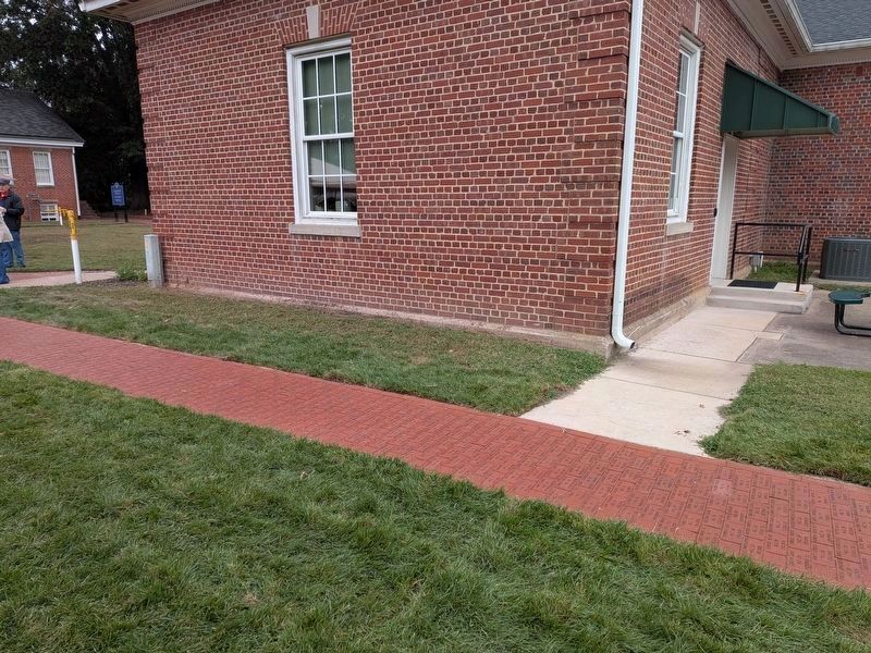
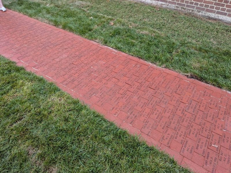
More about this marker. The marker is part of a coordinated memorial space that includes a Memorial Walkway comprised of engraved bricks listing known soldiers who trained at Chesterfield Barracks, printed by the Chesterfield Historical Society. The ribbon cutting for the walkway and the unveiling of the marker were part of a combined dedication on 10 October 2026. The small brick courtyard around the marker is a collaboration of the County of Chesterfield (bricks and contractor labor), the Bermuda Hundred Chapter NSDAR (one of the two benches), the Chesterfield Historical Society (the other of the two benches), and the Chester Garden Club (flowers, landscaping, mulch beds) in addition to the organizations that contributed to the marker's development and installation - the Pomeroy Foundation, Chesterfield Courthouse Chapter NSDAR, and the Virginia Department of Historic Resources.
Regarding Courthouse Camp. The courthouse green during the era described featured effectively just the courthouse itself (which was replaced in

Photographed by Evan Dwyer, October 10, 2026
3. Courthouse Camp Marker Unveiling Ceremony
During remarks by John Pagano, Historical Interpretation Supervisor for Chesterfield County.
Photographed by Evan Dwyer, October 10, 2026
4. Courthouse Barracks Memorial Walkway
Context view
Photographed by Evan Dwyer, October 10, 2026
5. Chesterfield Barracks Memorial Walkway
Detail view showing some of the inscribed names of men who were trained at the camp.

Photographed by Bernard Fisher, May 31, 2009
6. 1750 Courthouse Replica
The 1750 Chesterfield Courthouse was demolished to make way for the 1917 courthouse, which still stands. The replica shown here houses the Chesterfield Historical Museum and stands behind the 1917 Courthouse. Note the courthouse replica was built some 60 years after the original was demolished and does not contain original materials - nor is it on the same site (the old courthouse's footprint is encompassed by the 1917 courthouse's modern location).

Photographed by Evan Dwyer, July 12, 2025
7. 1917 Courthouse
In 1780-1 when the barracks and training camp were active, the 1750 Chesterfield County Court House stood on this site. The green courthouse square around - and especially to the east (where the marker is) of - the 'modern' courthouse was integral to the camp.

Photographed by Evan Dwyer, August 22, 2026
8. Chesterfield Barracks Site
The huts and structures of the Continental training camp were in this space (between the courthouse and Castlewood, viewed from Castlewood's lawn) and the surrounding fields.
Photographed by Evan Dwyer, August 22, 2026
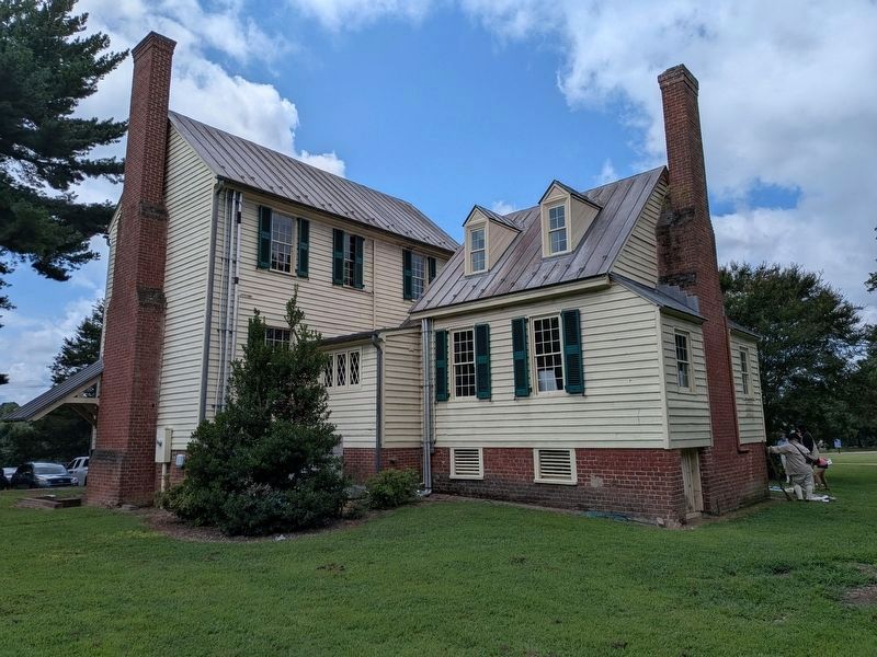
9. Castlewood
This small north wing of Castlewood, which Chesterfield County has dated to the 1760s as part of efforts to interpret the house in the mid-2020s, was on the grounds at the time of the barracks' construction and operation. Chesterfield County historical staff believe it was spared when Gen. Phillips burned the camp in order to provide the General himself with a temporary lodging. The large center section of the house, shown at left, was constructed by 1791 immediately adjacent to the 1760s original. Between 1816-22, the 1760s section was moved and rotated 90 degrees to its current location north of the house, and a new wing was built to the south at that time. The house has remained in that configuration since.
Credits. This page was last revised on October 11, 2026. It was originally submitted on October 10, 2026, by Evan Dwyer of Richmond, Virginia. This page has been viewed 7 times since then. Photos: 1, 2, 3, 4, 5. submitted on October 10, 2026, by Evan Dwyer of Richmond, Virginia. 6. submitted on June 1, 2009, by Bernard Fisher of Richmond, Virginia. 7. submitted on October 10, 2026, by Evan Dwyer of Richmond, Virginia. 8, 9. submitted on August 22, 2026, by Evan Dwyer of Richmond, Virginia.
