Sugar Loaf in Chester in Orange County, New York — The American Northeast (Mid-Atlantic)
Sugarloaf Historic District
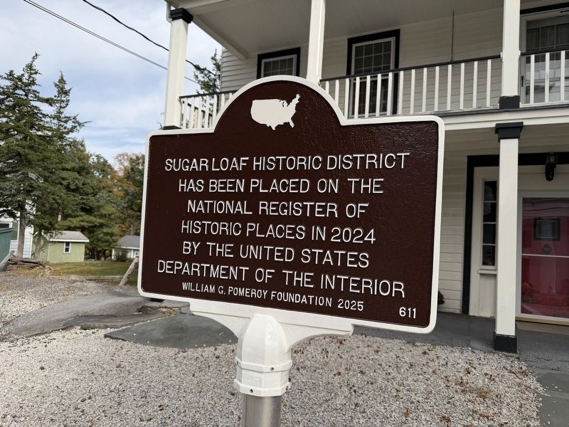
Photographed by Nicholas Scott, October 10, 2026
1. Sugarloaf Historic District Marker
has been placed on the
National Register of
Historic Places in 2024
by the United States
Department of the Interior
William G. Pomeroy Foundation 2025
Erected 2025. (Marker Number 611.)
Topics and series. This historical marker is listed in these topic lists: Industry & Commerce • Settlements & Settlers. In addition, it is included in the National Register of Historic Places (NRHP) series list. A significant historical year for this entry is 2024.
Location. 41° 19.176′ N, 74° 17.205′ W. Marker is in Chester, New York, in Orange County. It is in Sugar Loaf. It is on Kings Highway just south of Pine Hill Road, on the left when traveling south. Touch for map. Marker is at or near this postal address: 1388 Kings Hwy, Chester NY 10918, United States of America. Touch for directions.

Regionally, this marker is in Upstate New York and in the Hudson Valley. It is also in the American Northeast, in the Mid-Atlantic, and on the Eastern Seaboard. Globally, it is in the North Atlantic Region, North America, the Western Hemisphere, the Western World, and the Anglosphere. Historically,
this page online
Other nearby markers. At least 8 other markers are within 3 miles of this marker, measured as the crow flies: Sugar Loaf Community of Craftsmen (within shouting distance of this marker); Sugar Loaf School District #4 (approx. 0.2 miles away); Mountain Witch (approx. 0.3 miles away); Furybrook Farm (approx. 0.6 miles away); Hambletonian (approx. 0.9 miles away); Pet Cemetery (approx. 1.2 miles away); Chester Militia (approx. 2.6 miles away); Yelverton Inn (approx. 2.6 miles away). Touch for a list and map of all markers in Chester.
Also see . . . Sugar Loaf, NY.
The hamlet of Sugar Loaf, New York, was founded in the late 1740s as a waypoint along Kings Highway. Businesses supplied food and other goods, and horses to travelers. Today, Sugar Loaf, NY is a hamlet of artists, artisans, and unique shops.(Submitted on October 18, 2026, by Michael Herrick of Southbury, Connecticut.)
Credits. This page was last revised on October 18, 2026. It was originally submitted on October 10, 2026, by Nicholas Scott of New Vernon, New Jersey. This page has been viewed 9 times since then. Photo 1. submitted on October 10, 2026, by Nicholas Scott of New Vernon, New Jersey. • Michael Herrick was the editor who published this page.
Editor’s want-list for this marker. A wide view photo of the marker and its surroundings. • Can you help?
