Oxford in Oxfordshire, England, United Kingdom — Northwestern Europe (the British Isles)
Welcome to the Rewley Road Swing Bridge
Photographed by Ray Gurganus, May 20, 2026
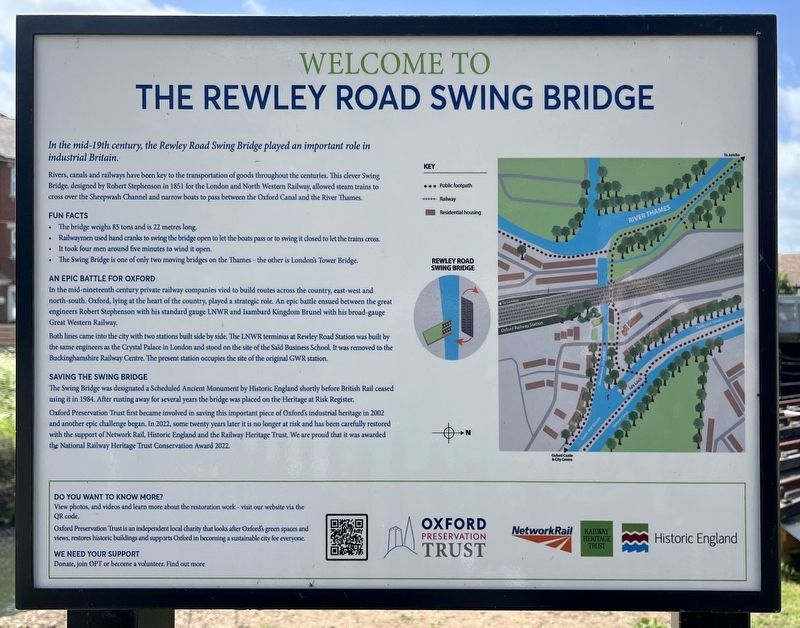
1. Welcome to the Rewley Road Swing Bridge Marker
Rivers, canals and railways have been key to the transportation of goods throughout the centuries. This clever Swing Bridge, designed by Robert Stephenson in 1851 for the London and North Western Railway, allowed steam trains to cross over the Sheepwash Channel and narrow boats to pass between the Oxford Canal and the River Thames.
Fun Facts
• The bridge weighs 85 tons and is 22 metres long.
• Railwaymen used hand cranks to swing the bridge open to let the boats pass or to swing it closed to let the trains cross.
• It took four men around five minutes to wind it open.
• The Swing Bridge is one of only two moving bridges on the Thames - the other is London's Tower Bridge.
An Epic Battle for Oxford
In the mid-nineteenth century private railway companies vied to build routes across the country, east-west and north-south. Oxford, lying at the heart of the country, played a strategic role. An epic battle ensued between the great engineers Robert Stephenson with his standard gauge LNWR and Isambard Kingdom Brunel
this page online
Both lines came into the city with two stations built side by side. The LNWR terminus at Rewley Road Station was built by the same engineers as the Crystal Palace in London and stood on the site of the Said Business School. It was removed to the Buckinghamshire Railway Centre. The present station occupies the site of the original GWR station.
Saving the Swing Bridge
The Swing Bridge was designated a Scheduled Ancient Monument by Historic England shortly before British Rail ceased using it in 1984. After rusting away for several years the bridge was placed on the Heritage at Risk Register.
Oxford Preservation Trust first became involved in saving this important piece of Oxford's industrial heritage in 2002 and another epic challenge began. In 2022, some twenty years later it is no longer at risk and has been carefully restored with the support of Network Rail, Historic England and the Railway Heritage Trust. We are proud that it was awarded the National Railway Heritage Trust Conservation Award 2022.
Erected by Oxford Preservation Trust.
Topics. This historical marker
David Sankey, via Wikimedia Commons (CC ), September 4, 2022
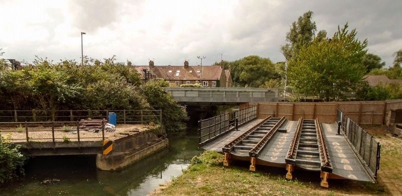
2. Rewley Road Swing Bridge
The (now reconstructed) swing bridge is visible here in the right half of the picture - the structure with rails on it.
Location. 51° 45.342′ N, 1° 16.21′ W. Marker is in Oxford, England, in Oxfordshire. It is on Rewley Road. Touch for map. Marker is at or near this postal address: 34 Rewley Road, Oxford, England OX1 2RG, United Kingdom. Touch for directions.

Regionally, this marker is in the Greater South East. Globally, it is on the Atlantic Ocean, in the North Atlantic Region, in Europe, in Atlantic Europe, on one of the British Isles, in the Western World, and in the Anglosphere. Historically, it finds itself in what was once the Roman Empire.
Other nearby markers. At least 8 other markers are within walking distance of this marker: Welcome to Jericho (approx. 0.4 kilometers away); Hythe Bridge Street (approx. 0.4 kilometers away); Park End Street (approx. half a kilometer away); Baptists of Oxford (approx. half a kilometer away); Beaumont Palace (approx. half a kilometer away); New Road (approx. 0.6 kilometers away); Vaulted Well Chamber (approx. 0.6 kilometers away); Oxford Castle Timeline (approx. 0.6 kilometers away). Touch for a list and map of all markers in Oxford.
Credits. This page was last revised on October 13, 2026. It was originally submitted on October 13, 2026, by Ray Gurganus of Washington, District of Columbia. This page has been viewed 3 times since then. Photos: 1. submitted on October 13, 2026, by Ray Gurganus of Washington, District of Columbia. 2. submitted on October 13, 2026. • Andrew Ruppenstein was the editor who published this page.
Editor’s want-list for this marker. photo of the marker within its surroundings • Can you help?
