Altstadt in Koblenz, Rhineland-Palatinate, Germany — Central Europe
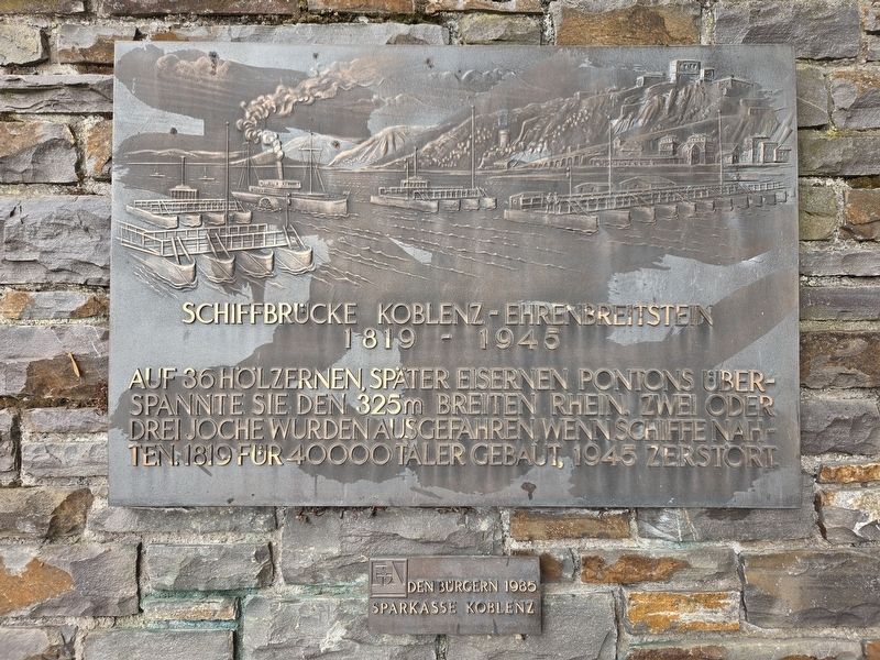
Schiffbrücke Koblenz-Ehrenbreitstein
⎯⎯⎯
Koblenz-Ehrenbreitstein Pontoon Bridge
1819 - 1945
Photographed by James Hulse, October 4, 2026
1. Schiffbrücke Koblenz-Ehrenbreitstein / Koblenz-Ehrenbreitstein Pontoon Bridge Marker

Supported by 36 wooden pontoons, later replaced by iron ones, the bridge spanned the 325-meter-wide Rhine. Two or three sections were moved out of the way when ships approached. Built in 1819 for 40,000 thalers and destroyed in 1945.
Erected 1985 by Sparkasse Koblenz.
Topics. This historical marker is listed in this topic list: Bridges & Viaducts. A significant historical year for this entry is 1819.
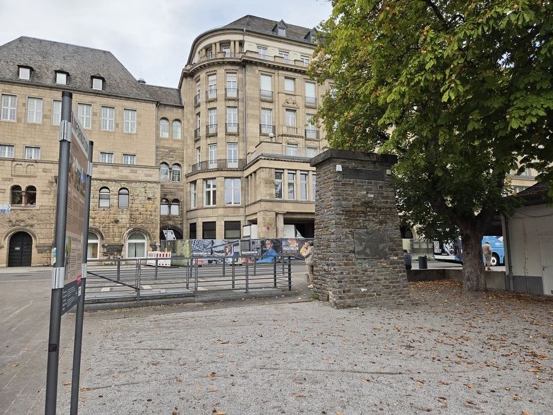
Location. 50° 21.521′ N, 7° 36.27′ E. Marker is in Koblenz, Rheinland-Pfalz (Rhineland-Palatinate). It is in Altstadt. It is on Konrad-Adenauer-Ufer 0.1 kilometers north of Stresemannstraße, on the right when traveling north. Touch for map. Marker is at or near this postal address: Konrad-Adenauer-Ufer 1, Koblenz RP 56068, Germany. Touch for directions.

Regionally, this marker is in the German Rhineland, in the Upper Middle Rhine Valley, and specifically in the Moselle Valley. Globally, it is in
this page online
Other nearby markers. At least 8 other markers are within walking distance of this marker: Altes Regierungsgebäude / Old Government Building (within shouting distance of this marker); The Good Old Times / Die gute alte Zeit (about 150 meters away, measured in a direct line); Oberlandesgericht Koblenz — Dienstgebäude II / Higher Regional Court of Koblenz (about 150 meters away); Father Joseph Kentenich / Pater Josef Kentenich (about 180 meters away); Carmelite Monastery (about 180 meters away); Oberlandesgericht Koblenz / Higher Regional Court of Koblenz (about 180 meters away); Rheinzollstrasse (about 210 meters away); Zum Gedenken an die Opfer des Nationalsozialismus / In memory of the victims of National Socialism (about 210 meters away). Touch for a list and map of all markers in Koblenz.
Photographed by James Hulse, October 4, 2026
2. Schiffbrücke Koblenz-Ehrenbreitstein / Koblenz-Ehrenbreitstein Pontoon Bridge Marker
Credits. This page was last revised on October 14, 2026. It was originally submitted on October 14, 2026, by James Hulse of Medina, Texas. This page has been viewed 4 times since then. Photos: 1, 2. submitted on October 14, 2026, by James Hulse of Medina, Texas.
