Wierschem in Mayen-Koblenz, Rhineland-Palatinate, Germany — Central Europe
Dorfschule und Backes
⎯⎯⎯
Village School and Bakehouse
Photographed by James Hulse, October 5, 2026
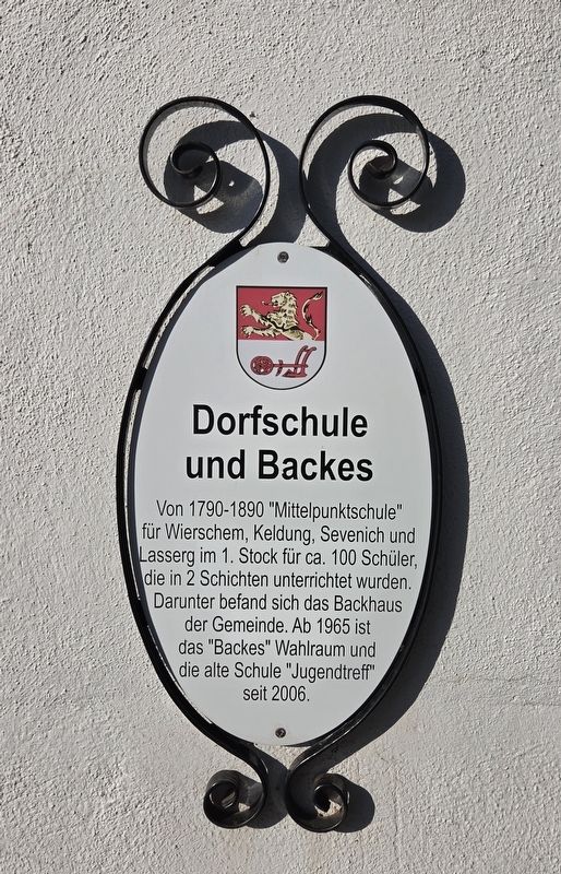
1. Dorfschule und Backes / Village School and Bakehouse Marker

Von 1790-1890 "Mittelpunktschule" für Wierschem, Keldung, Sevenich und Lasserg im 1. Stock für ca. 100 Schüler, die in 2 Schichten unterrichtet wurden. Darunter befand sich das Backhaus der Gemeinde. Ab 1965 ist das "Backes" Wahlraum und die alte Schule "Jugendtreff" seit 2006.
Village School and Bakehouse
From 1790 to 1890, the upper floor housed a central school serving Wierschem, Keldung, Sevenich and Lasserg. About 100 pupils were taught in two shifts. The communal bakehouse was located below. Since 1965, the bakehouse has served as a polling station, and since 2006, the old school has been a youth meeting place.
Topics. This historical marker is listed in this topic list: Notable Buildings. A significant historical year for this entry is 1965.
Location. 50° 13.542′ N, 7° 21.071′ E. Marker is in Wierschem, Rheinland-Pfalz (Rhineland-Palatinate), in Mayen-Koblenz. It is at the intersection of Raiffeisenplatz and Burstraße, on the right when traveling south on Raiffeisenplatz. Touch for map. Marker is at or near this postal address: Raiffeisenpl 4, Wierschem RP 56294, Germany. Touch for directions.

Regionally, this marker is in the German Rhineland and in the Eifel. Globally, it is in Europe, the European Union, Atlantic Europe, Central Europe, the Schengen Area, Western Europe, and the Western World. Historically, it finds itself in what was once the Roman Empire, the Holy Roman Empire, and the former West Germany.
Other nearby markers. At least 8 other markers are within 11 kilometers of this marker, measured as the crow flies: Paul Frost (here, next to this marker); Die wirtschaftliche Bauernbank / The Farmers’ Cooperative Bank (within shouting distance of this marker); Wasserturm / Water Tower (approx. 2.7 kilometers away); Elektrizitätswerk Nikolaus Molitor / Nikolaus Molitor Power Station (approx. 10.4 kilometers away); Ehemalige "Mittlere Getreidemühle" / Former "Middle Grain Mill" (approx. 10.4 kilometers away); Historische Grabkreuze / Historic Grave Crosses (approx. 10.5 kilometers away); Mittelalterliches Hofgut mit Fachwerk / Medieval Estate with Timber Framing (approx. 10.5 kilometers away); Grabplatte / Grave Slab (approx. 10.5 kilometers away). Touch for a list and map of all markers in Wierschem.
this page online
Photographed by James Hulse, October 5, 2026
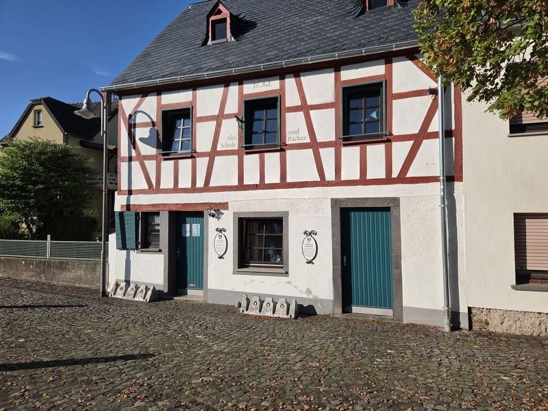
2. Dorfschule und Backes / Village School and Bakehouse Marker (Right Side)
The Paul Frost marker is on the left, and the Dorfschule und Backes marker is on the right.
Credits. This page was last revised on October 15, 2026. It was originally submitted on October 14, 2026, by James Hulse of Medina, Texas. This page has been viewed 7 times since then. Photos: 1, 2. submitted on October 15, 2026, by James Hulse of Medina, Texas.
