Downtown in Rapid City in Pennington County, South Dakota — The American Midwest (Upper Plains)
Tourism and Hotels
The Downtown Rapid City Historic District
Photographed by William Fischer, Jr., September 20, 2026
1. Tourism and Hotels Marker
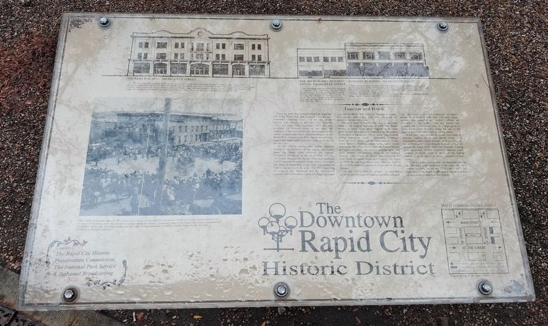
From an early day, tourism played an important role in the Black Hills and in Rapid City, the self-nominated "Gateway City". At the turn of the century, such volumes as the Black Hills Souvenir (1901) and Black Hills Illustrated (1903) not only promoted the mineral riches of the area, but contained florid descriptions and photographs of the scenic wonders and hotels accommodations of the Black Hills. Access to the Hills was by the railroads; wagon and stage roads connected those areas not on the rail lines.
By the 1920's, tourism had largely replaced mining in the economy of the region, and books about the Black Hills reflected the change. O'Harra's Handbook of the Black Hills (2nd ed., 1927) and Through the Blacks Hills and Badlands (1929) featured descriptions of the scenic attractions and detailed automobile routes, with information on what to see and do in the area. The 1927 beginning of work on Mt. Rushmore and the three-month summer visit of President Calvin Coolidge put Rapid City and the Black Hills firmly on the map of tourist destinations, and Rapid City has continued to promote tourism
this page online
The first hotel in Rapid City was a one-room cabin in the original townsite at Fifth and Rapid Streets; it made news when internal walls were added to provide a measure of privacy for the guests. By the turn of the century, the growing town boasted several impressive hotels: Merchants Exchange Hotel on Main Street and the International House, where the Elks Building stands today, (large frame structures); the Jester House (later the Patton House) at Eighth and Main was another popular spot. All were located conveniently close to the railroad depots. Other hotels of various dates included the Park Hotel on Myrtle Street and Chase's City Hotel. In 1928, the ten-story Hotel Alex Johnson, built by the C&NW Railroad, opened at Sixth and St. Joseph Streets.
In the 1920's with the growth of automobile tourism, another type of lodging appeared in Rapid City: the cabin camp. The predecessor of today's motels, these facilities with their individual cabins, ranging from primitive to "modern", offered an alternative to the hotels. The best known was probably the Baken Park Camp, in a large grove of cottonwoods
Photographed by William Fischer, Jr., September 20, 2026
2. Tourism and Hotels Marker
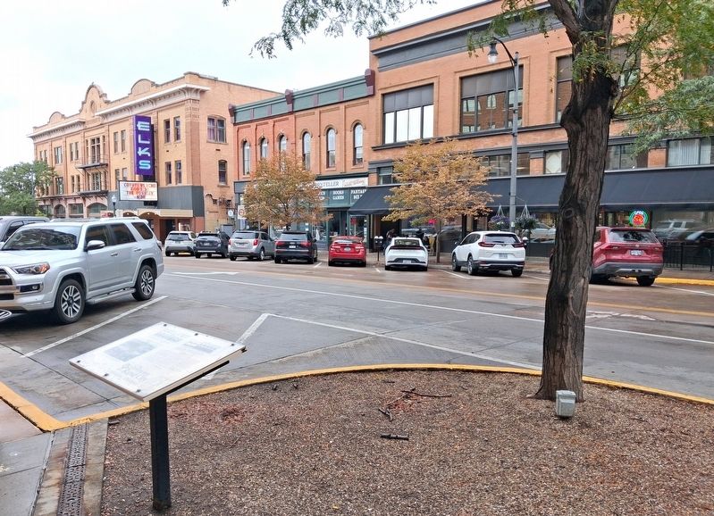
Highlighted buildings are in background
In the early days, no special efforts were made to entertain visitors, but in time special events were scheduled to draw larger crowds. In Rapid City, the annual Stockmen's Days brought in ranchers from all around the Black Hills, while the Duhamel Trading Post sponsored Native American dancers every summer on Sixth Street to show off the Lakota culture (and, of course, to attract customers to their store).
Over the years, tourist-oriented businesses sprang up. The early guide books tell of the caves and other natural wonders, but by the 1920's and 1930's, the highways of the Black Hill began to sprout a variety of attractions to entertain the visitors.
[Left photo caption reads]
This Collins photograph, taken in 1893, shows Sioux doing war dances at the intersection of Main and Sixth Streets in Rapid City - an annual event during which the spectators pitched coins to the Indians. Eventually, some of the Rapid City women complained of the Indians' nudity and, thereafter, the dancers performed in long underwear.
[Top building streetscape
Photographed by William Fischer, Jr., September 20, 2026
3. Duhamel Building and Annex
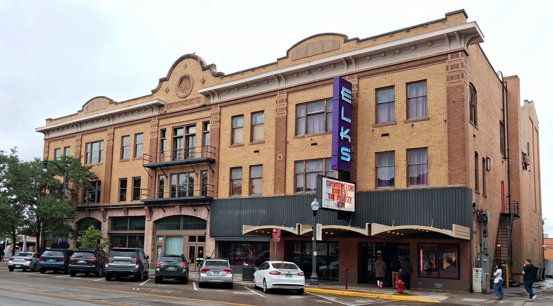
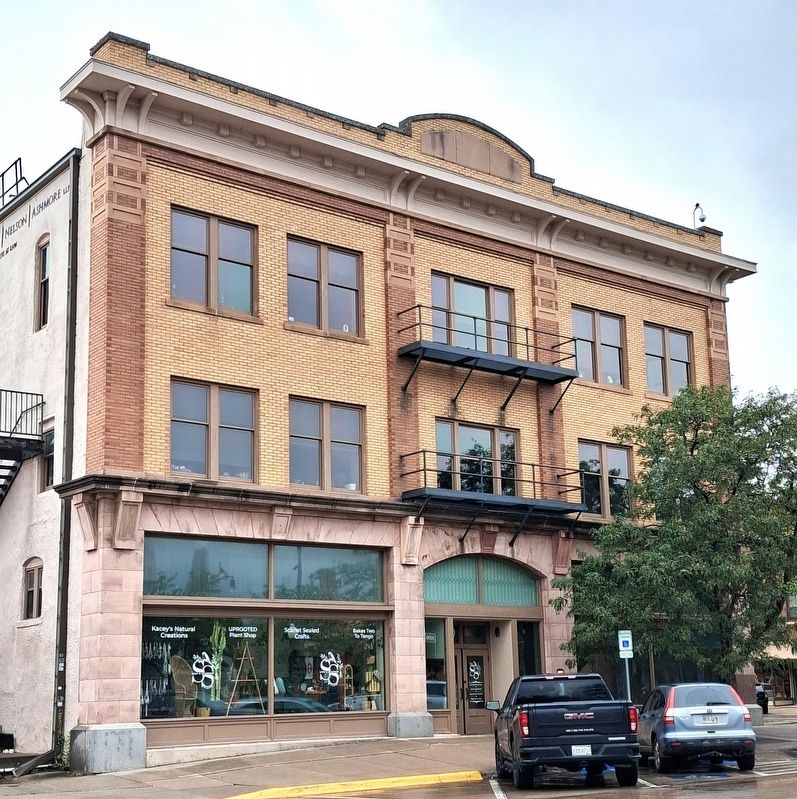
THE ELKS BUILDING: 502-512 SIXTH STREET
In 1911, this handsome masonry building was constructed for the Benevolent and Protective Order of Elks. The ground floor contained stores, while the second floor was the lavishly decorated clubrooms of the Elks Lodge. The south end of the building was a theater, with a 3-story fly for the scenery above the theater stage, and later became a motion picture theater. The theater's pipe organ was moved to Emmanuel Episcopal Church in the 1940's. The Elks Building's facade was restored in 1980.
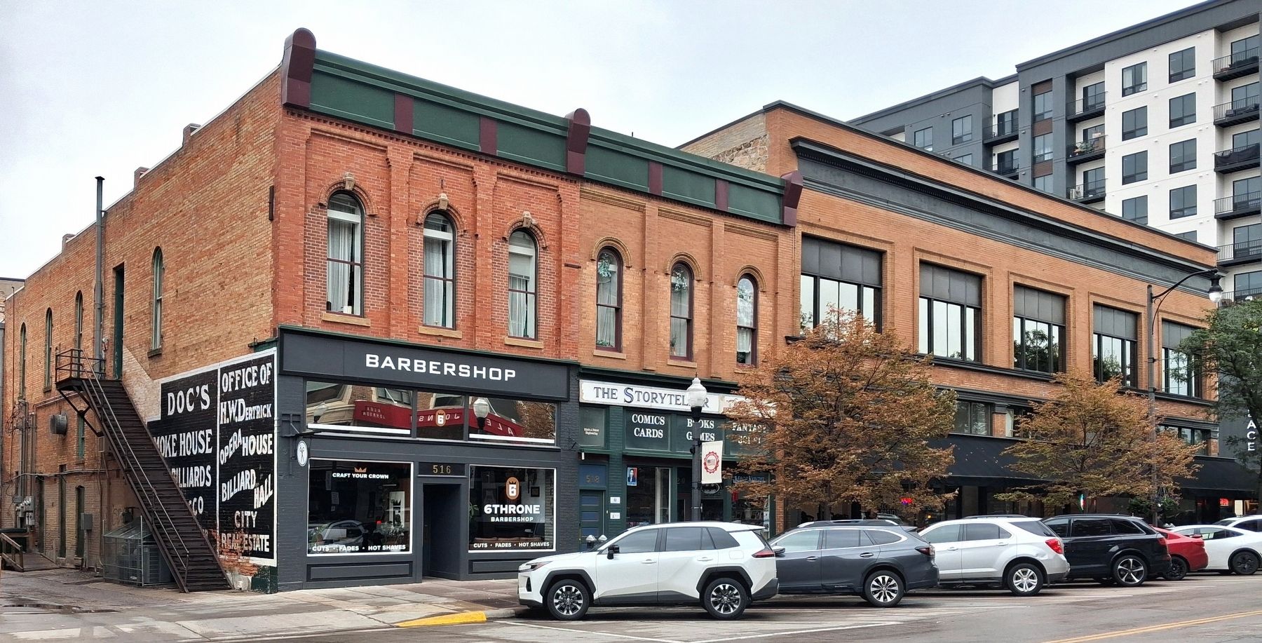
THE 1899 DUHAMEL BUILDING ANNEX: 516-520 SIXTH STREET
These buildings mark the close of the Italianate Commercial [Style] in this area. The north half of this pair housed, for many years, the Homecraft Bakery. Much of the original interior detailing, including the embossed tin ceilings, remains intact. The stucco facade covering the second story was removed when the front was partially restored in the 1980's.
DUHAMEL BUILDING: 522-530 SIXTH STREET
Peter Duhamel and his brothers and sons operated a large hardware and general merchandise firm in this 1890 building: the
Photographed by William Fischer, Jr., September 20, 2026
4. Elks Building
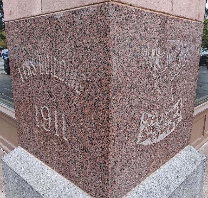
Facade restoration in 1989 returned the building to its original appearance (see the plaque on the column in the SW corner of the building).
Erected by the Rapid City Historic Preservation Commission, the National Park Service, and Duhamel Broadcasting.
Topics and series. This historical marker is listed in these topic lists: Communications • Fraternal or Sororal Organizations • Industry & Commerce • Settlements & Settlers. In addition, it is included in the National Register of Historic Places (NRHP) series list. A significant historical year for this entry is 1927.
Location. 44° 4.814′ N, 103° 13.644′ W. Marker is in Rapid City, South Dakota, in Pennington County. It is in Downtown. It is at the intersection of 6th Street and St. Joseph Street (Business Interstate 90), on the right when traveling south on 6th Street. Touch for map. Marker is at or near this postal address: 523 6th Street, Rapid City SD 57701, United States of America. Touch for directions.

Regionally,
Photographed by William Fischer, Jr., September 20, 2026
5. Elks Building (Main St Facade)
Other nearby markers. At least 8 other markers are within walking distance of this marker: George Washington (here, next to this marker); Early Rapid City History (a few steps from this marker); Ronald Reagan (within shouting distance of this marker); Jimmy Carter (within shouting distance of this marker); Donald J. Trump (within shouting distance of this marker); Mitakuye Oyasin (about 300 feet away, measured in a direct line); Hooky Jack Leary (about 300 feet away); George Herbert Walker Bush (about 300 feet away). Touch for a list and map of all markers in Rapid City.
Also see . . . Rapid City Historic Commercial District Nomination Form. (Submitted on October 16, 2026, by William Fischer, Jr. of Reynoldsburg, Ohio.)
Photographed by William Fischer, Jr., September 20, 2026
6. Elks Building Cornerstone
Credits. This page was last revised on October 16, 2026. It was originally submitted on October 16, 2026, by William Fischer, Jr. of Reynoldsburg, Ohio. This page has been viewed 6 times since then. Photos: 1, 2, 3, 4, 5, 6. submitted on October 16, 2026, by William Fischer, Jr. of Reynoldsburg, Ohio.
