Stanbridge East in Brome-Missisquoi, Québec — Central Canada (French-Canadian)
Cornell Mill
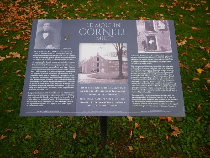
This early water-powered mill was pivotal in the community's economic and social development
Photographed by Kevin Craft, October 5, 2026
1. Le Moulin Cornell Mill Marker
This custom-work mill ground corn and buckwheat for flour and cattle feed. Farmers brought their grain to be milled and the miller kept a percentage of the ground product for his use or re-sale. Edwin Cornell (1820-1889) inherited the grist mill from his father and operated it with his son Matthew Saxe Cornell (1852-1934). They made significant changes to the mill property including building a granary on the west wall and a new mill dam across the river. By installing contemporary machinery and replacing the three original mill stones, the mill became a more commercial enterprise. One mill stone still leans on the mill wall. Matthew Allen Cornell (1874-Abt. 1947), great-grandson of the original owner, operated the mill until 1947 when, after 117 years of ownership by the Cornell family, he was obliged to sell it.
Successive mill owners were not able
this page online
CET ANCIEN MOULIN PROPULSÉ À L’EAU, ÉTAIT AU CŒUR DU DÉVELOPPEMENT ÉCONOMIQUE ET SOCIAL DE LA COMMUNAUTÉ.
À la fin du 18ᵉ siècle, Robert Wilson construisit un moulin à grain au bord de la rivière aux Brochets dans le village nouvellement colonisé de Stanbridge East. En 1830, Zebulon Cornell (1794-1852) du Vermont a acheté la propriété du moulin et a érigé un nouvel édifice en briques rouges à trois étages.
Ce moulin moulait du maïs et du sarrasin en farine et en grain pour le bétail. Les agriculteurs amenaient leur grain et le meunier conservait un pourcentage du produit moulu pour son utilisation ou sa revente. Edwin Cornell (1820-1889) a hérité du moulin à grain de son père et l’a exploité avec son fils Matthew Saxe Cornell (1852-1934). Ils ont fait d’importants changements à la propriété du moulin, notamment la construction d’un grenier sur le mur ouest et d’un nouveau barrage sur la rivière. En installant des machines contemporaines et en remplaçant les trois pierres d’origine du moulin, celui-ci devint une entreprise plus commerciale. Une de ces pierres repose toujours sur le mur du moulin. Matthew Allen Cornell (1874-1947), arrière-petit-fils du premier propriétaire, exploita le moulin jusqu’à ce qu’il soit obligé de le vendre en 1947. La famille Cornell fut propriétaire du moulin pendant 117 ans.
Les propriétaires successifs du moulin n’ont pas été en mesure de concurrencer les marchés en expansion du milieu du 20ᵉ siècle et en 1963, le moulin Cornell a cessé ses activités. Un an plus tard, il a été acheté par la Société d’histoire de Missisquoi et abrite maintenant le Musée Missisquoi, qui présente des expositions sur le patrimoine loyaliste de la région et sur d’autres aspects de l’histoire du comté.
Erected by Missisquoi
Photographed by Kevin Craft, October 5, 2026
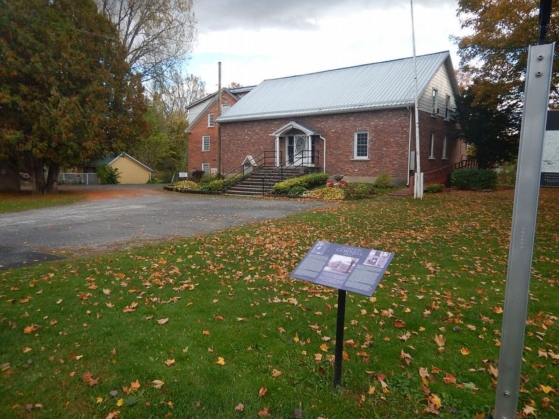
2. Wideview of Cornell Mill Marker
Topics. This historical marker is listed in this topic list: Landmarks. A significant historical year for this entry is 1830.
Location. 45° 7.282′ N, 72° 54.92′ W. Marker is in Stanbridge East, Québec, in Brome-Missisquoi. It is at the intersection of River Street and Caleb Tree Street, on the right when traveling east on River Street. Touch for map. Marker is at or near this postal address: 2 River Street, Stanbridge East QC J0J 2C0, Canada. Touch for directions.

Regionally, this marker is in the Outaouais & Eastern Townships. It is also in Central Canada. Globally, it is in North America, the Western Hemisphere, and the Western World. Historically, it finds itself in what was once a British colony, the Viceroyalty of New France, the Haudenosaunee (Iroquois) Confederacy, and Rupert’s Land.
Other nearby markers. At least 8 other markers are within 27 kilometers of this marker, measured as the crow flies: A different marker also named Cornell Mill (within shouting distance of this marker); In honour of Capt. Caleb Tree (approx. half a kilometer away); Grange Alexander-Solomon-Walbridge (approx. 6.6
Photographed by Kevin Craft, October 5, 2026
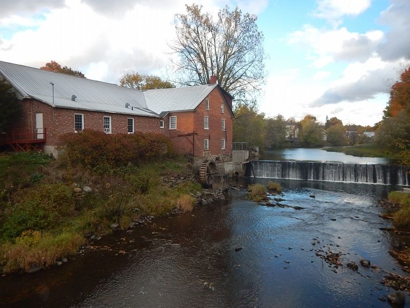
3. Cornell Mill (aka Missisquoi Museum)
More about this marker. Marker is located on the front lawn of the Missisquoi Museum.
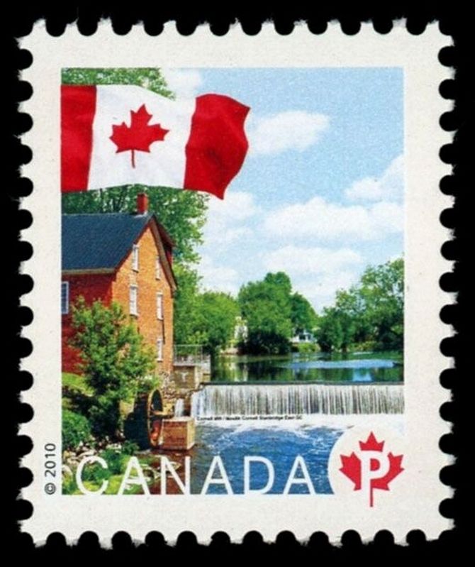
Regarding Cornell Mill. Cornell Mill was featured on a Canadian postage stamp in 2010.
Also see . . . Quebec Anglophone Heritage Network - Missisquoi Museum and Stanbridge East. (Submitted on October 16, 2026, by Kevin Craft of Bedford, Quebec.)
Photographed by Kevin Craft
4. Canadian postage stamp of Cornell Mill
Credits. This page was last revised on October 16, 2026. It was originally submitted on October 16, 2026, by Kevin Craft of Bedford, Quebec. This page has been viewed 4 times since then. Photos: 1, 2, 3, 4. submitted on October 16, 2026, by Kevin Craft of Bedford, Quebec.
