Goleta in Santa Barbara County, California — The American West (Pacific Coastal)
Bunkhouse
Photographed by Adam Margolis, June 4, 2026
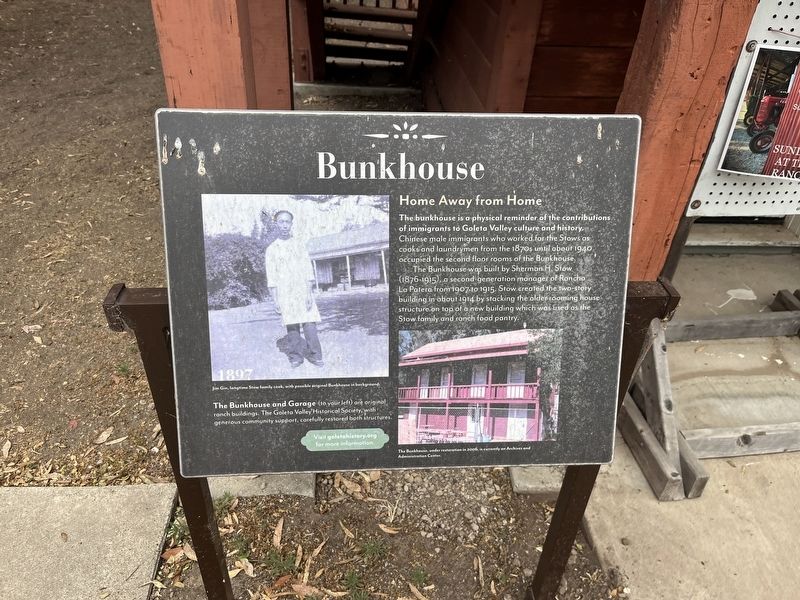
1. Bunkhouse Marker
The Bunkhouse was built by Sherman H. Stow (1876-1915), a second generation manager of Rancho La Patera from 1907 to 1915: Stow created the two-story building in about 1914 by stacking the older rooming house structure on top of a new building which was used as the Stow family and ranch food pantry.
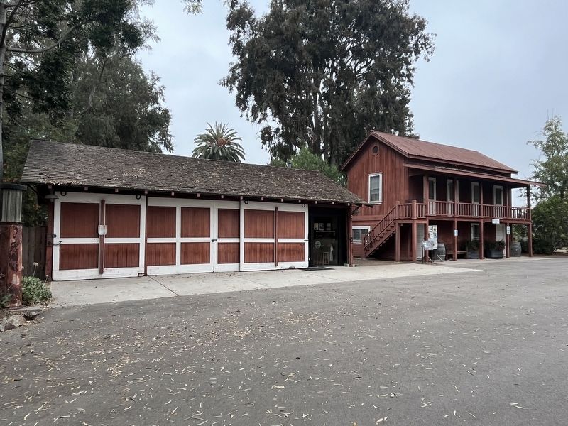
The Bunkhouse and Garage (to your left) are original ranch buildings. The Goleta Valley Historical Society, with generous community support, carefully restored both structures.
Topics. This historical marker is listed in these topic lists: Architecture • Asian Americans • Settlements & Settlers. A significant historical year for this entry is 1940.
Location. 34° 26.592′ N, 119° 51.12′ W. Marker is in Goleta, California, in Santa Barbara County. It can be reached from North Los Carneros Road, on the right when traveling north. Touch for map. Marker is
this page online

Regionally, this marker is on the Central Coast, specifically on the Coast Ranges, and specifically in the Transverse Ranges. It is also on the American Pacific Coast. Globally, it is in North America, on the Ring of Fire, on the Pacific Rim, in the Western Hemisphere, in the Western World, and in the Anglosphere. Historically, it finds itself in what was once New Spain and also Mexico’s Alta California.
Other nearby markers. At least 8 other markers are within 3 miles of this marker, measured as the crow flies: Stow House (within shouting distance of this marker); a different marker also named Stow House (within shouting distance of this marker); a different marker also named Stow House (within shouting distance of this marker); Goleta Depot (about 300 feet away, measured in a direct line); United States Marine Corps Aviation Memorial (approx. 1.1 miles away); Earle Ovington Terminal (approx. 1½ miles away); Ovington's Hangar (approx. 1.6 miles away); Sexton House (approx. 2.1 miles away). Touch for a list and map
Photographed by Adam Margolis, June 4, 2026
2. Bunkhouse Marker
Credits. This page was last revised on November 1, 2026. It was originally submitted on October 18, 2026, by Adam Margolis of Mission Viejo, California. This page has been viewed 8 times since then. Photos: 1, 2. submitted on October 18, 2026, by Adam Margolis of Mission Viejo, California. • Andrew Ruppenstein was the editor who published this page.
