Bures in Essex, England, United Kingdom — Northwestern Europe (the British Isles)
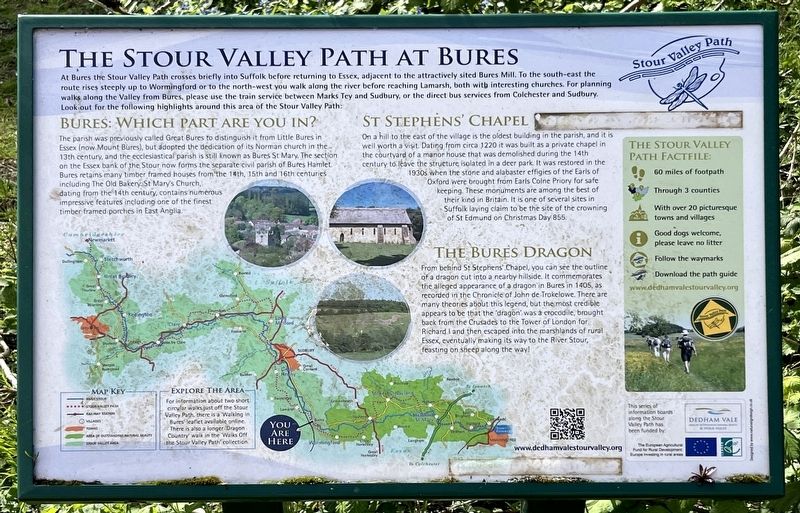
The Stour Valley Path at Bures
| — | Stour Valley Path | — |
Photographed by Ray Gurganus, April 18, 2026
1. The Stour Valley Path at Bures Marker
Bures: Which part are you in?
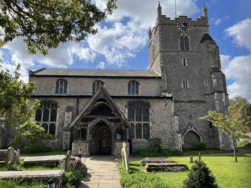
The parish was previously called Great Bures to distinguish it from Little Bures in Essex (now Mount Bures), but adopted the dedication of its Norman church in the 13th century, and the ecclesiastical parish is still known as Bures St Mary. The section on the Essex bank of the Stour now forms the separate civil parish of Bures Hamlet. Bures retains many timber framed houses from the 14th, 15th and 16th centuries including The Old Bakery. St Mary's Church, dating from the 14th century, contains numerous impressive features including one of the finest timber
this page online
St Stephen's Chapel
On a hill to the east of the village is the oldest building in the parish, and it is well worth a visit Dating from circa 1220 it was built as a private chapel in the courtyard of a manor house that was demolished during the 14th century to leave the structure isolated in a deer park. It was restored in the 1930s when the stone and alabaster effigies of the Earls of Oxford were brought from Earls Colne Priory for safe keeping. These monuments are among the best of their kind in Britain. It is one of several sites in Suffolk laying claim to be the site of the crowning of St Edmund on Christmas Day 855.
The Bures Dragon
From behind St Stephens Chapel, you can see the outline of a dragon cut into a nearby hillside. It commemorates the alleged appearance of a dragon in Bures in 1405, as recorded in the Chronicle of John de Trokelowe. There are many theories about this legend, but the most credible appears to be that the dragon was a crocodile, brought back from the Crusades to the Tower of London for Richard I and then escaped into the marshlands of rural Essex, eventually making
Photographed by Ray Gurganus, April 18, 2026
2. St Mary's Church
Topics. This historical marker is listed in these topic lists: Animals • Religion & Religious Structures.
Location. 51° 58.321′ N, 0° 46.408′ E. Marker is in Bures, England, in Essex. It is on Bridge Street, on the right when traveling east. The marker is mounted to a small stand and is encountered shortly before crossing the bridge as one heads east. Touch for map. Marker is at or near this postal address: 19 Bridge Street, Bures, England CO8 5AD, United Kingdom. Touch for directions.

Regionally, this marker is in the Greater South East. Globally, it is on the Atlantic Ocean, in the North Atlantic Region, in Europe, in Atlantic Europe, on one of the British Isles, in the Western World, and in the Anglosphere. Historically, it finds itself in what was once the Roman Empire.
Other nearby markers. At least 8 other markers are within 8 kilometers of this marker, measured as the crow flies: The History of Bures Common (within shouting distance of this marker); Thomas Gainsborough (approx. 0.3 kilometers away); Bury St Edmunds Yard Signal Box (approx. 0.3 kilometers away); The History of Bures (approx. 0.3 kilometers away); The History of Chappel and Wakes Colne (approx. 5.3 kilometers away); A Short History of Beautiful Sudbury (approx. 7.6 kilometers away); Sudbury Station (approx. 7.6 kilometers away); The Lady Elizabeth (approx. 8 kilometers away). Touch for a list and map of all markers in Bures.
Credits. This page was last revised on November 1, 2026. It was originally submitted on October 19, 2026, by Ray Gurganus of Washington, District of Columbia. This page has been viewed 7 times since then. Photos: 1, 2. submitted on October 19, 2026, by Ray Gurganus of Washington, District of Columbia. • Andrew Ruppenstein was the editor who published this page.
Editor’s want-list for this marker. photo of the marker within its surroundings • Can you help?
