Spotsylvania Courthouse in Spotsylvania County, Virginia — The American South (Mid-Atlantic)
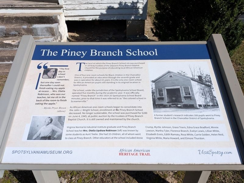
The Piney Branch School
| — | Spotsylvania African American Heritage Trail | — |
Photographed by Evan Dwyer, October 12, 2026
1. The Piney Branch School Marker
The school, under the jurisdiction of the Spotsylvania School Board, operated five months during the academic year. It was officially named "Piney Branch" in the 1919-20 Spotsylvania School Board minutes; prior to that time it was referred to as "the colored school in Screamerville."
As African American one-room schools began to consolidate into the John J. Wright School, enrollment at the Piney Branch School decreased. No longer sustainable, the school was purchased for $280 on June 4, 1945, at public auction by the trustees of Piney Branch Baptist Church. It is still owned and maintained by the church.
Virginia Normal & Industrial Institute graduate and Piney Branch School teacher Mrs. Otelia Upshaw Robinson (left) was known by some students as Aunt Teelie. She had 10 children, all of whom went to class at Piney Branch. Other educators at the school included Annie Crump, Myrtle Johnson, Grace Travis, Edna Grace Bradford, Minnie Lawson,
this page online
"The first day in school I don't remember, but one day soon thereafter I could not finish eating my apple at recess... Mrs. Otelia Robinson, who was our teacher, let me sit in the back of the room to finish eating the apple."
- Myrtle Pryor Brown (above)
Caption:
A former student's research indicates 168 pupils went to Piney Branch School in the Chancellor District of Spotsylvania
Spotsylvaniamuseum.org - VisitSpotsy.com
Erected by Spotsylvania County Museum.
Topics. This historical marker is listed in these topic lists: African Americans • Education • Religion & Religious Structures. A significant historical year for this entry is 1878.
Location. 38° 15.361′ N, 77° 38.209′ W. Marker is in Spotsylvania Courthouse, Virginia, in Spotsylvania County. It is on Piney Branch Road (Virginia Route 624) 0.3 miles south of Catharpin Road (County Route 612), on the left when traveling south. Touch for map. Marker is at or near this postal address:
Photographed by Evan Dwyer, October 12, 2026
2. The Piney Branch School
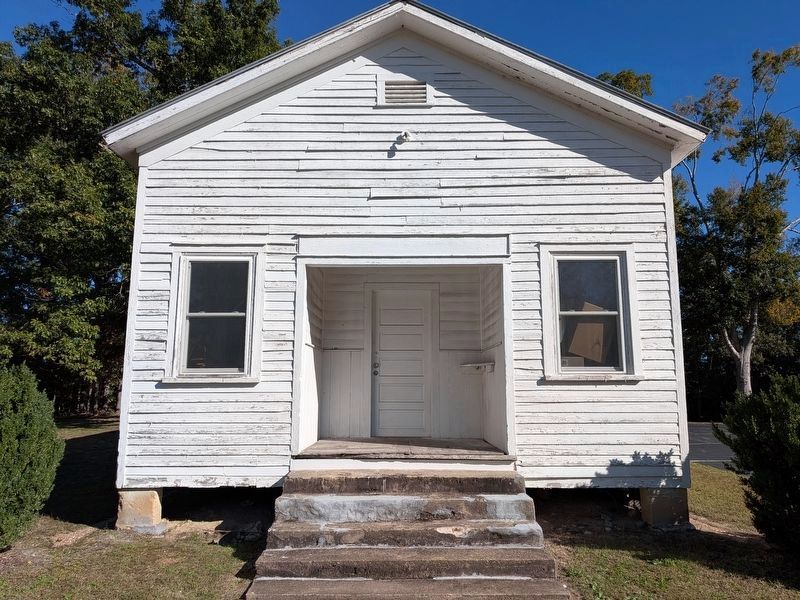
Used today for storage, this structure dates to the mid-late 1870s.

Regionally, this marker is in the Washington Metropolitan Area, in Northern Virginia, and in the Piedmont. It is also in the American South, specifically in the Upper South, in the Mid-Atlantic, and on the Eastern Seaboard. Globally, it is in the North Atlantic Region, North America, the Western Hemisphere, the Western World, and the Anglosphere. Historically, it finds itself in what was once the territory of the Mississippian Culture, one of the original Thirteen Colonies, one of the Confederate States of America, and the Antebellum South.
Other nearby markers. At least 8 other markers are within 2 miles of this marker, measured as the crow flies: Heroics of Sgt. Benjamin Brown (approx. 1½ miles away); U.S. Colored Troops (approx. 1½ miles away); First Shots of Freedom (approx. 1½ miles away); Ordeal of the Wellfords (approx. 1.7 miles away); Rearguard Action (approx. 1.7 miles away); Chancellorsville Campaign (approx. 1.8 miles away); Lafayette at Corbin’s Bridge (approx. 1.8 miles away); Todd’s Tavern (approx. 1.8 miles
Photographed by Evan Dwyer, October 12, 2026
3. The Piney Branch School
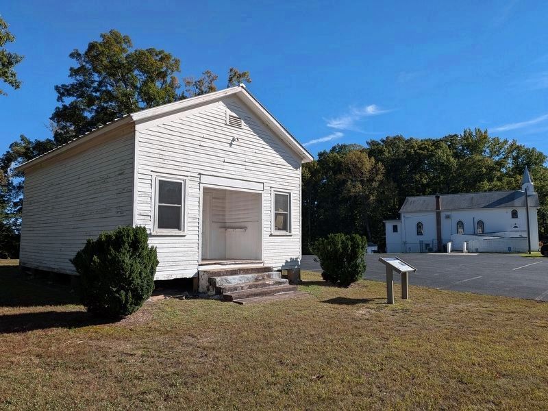
With marker in front. Piney Branch Baptist Church, constructed in 1932 to replace a deteriorated predecessor church building, stands in the distance; the current congregation was established around the same time that the county purchased the land for the school, though the church's website is unclear about whether the school was built before they bought its site in 1878 or after.
Other markers no longer nearby. The Piney Branch School (has been replaced with this marker); Sergeant Benjamin Brown (was approx. 1½ miles away but has been replaced with another marker now near it); U. S. Colored Troops in Spotsylvania (was approx. 1½ miles away but has been replaced with another marker now near it); The Wilderness and the Overland Campaign (was approx. 1½ miles away but has been permanently removed).
Related marker. Click here for another marker that is related to this marker. The linked marker preceded this one in the same location.
Photographed by Bernard Fisher, June 21, 2015
4. Piney Branch Baptist Church
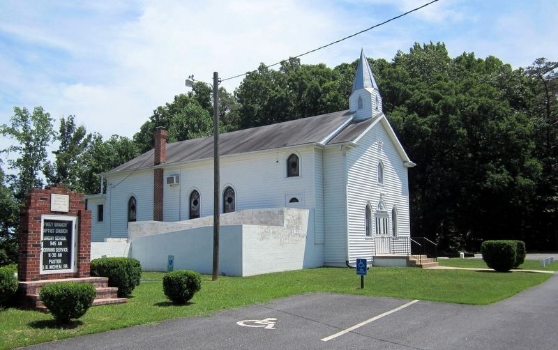
The church has a long history, originating in the 1760s as an Anglican church of St. George's Parish. It became an Episcopal church in 1789 following the Revolutionary War, and remained such until the 1870s. The Piney Branch church that stood here during the Civil War was wooden, and served as a Federal Hospital during the fighting around Spotsylvania Courthouse. Generals Grant and Meade also stopped on the broad, low hill - called "Church Hill" locally - that the church occupies while en route to Spotsylvania Courthouse following the Battle of the Wilderness. The church fell into disrepair as membership dwindled between 1869-72, with The Wilderness, Goshen, and Mt. Zion Baptist churches taking most of the congregation. The land was purchased for the formation of a new congregation, predominantly African American, during the 1870s and the old church was replaced with a a new building, of which apparently the concrete steps are the only surviving element. That building was itself replaced in 1932 by the current structure.
Credits. This page was last revised on October 19, 2026. It was originally submitted on October 19, 2026, by Evan Dwyer of Richmond, Virginia. This page has been viewed 12 times since then. Photos: 1, 2, 3. submitted on October 19, 2026, by Evan Dwyer of Richmond, Virginia. 4. submitted on June 22, 2015, by Bernard Fisher of Richmond, Virginia.
