Chestnut Hill in Nashville in Davidson County, Tennessee — The American South (East South Central)
Central Tennessee College
Photographed by Darren Jefferson Clay, October 18, 2026
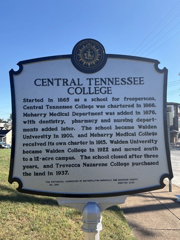
1. Central Tennessee College Marker
Started in 1865 as a school for freepersons, Central Tennessee College was chartered in 1866. Meharry Medical Department was added in 1876, with dentistry, pharmacy and nursing departments added later. The school became Walden University in 1900, and Meharry Medical College received its own charter in 1915. Walden University became Walden College in 1922 and moved south to a 12-acre campus. The school closed after three years, and Trevecca Nazarene College purchased the land in 1937.
Side 2:
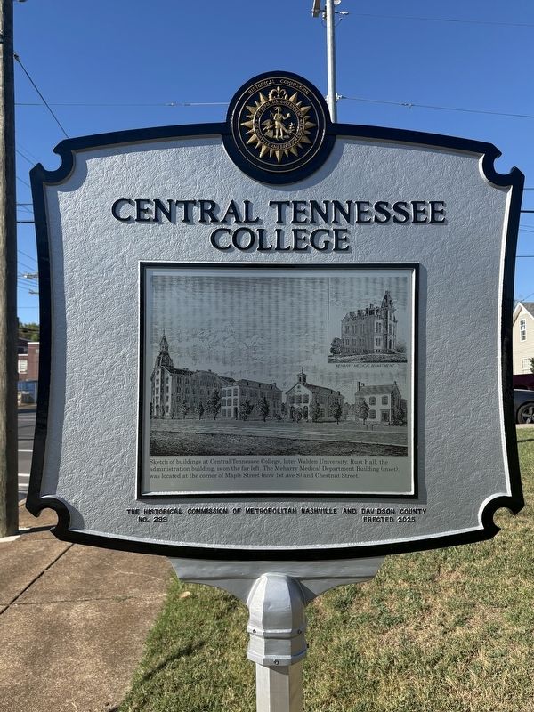
Sketch of buildings at Central Tennessee College, later Walden University. Rust Hall, the administration building, is on the far left. The Meharry Medical Department Building (inset) was located at the corner of Maple Street (now 1st Ave S) and Chestnut Street.
Erected 2026 by The Historical Commission of Metropolitan Nashville and Davidson County. (Marker Number 299.)
Topics. This historical marker is listed in these topic lists: African Americans • Education. A significant historical year for this entry is 1865.
Location. 36° 8.79′ N, 86° 45.797′ W. Marker is in Nashville, Tennessee, in Davidson County. It
this page online

Regionally, this marker is in Middle Tennessee. It is also in the American South and specifically in the Upper South. Globally, it is in North America, the Western Hemisphere, the Western World, and the Anglosphere. Historically, it finds itself in what was once the territory of the Mississippian Culture, one of the Confederate States of America, and the Antebellum South.
Other nearby markers. At least 8 other markers are within walking distance of this marker: Hubbard House (about 300 feet away, measured in a direct line); Tom Wilson Park / Thomas T. Wilson (about 500 feet away); St. Patrick Catholic Church (about 700 feet away); Robert Emmitt Lillard (approx. 0.2 miles away); Battle of Nashville (approx. 0.2 miles away); James Carroll Napier (approx. 0.2 miles away); Lieutenant Henry Alvin Cameron 1875-1918 / Cameron School (approx. 0.2
Photographed by Darren Jefferson Clay, October 18, 2026
2. Central Tennessee College Marker
Photographed by Darren Jefferson Clay, October 18, 2026
3. Central Tennessee College Marker
Credits. This page was last revised on October 23, 2026. It was originally submitted on October 19, 2026, by Darren Jefferson Clay of Duluth, Georgia. This page has been viewed 10 times since then. Photos: 1, 2, 3. submitted on October 19, 2026, by Darren Jefferson Clay of Duluth, Georgia. • James Hulse was the editor who published this page.
