Wymondham in Norfolk, England, United Kingdom — Northwestern Europe (the British Isles)
Wymondham Abbey, South Side
Photographed by Ray Gurganus, April 22, 2026
1. Wymondham Abbey, South Side Marker
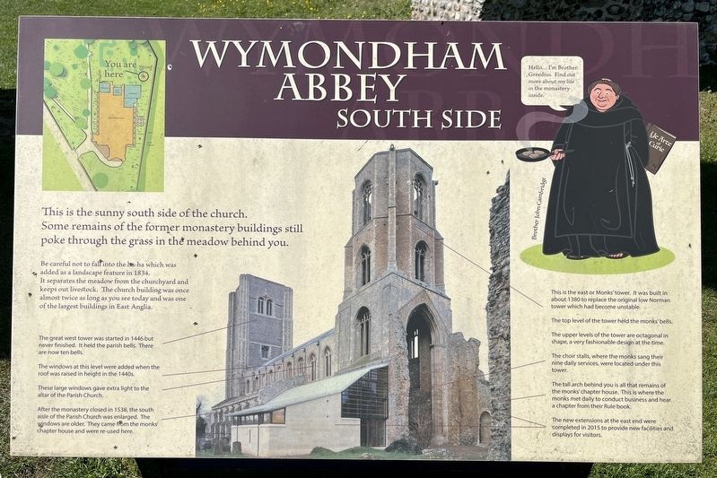
Be careful not to fall into the ha-ha which was added as a landscape feature in 1834. It separates the meadow from the churchyard and keeps out livestock. The church building was once almost twice as long as you see today and was one of the largest buildings in East Anglia.
• The great west tower was started in 1446 but never finished. It held the parish bells. There are now ten bells.
• The windows at this level were added when the roof was raised in height in the 1440s.
• These large windows gave extra light to the altar of the Parish Church.
• After the monastery closed in 1538, the south aisle of the Parish Church was enlarged. The windows are older. They came from the monks chapter house and were re-used here.
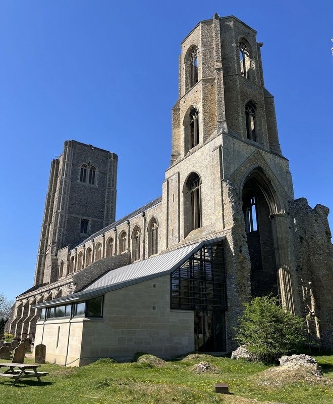
• This is the east or Monks' tower. It was built in about 1380 to replace the original low Norman tower which had become unstable.
• The top level of the tower held the monks' bells.
• The upper levels of the tower are octagonal in shape, a very
this page online
• The choir stalls, where the monks sang their nine daily services, were located under this tower.
• The tall arch behind you is all that remains of the monks' chapter house. This is where the monks met daily to conduct business and hear a chapter from their Rule book.
• The new extensions at the east end were completed in 2015 to provide new facilities and displays for visitors
Topics. This historical marker is listed in this topic list: Religion & Religious Structures.
Location. 52° 34.216′ N, 1° 6.495′ E. Marker is in Wymondham, England, in Norfolk. It can be reached from Church Street. On the grounds of Wymondham Abbey. Touch for map. Marker is at or near this postal address: 21 Church Street, Wymondham, England NR18 0PH, United Kingdom. Touch for directions.

Regionally, this marker is in East Anglia. Globally, it is on the Atlantic Ocean, in the North Atlantic Region, in Europe, in Atlantic Europe, on one of the British Isles, in the Western World, and in the Anglosphere. Historically, it finds itself in what was once the
Photographed by Ray Gurganus, April 22, 2026
2. Wymondham Abbey
Other nearby markers. At least 8 other markers are within walking distance of this marker: A different marker also named Wymondham Abbey (within shouting distance of this marker); Aromatic Herbs (within shouting distance of this marker); Medicinal Herbs (within shouting distance of this marker); Wymondham Abbey, North Side (about 90 meters away, measured in a direct line); Wymondham Abbey, West End (about 90 meters away); The Green Dragon Inn (about 150 meters away); Robert and William Kett (about 150 meters away); Market Cross (approx. 0.3 kilometers away). Touch for a list and map of all markers in Wymondham.
Credits. This page was last revised on November 1, 2026. It was originally submitted on October 20, 2026, by Ray Gurganus of Washington, District of Columbia. This page has been viewed 9 times since then. Photos: 1, 2. submitted on October 20, 2026, by Ray Gurganus of Washington, District of Columbia. • Andrew Ruppenstein was the editor who published this page.
