Chapman in Merrick County, Nebraska — The American Midwest (Upper Plains)
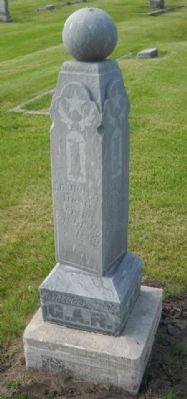
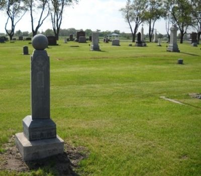
Chapman Cemetery GAR Marker
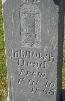
Unknown Dead
From 1861 to 1865
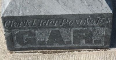
bottom inscription
Clark Elder Post No. 158
G.A.R.
Erected by Clark Elder Post No. 158.
Topics. This historical marker is listed in this topic list: War, US Civil. A significant historical year for this entry is 1861.
Location. 41° 0.992′ N, 98° 9.334′ W. Marker is in Chapman, Nebraska, in Merrick County. Marker can be reached from G Road, 0.1 miles west of Prairie Street. This GAR marker is located in the center of the Chapman Cemetery. Touch for map. Marker is at or near this postal address: G Road, Chapman NE 68827, United States of America. Touch for directions.
Other nearby markers. At least 8 other markers are within 11 miles of this marker, measured as the crow flies. Central Nebraska Regional Airport (approx. 9.1 miles away); B-29 Superfortress / 6th Bomb Group / Tinian Island (approx. 9.1 miles away); Arrasmith Field (approx. 9.1 miles away); The Mormon Trail (approx. 9.3 miles away); Lone Tree (approx. 9.3 miles away); B-17 Bomber Crash, 1944 (approx. 9.7 miles away); Site of the Original Settlement in Hall County, Nebraska (approx. 10˝ miles away); The Seedling Mile (approx. 10.6 miles away).
Credits. This page was last revised on June 16, 2016. It was originally submitted on June 1, 2010, by Thomas Onions of Olathe, Kansas. This page has been viewed 1,273 times since then and 22 times this year. Photos: 1, 2, 3, 4. submitted on June 1, 2010, by Thomas Onions of Olathe, Kansas.


