Thetford in Norfolk, England, United Kingdom — Northwestern Europe (the British Isles)
The Prior's Lodging
Photographed by Ray Gurganus, April 24, 2026
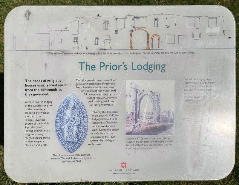
1. The Prior's Lodging Marker
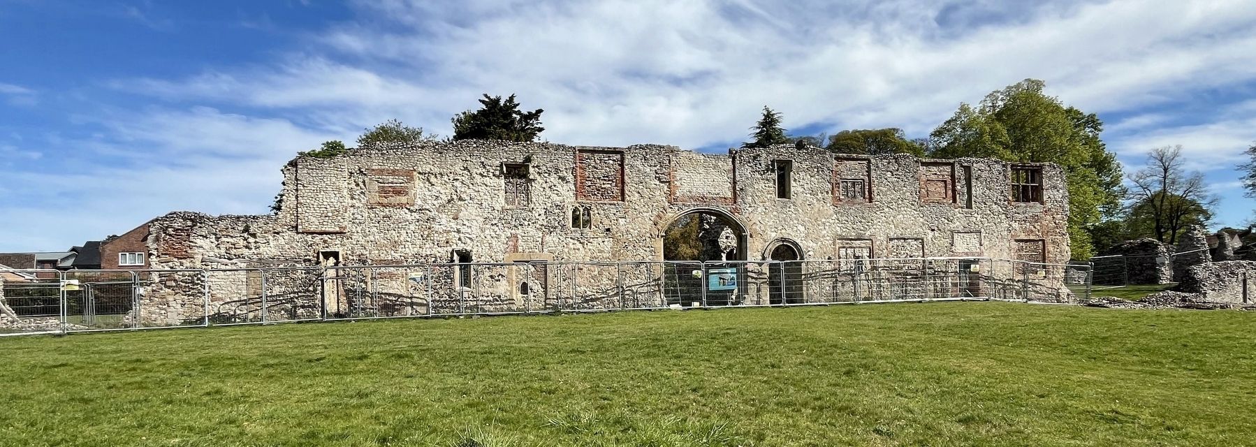
At Thetford the lodging of the superior or prior of the monastery stood to the west of the church and cloister. Over the course of the Middle Ages the prior's lodging evolved into a long, two-storey range. It incorporated its own chapel, a chamber and a hall.
The prior provided entertainment for guests or in celebration of important feasts. Surviving account books record the visit of King Henry VII in 1498-99, he was entertained by the waits of Norwich, who were paid I shilling and 4 pence for their performance.
Following the dissolution of the priory in 1540, the lodging continued to be occupied as a house for another two hundred years. During this period it underwent further alteration. By the 1820s, however, the building was a roofless ruin.
Beyond the lodging range is Abbey House, a large house built in the 19th century. The priory remains were incorporated into the grounds of the house as a romantic ruin.
Erected by English Heritage.
Topics. This historical marker is listed in this topic list: Religion & Religious Structures.
Location. 52° 24.991′ N,
this page online

Regionally, this marker is in East Anglia. Globally, it is on the Atlantic Ocean, in the North Atlantic Region, in Europe, in Atlantic Europe, on one of the British Isles, in the Western World, and in the Anglosphere. Historically, it finds itself in what was once the Roman Empire.
Other nearby markers. At least 8 other markers are within walking distance of this marker: The Refectory (within shouting distance of this marker); The Abbey before the Dissolution (within shouting distance of this marker); Thetford Priory - The Church and Nave (within shouting distance of this marker); Thetford Priory (about 150 meters away, measured in a direct line); Angles Way (approx. 0.4 kilometers away); St. Peter's Church (approx. 0.4 kilometers away); Captain Mainwaring's Statue (approx. 0.4 kilometers away); Famous Scripts - Fact and Fiction (approx.
Photographed by Ray Gurganus, April 24, 2026
2. Thetford Priory Ruins
Credits. This page was last revised on October 21, 2026. It was originally submitted on October 20, 2026, by Ray Gurganus of Washington, District of Columbia. This page has been viewed 5 times since then. Photos: 1, 2. submitted on October 20, 2026, by Ray Gurganus of Washington, District of Columbia. • Andrew Ruppenstein was the editor who published this page.
Editor’s want-list for this marker. photo of the marker within its surroundings • Can you help?
