Thetford in Norfolk, England, United Kingdom — Northwestern Europe (the British Isles)
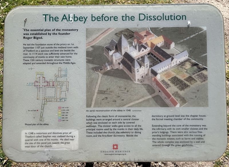
The Abbey before the Dissolution
Photographed by Ray Gurganus, April 24, 2026
1. The Abbey before the Dissolution Marker
He laid the foundation stone of the priory on 1st September 1107 just outside the medieval town walls of Thetford on a spacious and level site beside the river. In 1114 work was sufficiently advanced for the community of monks to enter their new home. These 12th century monastic structures were adapted and extended throughout the Middle Ages.
In 1248 a notorious and dissolute prior of Thetford called Stephen was stabbed during a quarrel with one of his monks. He died near the site of this panel just outside the great west door of the church.
Following the classic form of monasteries, the buildings were arranged around a central cloister which was enclosed on each side by covered walkways. The cloister walks gave access to all the principal rooms used by the monks in their daily life.. These included the church, the refectory or dining room, and the first-floor dormitory. Beside the dormitory at ground level was the chapter house, the formal meeting chamber of the community.
Extending beyond the core of the monastery was the infirmary,
this page online
Erected by English Heritage.
Topics. This historical marker is listed in this topic list: Religion & Religious Structures. A significant historical year for this entry is 1107.
Location. 52° 25.016′ N, 0° 44.509′ E. Marker is in Thetford, England, in Norfolk. It can be reached from Abbey Green. On the grounds of Thetford Priory. Touch for map. Marker is at or near this postal address: 2 Abbey Green, Thetford, England IP24 1BX, United Kingdom. Touch for directions.

Regionally, this marker is in East Anglia. Globally, it is on the Atlantic Ocean, in the North Atlantic Region, in Europe, in Atlantic Europe, on one of the British Isles, in the Western World, and in the Anglosphere. Historically, it finds itself in what was once the Roman Empire.
Other nearby markers. At least 8 other markers are within walking distance of this marker: Thetford Priory - The Church and Nave
Photographed by Ray Gurganus, April 24, 2026
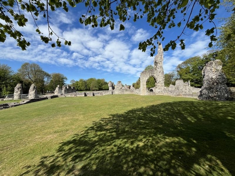
2. Thetford Priory Ruins
Credits. This page was last revised on October 21, 2026. It was originally submitted on October 20, 2026, by Ray Gurganus of Washington, District of Columbia. This page has been viewed 5 times since then. Photos: 1, 2. submitted on October 20, 2026, by Ray Gurganus of Washington, District of Columbia. • Andrew Ruppenstein was the editor who published this page.
Editor’s want-list for this marker. photo of the marker within its surroundings • Can you help?
