Kuniberts-Viertel in Köln, North Rhine-Westphalia, Germany — Central Europe
St. Kunibert
Photographed by James Hulse, October 6, 2026
1. St. Kunibert Marker

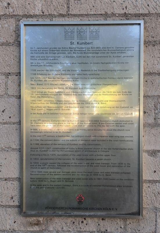
866 wird eine Gemeinschaft von Klerikern (Stift) bei der jetzt zunehmend St. Kunibert genannten Kirche urkundlich erwähnt.
Mitte des 11. Jahrhunderts Errichtung einer basilikalen, im Innern flachgedeckten Kirche mit dreiteiligem Westbau.
1106 werden der Stiftsbezirk und die Vorstadt Niederich in die Stadtbefestigung einbezogen.
1168 Erhebung der Gebeine Kuniberts und seine Heiligsprechung.
Um 1215–1247 Bau der heutigen dreitürmigen Kirche in spätstaufischen Formen; damit beendet St. Kunibert die romanische Bauepoche Kölns.
Nach Brand 1376 Wiederherstellung des Westturms mit gotischem Obergeschoss.
1802 Säkularisierung des Stifts, St. Kunibert wird Pfarrkirche.
1830 bringt ein Sturm Westturm und Westquerschiff zum Einsturz. Ab 1835 bis zum Ende des 19. Jahrhunderts erfolgen der Wiederaufbau des Westbaus und die Restaurierung der Kirche im Geist des Historismus.
1942–1945 schwerste Kriegsschäden: Erneut Einsturz von Westturm und Westquerschiff. Wiederaufbau der Ostteile und des Langhauses bis 1956 durch K. Band.
Neuaufbau von Westquerschiff und Westturm erst 1981–1993 in Anlehnung an den Zustand vor 1830 durch L. Hugot und O. Schwab.
In der Apsis und im östlichen Querhaus ein Zyklus farbiger romanischer Glasfenster der Zeit um 1220/30.
In the 7th century, Cologne’s Bishop Kunibert (approx.
this page online
In 866, a community of clerics (convent) was mentioned in documents about the church now increasingly referred to as St. Kunibert.
In the mid-11th century, a basilica-like, flat-ceilinged church with a tripartite west wing was erected.
In 1106, the convent district and the suburb of Niederich were included in the town fortifications.
In 1168, elevation of the remains of Kunibert and his canonization.
Around 1215–1247, construction of today’s three towered church in the late Hohenstaufen style; thus St. Kunibert ended the Romanesque epoch of architecture in Cologne.
Following a fire in 1376, restoration of the west tower with a Gothic upper floor.
In 1802, secularization of the convent, St. Kunibert became a parish church.
In 1830, a storm caused the collapse of the west tower and west transept. From 1835 to the end of the 19th century, followed the reconstruction of the west tower and restoration of the church in spirit of historicism.
1942–1945 most severe war damage: once more the west tower and west transept collapsed. Reconstruction of the eastern sections and the nave up to 1956 by K. Band.
New construction of the west transept and west tower only in 1981–1993 based on the condition before 1830 by L. Hugot and O. Schwab.
In the apse and in the eastern transept, there is a cycle of coloured Romanesque glass windows from the period around 1220/30.
Erected by Förderverein
Photographed by James Hulse, October 6, 2026
2. St. Kunibert Marker
Topics. This historical marker is listed in this topic list: Religion & Religious Structures.
Location. 50° 56.814′ N, 6° 57.755′ E. Marker is in Köln, Nordrhein-Westfalen (North Rhine-Westphalia). It is in Kuniberts-Viertel. It is on Kunibertsklostergasse 0.1 kilometers west of Konrad-Adenauer-Ufer, on the left when traveling west. Touch for map. Marker is at or near this postal address: Kunibertsklostergasse 2, Köln HE 50668, Germany. Touch for directions.

Regionally, this marker is in the German Rhineland. Globally, it is in Europe, the European Union, Atlantic Europe, Central Europe, the Schengen Area, Western Europe, and the Western World. Historically, it finds itself in what was once the Roman Empire, the Holy Roman Empire, the Hanseatic League, and the former West Germany.
Other nearby markers. At least 8 other markers are within walking distance of this marker: Historisches Baudenkmal (about 150 meters away, measured in a direct line); Dr. Kurt Ehrlich (approx. 0.3 kilometers away); Hermann Buscher (approx. 0.3 kilometers away); Käthe Buscher (approx. 0.3 kilometers away); Paula Rosenberg (approx. 0.3 kilometers away); Siegfried Rosenberg (approx. 0.3 kilometers away); Dora Cohen (approx. 0.4 kilometers away); Friedrich von Spee S.J. (approx. 0.6 kilometers away). Touch for a list and map of all markers in Köln.
Photographed by James Hulse, October 6, 2026
3. St. Kunibert Marker
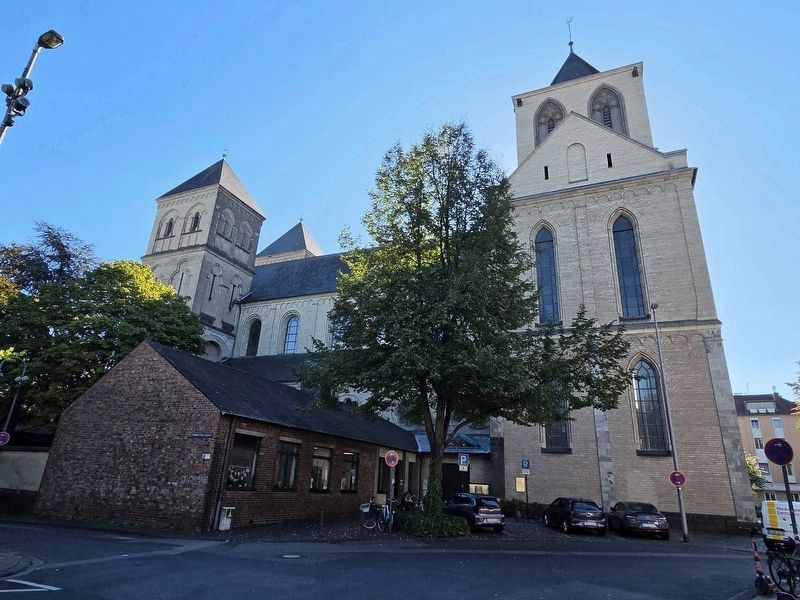
The view of the basilica from the north side.
Photographed by James Hulse, October 6, 2026
4. St. Kunibert Marker
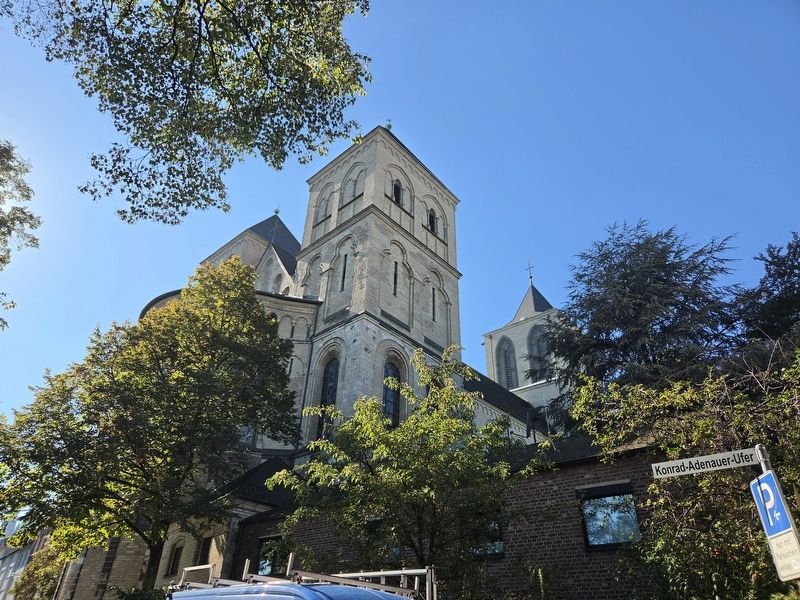
The view of the basilica from the east side near the river.
Credits. This page was last revised on October 23, 2026. It was originally submitted on October 22, 2026, by James Hulse of Medina, Texas. This page has been viewed 4 times since then. Photos: 1, 2, 3, 4. submitted on October 23, 2026, by James Hulse of Medina, Texas.
