Burritts Rapids in Ottawa, Ontario — Central Canada (North America)
Christ Church
Photographed by William Fischer, Jr., October 11, 2026
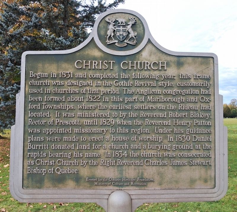
1. Christ Church Marker
Begun in 1831 and completed the following year this frame church was designed in the Gothic Revival style, customarily used in churches of that period. The Anglican congregation had been formed about 1822 in this part of Marlborough and Oxford Townships, where the earliest settlers on the Rideau had located. It was ministered to by the Reverend Robert Blakey, Rector of Prescott, until 1829 when the Reverend Henry Patton was appointed missionary to this region. Under his guidance plans were made to erect a house of worship. In 1830 Daniel Burritt donated land for a church and a burying ground at the rapids bearing his name. In 1834 the church was consecrated as Christ Church by the Right Reverend Charles James Stewart Bishop of Quebec.
Erected by Ontario Heritage Foundation.
Topics and series. This historical marker is listed in these topic lists: Religion & Religious Structures • Settlements & Settlers. In addition, it is included in the Canada, Ontario Heritage Trust series list. A significant historical year for this entry is 1834.
Location. 44° 59.021′ N, 75° 47.913′ W. Marker is in Ottawa, Ontario.
this page online

Regionally, this marker is in Central Canada. Globally, it is in North America, the Western Hemisphere, the Western World, and the Anglosphere. Historically, it finds itself in what was once a British colony, the Viceroyalty of New France, the Haudenosaunee (Iroquois) Confederacy, and Rupert’s Land.
Other nearby markers. At least 8 other markers are within 8 kilometers of this marker, measured as the crow flies: The Pioneers Who Built Christ Church (a few steps from this marker); Founding of Merrickville (approx. 8 kilometers away); Blockhaus de Merrickville Blockhouse (approx. 8.1 kilometers away); The Merrickville Blockhouse / Le blockhaus de Merrickville (approx. 8.1 kilometers away); Merrickville United Church (approx. 8.1 kilometers away); Merrickville (approx. 8.1 kilometers away); Merrickville Blockhouse 1832 (approx. 8.1 kilometers away); Twin Canals / Les canaux jumelés
Photographed by William Fischer, Jr., October 11, 2026
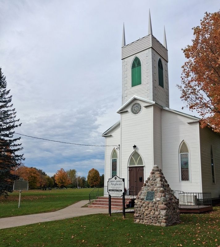
2. Christ Church and Marker
Credits. This page was last revised on October 22, 2026. It was originally submitted on October 22, 2026, by William Fischer, Jr. of Reynoldsburg, Ohio. This page has been viewed 11 times since then. Photos: 1, 2. submitted on October 22, 2026, by William Fischer, Jr. of Reynoldsburg, Ohio.
