Liverpool in Merseyside, England, United Kingdom — Northwestern Europe (the British Isles)
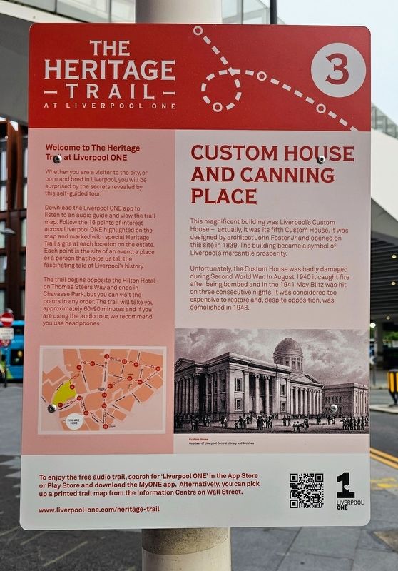
Custom House and Canning Place
| — | The Heritage Trail at Liverpool ONE | — |
Photographed by Ian Lefkowitz, September 13, 2026
1. Custom House and Canning Place Marker
Unfortunately, the Custom House was badly damaged during Second World War. In August 1940 it caught fire after being bombed and in the 1941 May Blitz was hit on three consecutive nights. It was considered too expensive to restore and, despite opposition, was demolished in 1948.
(Captions)
Custom House
Courtesy of Liverpool Central Library and Archives
Welcome to The Heritage Trail at Liverpool One
Whether you are a visitor to the city, or born and bred in Liverpool, you will be surprised by the secrets revealed by this self-guided tour.
Download the Liverpool One app to listen to an audio guide and view the trail map. Follow the 16 points of interest across Liverpool One highlighted on the map and marked with special Heritage Trail signs at each location on the estate. Each point is the site of an event, a place or a person that helps us tell the fascinating tale of Liverpool’s history.
The
this page online
Erected by Liverpool ONE. (Marker Number 3.)
Topics. This historical marker is listed in these topic lists: Architecture • Industry & Commerce • War, World II. A significant historical year for this entry is 1839.
Location. 53° 24.145′ N, 2° 59.229′ W. Marker is in Liverpool, England, in Merseyside. It is at the intersection of Canning Place and Custom House Place, on the left when traveling east on Canning Place. Touch for map. Marker is at or near this postal address: 1 Canning Pl, Liverpool, England L1 8LZ, United Kingdom. Touch for directions.

Regionally, this marker is in North West England. Globally, it is on the Atlantic Ocean, in the North Atlantic Region, in Europe, in Atlantic Europe, on one of the British Isles, in the Western World, and in the Anglosphere. Historically, it finds itself in what was once the Roman Empire.
Other nearby markers. At
Photographed by Ian Lefkowitz, September 13, 2026
2. Custom House and Canning Place Marker
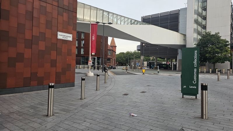
The marker is located at the site of the former Custom House.
Also see . . . Custom House, Liverpool (Wikipedia).
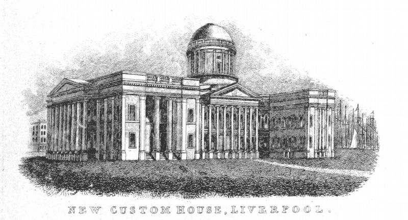
The Custom House was a 19th-century Neo-classical building located in Liverpool, England. It housed a post office, dock office, and offices for Customs and Excise. It was built on the site of the historic Old Dock in 1839 and operated up to World War II when it was partly destroyed during the Liverpool Blitz, then finally demolished in 1948. Today the area which formed the base of the building makes up part of the Liverpool One shopping complex.(Submitted on October 23, 2026, by Ian Lefkowitz of New York, New York.)
Mechanical Curator collection
3. Custom House, 1842
Credits. This page was last revised on October 24, 2026. It was originally submitted on October 23, 2026, by Ian Lefkowitz of New York, New York. This page has been viewed 6 times since then. Photos: 1, 2, 3. submitted on October 23, 2026, by Ian Lefkowitz of New York, New York. • Andrew Ruppenstein was the editor who published this page.
