Northwestern Precinct in Saint Paul in Ramsey County, Minnesota — The American Midwest (Upper Plains)
Service & Sacrifice
Photographed by McGhiever, September 28, 2025
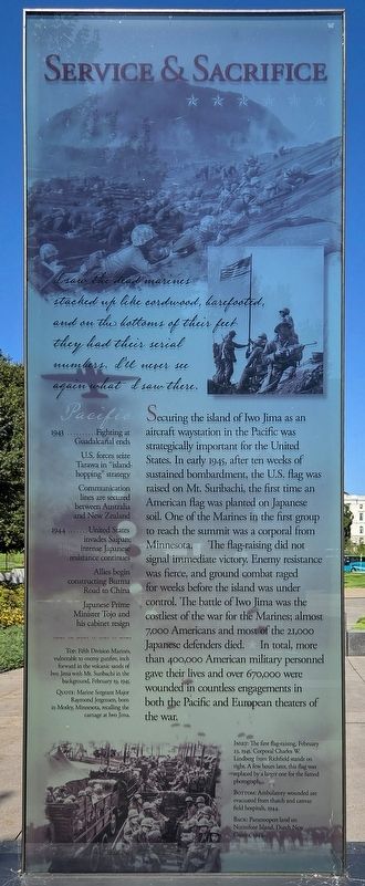
1. Service & Sacrifice Marker
I saw the dead marines stacked up like cordwood, barefooted, and on the bottoms of their feet they had their serial numbers. I'll never see again what I saw there.
Securing the island of Iwo Jima as an aircraft waystation in the Pacific was strategically important for the United States. In early 194, after ten weeks of sustained bombardment, the U.S. flag was raised on Mt. Suribachi, the first time an American flag was planted on Japanese soil. One of the Marines in the first group to reach the summit was a corporal from Minnesota. ★ The flag-raising did not signal immediate victory. Enemy resistance was fierce, and ground combat raged for weeks before the island was under control. The battle of Iwo Jima was the costliest of the war for the Marines; almost 7,000 Americans and most of the 21,000 Japanese defenders died. ★ In total, more than 400,000 American military personnel gave their lives and over 670,000 were wounded in countless engagements in both the Pacific and European theaters of the war.
Pacific
1943:
· Fighting at Guadalcanal ends
· U.S. forces seize Tarawa in "island-hopping" strategy
· Communication lines are secured between Australia and New Zealand
1944:
· United States invades Saipan; intense Japanese resistance continues
· Allies begin constructing Burma Road to China
· Japanese Prime Minister Tojo and his cabinet resign
Top: Fifth Division Marines, vulnerable to enemy gunfire, inch forward in the volcanic sands of Iwo Jima with Mt. Suribachi in the background, February 19, 1945.
Quote: Marine Sergeant Major Raymond Jergensen, born in Motley, Minnesota, recalling the carnage at Iwo Jima.
Inset: The first flag-raising, February 23, 1945. Corporal Charles W. Lindberg from Richfield stands on the right. A few hours later, this flag was replaced by a larger one for the famed photograph.
Bottom: Ambulatory wounded are evacuated from thatch and canvas field hospitals, 1944.
Back: Paratroopers land on Noemfoor Island, Dutch New Guinea, 1944.
Erected 2007
this page online
Topics. This historical marker is listed in this topic list: War, World II. A significant historical year for this entry is 1943.
Location. 44° 57.123′ N, 93° 6.144′ W. Marker is in Saint Paul, Minnesota, in Ramsey County. It is in Northwestern Precinct. It can be reached from W. 12th Street. The marker is centered on the west side of the Minnesota World War II Memorial on the Capitol Mall. Touch for map. Marker is in this post office area: Saint Paul MN 55155, United States of America. Touch for directions.

Regionally, this marker is in the Twin Cities Metropolitan Area. It is also in the American Midwest, in the Corn Belt, and in the Great River Road Region. Globally, it is in North America, the Western Hemisphere, the Western World, and the Anglosphere. Historically, it finds itself in what was once Rupert’s Land, the territory of the Mississippian Culture, and the Louisiana Purchase.
Other nearby markers. At least 8 other markers are within walking distance of this marker: Governor, Warrior, Peacemaker (here, next to this marker); The Cost of War (a few steps from this marker); The War at Home
Photographed by McGhiever, September 28, 2025
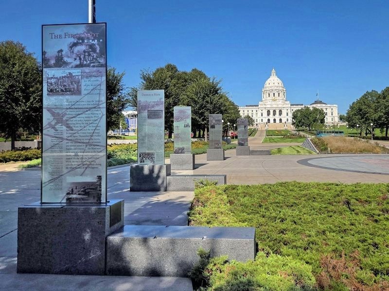
2. Service & Sacrifice Marker (third back) on the west side of the Minnesota WWII Memorial
Credits. This page was last revised on October 24, 2026. It was originally submitted on October 24, 2026, by McGhiever of Minneapolis, Minnesota. This page has been viewed 8 times since then. Photos: 1. submitted on October 24, 2026, by McGhiever of Minneapolis, Minnesota. 2. submitted on July 23, 2026, by McGhiever of Minneapolis, Minnesota.
