Beezley Trailhead in Ephrata in Grant County, Washington — The American West (Northwest)
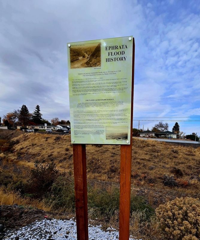
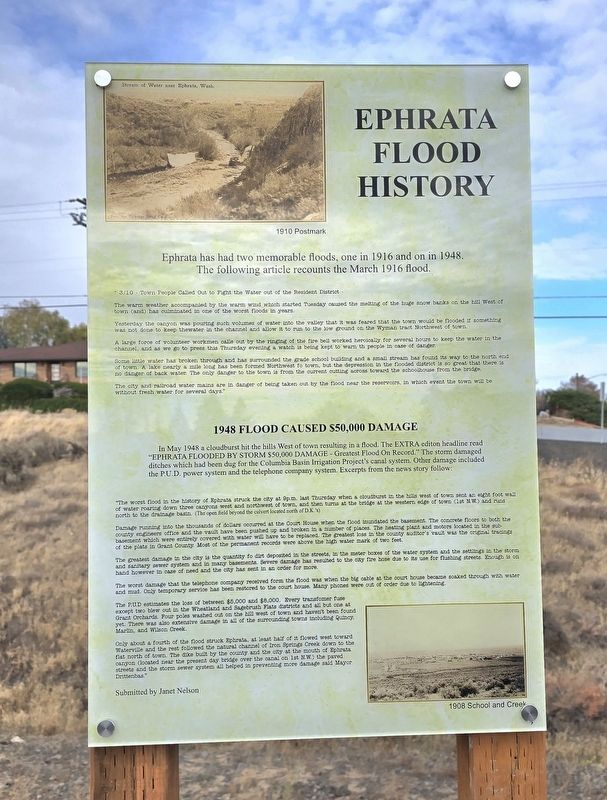
Ephrata Flood History
Photographed by Shirley A Stirling, October 24, 2026
1. Ephrata Flood History Marker
3/10 Town People Called out to Fight the Water out of the Resident District.1948 Flood Caused $50,000 Damage
The warm weather accompanied by the warm wind which started Tuesday caused the melting of the huge snow banks on the hill West of town (and) has culminated in one of the worst foods in years.
Yesterday the canyon was pouring such volumes of water into the valley that was feared that the town would be flooded if something was not done to keep the water in the channel and allow it to run to the low ground on the Wyman tract Northwest of town.
A large force of volunteer workmen called out by the ringing of the fire bell worked heroically for several hours to keep the water in the channel and as we go to press this Thursday evening watch is being kept to warn the people in case of danger.
Some little water has broken through and has surrounded the grade school building and a small stream has found the way to the north end of town. A lake nearly a mile long has been formed Northwest to town, but the depression inthe flooded district is so great that there is no danger of back water. The only danger to the town is from the current cutting across toward the schoolhouse from the bridge.
Click or scan to see
this page online
The city and railroad water mains are in danger of being taken out by the food near the reservoirs, in which event the town will be without freshwater for several days."
In May 1948 a cloudburst hit the hills West of town resulting in a flood. The Extra edition headline read, "Ephrata Flooded by Storm $50,000 Damage - Greatest Flood On Record." The storm damaged ditches which had been dug for the Columbia Basin Irrigation Project's canal system. Other damage included the P.U.D. power system and the telephone company system. Excerpts from the news story follow:
"The worst flood in the history of Ephrata struck the city at 9 p.m. last Thursday when a cloudburst in the hills west of town sent an eight foot wall of water roaring down three canyons west and northwest of town, and then turns at the bridge at the western edge of town (1st N.W.) and runs north to the drainage basin. (The open field beyond the culvert locatednorth of D.K.s)Photographed by Shirley A Stirling, October 24, 20262. Wide View of Ephrata Flood History Marker
Damage running into the thousands of dollars occurred at the Court House when the flood inundated the basement. The concrete floors to both the county engineers office and the vault have been pushed up and broken in a number of places. The heating plant and motors located in the sub-basement which were entirely covered with water will have to be replaced. The greatest loss in the county auditor's vault was the original tracings of the plats in Grant County. Most of the permanent records were above the high water mark of two feet.
The greatest damage in the city is the quantity of dirt deposited in the streets, in the meter boxes of the water system and the settings in the storm and sanitary sewer system and in many basements. Severe damage has resulted to the city fire hose due to its use for flushing streets. Enough is on hand however in case of need and the city has set in an order for more.
The worst damage that the telephone company received from the flood was when the big cable at the court house became soaked through with water and mud. Only temporary service has been restored to the court house. Many phones were out of order due to lightening.
The P.U.D. estimates the loss of between $5,000 and $8,000. Every transformer fuse except two blew out in the Wheatland and Sagebrush Flats districts and all but one at Grant Orchards. Four poles washed out on the hill west of town and haven't been found yet. There was also extensive damage in all of the surrounding towns including Quincy, Martin, and Wilson Creek.
Only about a fourth of the flood struck Ephrata, at least half of it flowed west toward Waterville and the rest followed the natural channel of Iron Springs Creek down to the flat north of town. The dike built by the county and the city at the mouth of Ephrata canyon (located near the present day bridge over the canal on 1st N.W.) the paved streets and the storm sewer system all helped in preventing more damage said Mayor Drittenbaus.
Submitted by Janet Nelson
Erected 2026 by by Michael Scellick with installation by Don Bean and production by Purple Coyote.
Topics. This historical marker is listed in this topic list: Disasters. A significant historical date for this entry is March 10, 1916.
Location. 47° 19.402′ N, 119° 33.527′ W. Marker is in Ephrata, Washington, in Grant County. It is in Beezley Trailhead. It is at the intersection of 1st Avenue and Cyrus Road, on the right when traveling east on 1st Avenue. Near St. John the Baptist Episcopal Church. Touch for map. Marker is at or near this postal address: 750 1st Avenue NW, Ephrata WA 98823, United States of America. Touch for directions.
Regionally, this marker is in the Columbia Basin. It is also in the American Mountain West and in the Lewis & Clark Corridor. Globally, it is in North America, on the Pacific Rim, in the Western Hemisphere, in the Western World, and in the Anglosphere.
Other nearby markers. At least 8 other markers are within walking distance of this marker: Swimming/Ice Skating Floods (here, next to this marker); Springs and Streams in Canyon Made Ephrata an Oasis (here, next to this marker); The Liberty Bell in Ephrata (a few steps from this marker); Camp Tuc-Ta-Hyaspum (a few steps from this marker); Gladys Fuller Washington (within shouting distance of this marker); South East Asian War Memorial (approx. 0.3 miles away); Early Days in Ephrata (approx. 0.3 miles away); Nat House (approx. 0.3 miles away). Touch for a list and map of all markers in Ephrata.
Credits. This page was last revised on November 4, 2026. It was originally submitted on October 25, 2026, by Shirley A Stirling of Lacey, Washington. This page has been viewed 18 times since then. Photos: 1, 2. submitted on October 25, 2026, by Shirley A Stirling of Lacey, Washington. • Andrew Ruppenstein was the editor who published this page.