Port Melbourne in Port Phillip, Victoria, Australia — Oceania
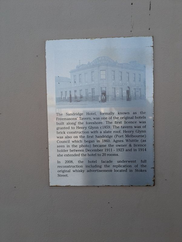
The Sandridge Hotel
Photographed by Dean Barton-Ancliffe, September 29, 2026
1. The Sandridge Hotel Marker
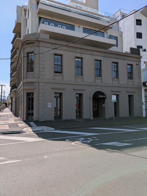
In 2008, the hotel facade underwent full reconstruction including the replication of the original whisky advertisement located in Stokes Street.
Topics. This historical marker is listed in these topic lists: Architecture • Industry & Commerce. A significant historical year for this entry is 1859.
Location. 37° 50.509′ S, 144° 56.16′ E. Marker is in Port Melbourne, Victoria, in Port Phillip. It is at the intersection of Beach Street and Stokes Street, on the left when traveling east on Beach Street. Touch for map. Marker is at or near this postal address: 71 Beach Street, Port Melbourne VIC 3207, Australia. Touch for directions.

Regionally, it is in Oceania,
this page online
Other nearby markers. At least 8 other markers are within walking distance of this marker: World War I Rotunda Memorial Port Melbourne (within shouting distance of this marker); Windsor Train Disaster of 1887 (about 90 meters away, measured in a direct line); The Liardet Memorial (about 120 meters away); Centenary Bridge Pillar (about 150 meters away); War Memorial Port Melbourne (about 180 meters away); Great War Drinking Fountain Memorial Port Melbourne (about 180 meters away); Port Melbourne Foreshore (about 210 meters away); Sandridge Town Pier (about 240 meters away). Touch for a list and map of all markers in Port Melbourne.
Also see . . . Sandridge. Victorian Places
Sandridge was the name of the locality at the head of Hobsons Bay where colonial passengers disembarked to journey across the sandy land between there and the Yarra River, Melbourne. It is now known as Port Melbourne.(Submitted on October 25, 2026, by Dean Barton-Ancliffe of Rowville, Victoria.)
The name Sandridge was given by a surveyor,William Darke, in 1839, after the ridge of sand dunes along the beach. Darke marked a track to the infant Melbourne settlement for travellers and settlers.Photographed by Dean Barton-Ancliffe, September 29, 20262. The Sandridge Hotel
Apart from Liardet’s Pier Hotel there were few other buildings at Sandridge for several years. In 1849 some township allotments were marked out and Sandridge was defined by six blocks west of the lagoon (now the Esplanade). There was a government jetty at the end of Bay Street, near the Pier Hotel.
After the influx of goldfields, population at Sandridge grew quickly to about 2000 inhabitants in 1854, and its boundaries expanded westwards and northwards to Raglan Street. Agitation began for separation from the Melbourne City Council, but a hiatus was reached when Sandridge was made a separate ward in 1856 that returned its own councillors. Eventually the agitation was successful and on 13 July 1860, Sandridge borough was proclaimed. The name continued until 25 January 1884, when the borough was renamed Port Melbourne.
Sandridge survives as the name of a local lifesaving club and as the name of some local businesses.
Credits. This page was last revised on October 25, 2026. It was originally submitted on October 25, 2026, by Dean Barton-Ancliffe of Rowville, Victoria. This page has been viewed 10 times since then. Photos: 1, 2. submitted on October 25, 2026, by Dean Barton-Ancliffe of Rowville, Victoria. • Andrew Ruppenstein was the editor who published this page.
