South Hill in Mecklenburg County, Virginia — The American South (Mid-Atlantic)
South Hill
Photographed by Donald B. Caselli (Barry), October 25, 2026
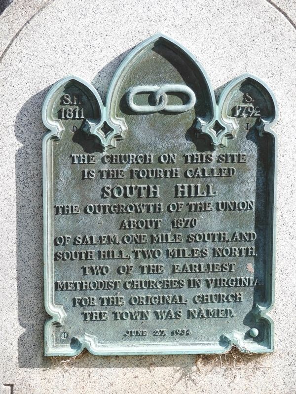
1. The church on this site Marker
S.H. 1811 • S. 1792
The church on this site is the fourth called South Hill The outgrowth of the union about 1870 of Salem, one mile south, and South Hill, two miles north, two of the earliest Methodist churches in Virginia. For the original church, the town was named.
June 27, 1934
Topics. This historical marker is listed in these topic lists: Religion & Religious Structures • Settlements & Settlers. A significant historical date for this entry is June 27, 1934.
Location. 36° 43.657′ N, 78° 7.695′ W. Marker is in South Hill, Virginia, in Mecklenburg County. It is at the intersection of Mecklenburg Avenue (U.S. 1) and Franklin Street, on the right when traveling north on Mecklenburg Avenue. Touch for map. Marker is at or near this postal address: 210 N Mecklenburg Ave, South Hill VA 23970, United States of America. Touch for directions.

Regionally, this marker is in Southern Virginia, specifically in the Piedmont, in Southside Virginia, and specifically in Central Virginia. It is also in the American South and specifically in the Upper South. Globally, it is in North America, the Western Hemisphere, the Western
this page online
Other nearby markers. At least 8 other markers are within 7 miles of this marker, measured as the crow flies: A different marker also named South Hill (approx. 0.2 miles away); Veterans Memorial Park (approx. 0.2 miles away); Mecklenburg County Training School (approx. 0.3 miles away); Salem Chapel (approx. 0.4 miles away); Town of La Crosse (approx. 2.6 miles away); Mecklenburg County / Brunswick County (approx. 5½ miles away); Brunswick County / Mecklenburg County (approx. 6.2 miles away); Broadnax (approx. 6.2 miles away). Touch for a list and map of all markers in South Hill.
Also see . . . South Hill United Methodist Church. (Submitted on October 29, 2026.)
Photographed by Donald B. Caselli (Barry), October 25, 2026
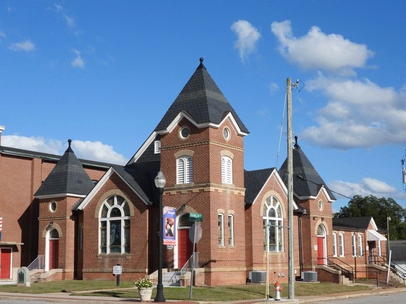
2. This is the church discussed on the marker.
The marker can be seen at the bottom left of the photo.
Credits. This page was last revised on October 29, 2026. It was originally submitted on October 28, 2026, by Donald B. Caselli (Barry) of Hopewell, Virginia. This page has been viewed 11 times since then. Photos: 1, 2. submitted on October 28, 2026, by Donald B. Caselli (Barry) of Hopewell, Virginia. • Bernard Fisher was the editor who published this page.
