Saint Kilda West in Port Phillip, Victoria, Australia — Oceania
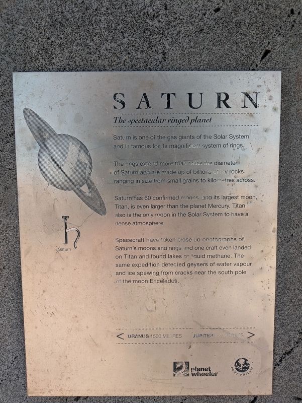
Saturn
The spectacular ringed planet
| — | Solar System Trail | — |
Photographed by Dean Barton-Ancliffe, September 29, 2026
1. Saturn Marker
The rings extend more than twice the diameter of Saturn and are made up of billions of icy rocks ranging in size from small grains to kilometres across.
Saturn has 60 confirmed moons, and its largest moon, Titan, is even larger than the planet Mercury. Titan also is the only moon in the Solar System to have a dense atmosphere.
Spacecraft have taken close up photographs of Saturn's moons and rings and one craft even landed on Titan and found lakes of liquid methane. The same expedition detected geysers of water vapour and ice spewing from cracks near the south pole of the moon Enceladus.
< Uranus 1500 Metres - Jupiter 622 Metres > (Marker Number 7.)
Topics and series. This historical marker is listed in these topic lists: Air & Space • Exploration. In addition, it is included in the Melbourne Solar System Trail series list. A significant historical year for this entry is 1500.
Location. 37° 51.58′ S, 144° 58.167′ E. Marker is in Saint Kilda West, Victoria, in Port Phillip. It is on Pier Road 0.1 kilometers
this page online

Regionally, it is in Oceania, in Australasia, in the Pacific Ocean, in South Pacific, on the Pacific Rim, in the Western World, and in the Anglosphere. Historically, it finds itself in what was once a British colony.
Other nearby markers. At least 8 other markers are within walking distance of this marker: The Great War and World War II - St Kilda (approx. 0.4 kilometers away); Sir William Rooke Creswell (approx. 0.4 kilometers away); Crew of the H.M.S. Endeavour (approx. half a kilometer away); A most resolute lady (approx. 0.6 kilometers away); Jupiter (approx. 0.8 kilometers away); Catani Archway (approx. 0.9 kilometers away); Blackie-Ironmonger Stand (approx. one kilometer away); Great Scenic Railway (approx. 1.1 kilometers away).
Regarding Saturn. Although the marker is somewhat light on detail, the exploratory mission mentioned in the last paragraph of the marker is that of the Cassini-Huygens
Photographed by Dean Barton-Ancliffe, September 29, 2026
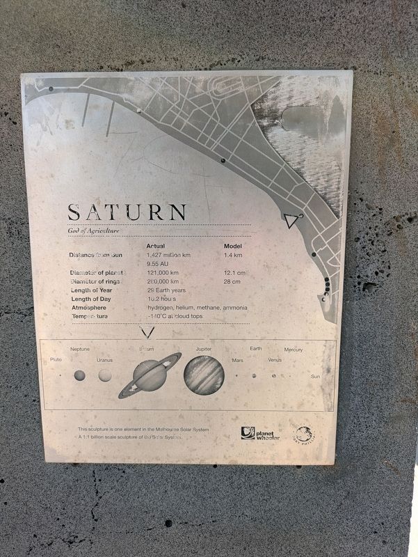
2. Saturn Marker Side Plaque
Also see . . . Solar System Trail. Walks in Port Phillip
Navigate the solar system from the sun to the outer planets by following the bike and walking trail on the City of Port Phillip’s foreshore.(Submitted on October 28, 2026, by Dean Barton-Ancliffe of Rowville, Victoria.)
In 2008 artists and scientists constructed a model of our solar system to a scale of one to one billion between St Kilda and Port Melbourne. Instead of navigating 4.5 billion kilometres from the sun to Neptune, and 5.9 billion kilometres from the sun to Pluto, you only travel 4.5 kilometres and 5.9 kilometres.
The foreshore has always been a superb location to view the sun setting on the western horizon. Port Phillip Bay’s crescent shape is perfect for a model where the ‘sun’ can be viewed from every one of the nine model locations.
Photographed by Dean Barton-Ancliffe, September 29, 2026
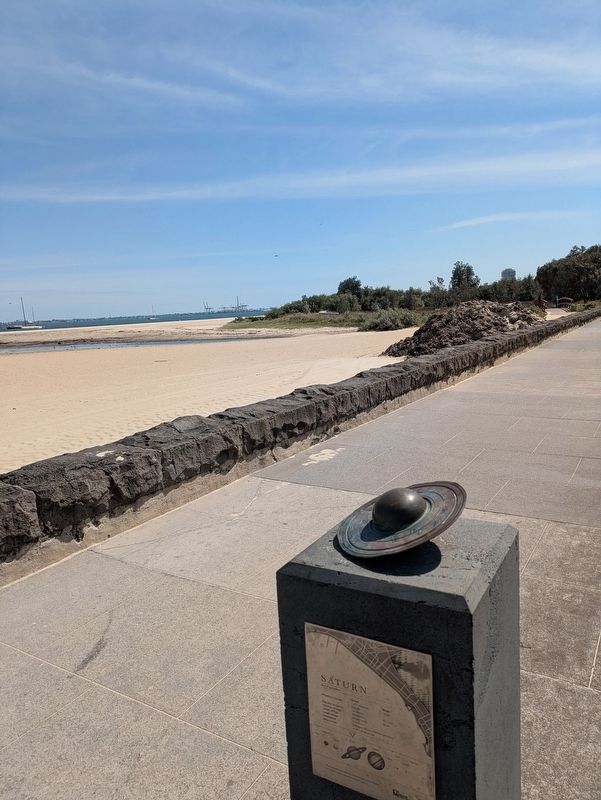
3. Saturn Marker along the foreshore
Credits. This page was last revised on November 6, 2026. It was originally submitted on October 28, 2026, by Dean Barton-Ancliffe of Rowville, Victoria. This page has been viewed 19 times since then. Photos: 1, 2, 3. submitted on October 28, 2026, by Dean Barton-Ancliffe of Rowville, Victoria. • Andrew Ruppenstein was the editor who published this page.
