Havelock-Belmont-Methuen in Peterborough County, Ontario — Central Canada (North America)
Township of Havelock-Belmont-Methuen
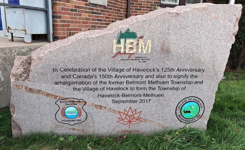
Photographed by William Fischer, Jr., October 9, 2026
1. Township of Havelock-Belmont-Methuen Marker
In Celebration of the Village of Havelock's 125th Anniversary
and Canada's 150th Anniversary and also to signify the
amalgamation of the former Belmont Methuen Township and the
Village of Havelock to form the Township of
Havelock-Belmont-Methuen
September 2017
Erected 2017 by Township of Havelock-Belmont-Methuen.
Topics. This historical marker is listed in this topic list: Government & Politics. A significant historical year for this entry is 1867.
Location. 44° 26′ N, 77° 53.111′ W. Marker is in Havelock-Belmont-Methuen, Ontario, in Peterborough County. It is at the intersection of Ottawa Street East (National Highway 7) and Oak Street, on the left when traveling east on Ottawa Street East. Marker is in front of the Havelock-Belmont-Methuen Municipal Office, on the Trans-Canada Highway. Touch for map. Marker is at or near this postal address: 1 Ottawa Street East, Havelock-Belmont-Methuen ON K0L 1Z0, Canada. Touch for directions.

Regionally, this marker is in the Kawarthas Northumberland Area and in Eastern Ontario. It is also in Central Canada. Globally, it is in North America, the Western Hemisphere,
this page online
Other nearby markers. At least 8 other markers are within 18 kilometers of this marker, measured as the crow flies: Seabrook Historical Monument (about 180 meters away, measured in a direct line); World Wars Memorial (approx. 9.5 kilometers away); Hastings Cenotaph (approx. 14.9 kilometers away); The Founding of Hastings (approx. 15.2 kilometers away); Founders of Campbellford (approx. 15.4 kilometers away); Trent-Severn Waterway National Historic Site of Canada (approx. 15.5 kilometers away); Old Mill Park (approx. 15.5 kilometers away); a different marker also named World Wars Memorial (approx. 16.8 kilometers away).
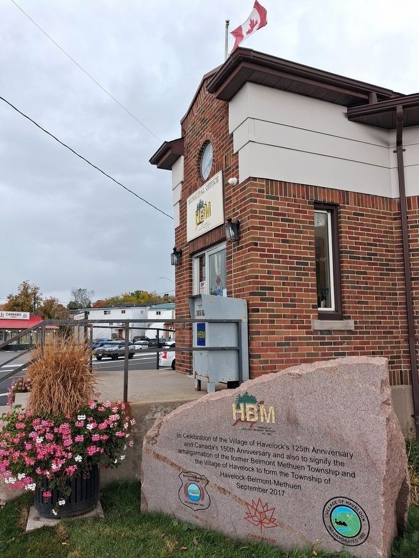
Photographed by William Fischer, Jr., October 9, 2026
2. Township of Havelock-Belmont-Methuen Marker
Credits. This page was last revised on October 28, 2026. It was originally submitted on October 28, 2026, by William Fischer, Jr. of Reynoldsburg, Ohio. This page has been viewed 10 times since then. Photos: 1, 2. submitted on October 28, 2026, by William Fischer, Jr. of Reynoldsburg, Ohio.
