Chorlton-on-Medlock in Manchester in Greater Manchester, England, United Kingdom — Northwestern Europe (the British Isles)
Main Library
Photographed by Ian Lefkowitz, September 14, 2026
1. Main Library Marker
The Arts Library
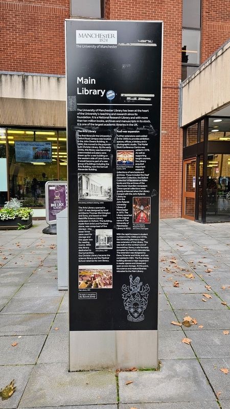
The first library at the University’s Oxford Road campus was located in the John Owens Building. In 1898, this moved to the purpose-built Christie Library. By the early 1930s, this library was becoming overcrowded and plans were drawn up for a new building on the western side of Lime Grove. It would become part of a new group of buildings including the Arts Building, now the Samuel Alexander Building.
The Arts Library opened in 1937. It was designed by local architects Thomas Worthington and Sons, and based on their Radcliffe Science Library extension in Oxford. The building, made from brick and Portland stone, was comprised of five storeys — the lower three were used for storage and the upper two for reading rooms. With this library dedicated to the humanities, the Christie Library became the science library and the Medical School retained its own library.
Post-war expansion
Further extensions were added in the 1950s to provide exhibition spaces, offices, a bindery and a photographic studio. The Muriel Stott Conference Centre was added in 1978. As well as supporting taught courses, the Library acquired important research collections of rare books and archives. These included the Deaf Education Collection, the Bullock Collection of Renaissance Italian books and the archives of the Manchester Guardian newspaper. These special collections were greatly enhanced when the Library merged with the John Rylands Library to form the John Rylands University Library of Manchester in 1972. The Library reverted to its original
this page online
With the rapid increase in student numbers in the 1960s and 1970s, the University planned a major new extension of the Library. This was built on the northern end of the existing Library, a site formerly occupied by chemistry laboratories. The extension was designed by Dane, Scherrer and Hicks, and was completed in 1981. The five-storey building allowed a major expansion in reader spaces and closed and open access storage. At this point, the science and medical libraries relocated to the Main Library.
(Captions)
Arts Library, architect’s drawing, 1930s
Arts Library, 1937
Main Library, 1981
Muriel Stott Conference Centre, 1978
The John Rylands Research Institute and Library, Deansgate
Erected by The University of Manchester.
Topics. This historical marker is listed in these topic lists: Arts, Letters, Music • Education. A significant historical year for this entry is 1937.
Location. 53° 27.876′ N, 2° 14.107′ W. Marker is in Manchester, England, in Greater Manchester. It is in Chorlton-on-Medlock. It is at the intersection of Oxford Road and Burlington Street, on the left when traveling
Photographed by Ian Lefkowitz, September 14, 2026
2. Main Library Marker
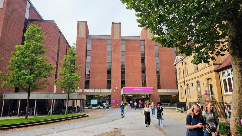
Main Library at the University of Manchester campus. The marker is located next to the library entrance.

Regionally, this marker is in North West England. Globally, it is on the Atlantic Ocean, in the North Atlantic Region, in Europe, in Atlantic Europe, on one of the British Isles, in the Western World, and in the Anglosphere. Historically, it finds itself in what was once the Roman Empire.
Other nearby markers. At least 8 other markers are within walking distance of this marker: The John Owens Building (about 90 meters away, measured in a direct line); The Christie Building (about 90 meters away); Peter Mark Roget (about 90 meters away); A.V. Hill (about 90 meters away); Coupland Building 3 (about 90 meters away); Samuel Alexander Building (about 90 meters away); Ellen Wilkinson (about 120 meters away); Anthony Burgess (about 120 meters away). Touch for a list and map of all markers in Manchester.
Also see . . . Main Library (The University of Manchester Library).
The Main Library is the largest library on campus and holds the principal collections for teaching and research in the humanities, education, law, medicine, science and the social sciences.(Submitted on October 31, 2026, by Ian Lefkowitz of New York, New York.)
Credits. This page was last revised on October 31, 2026. It was originally submitted on October 31, 2026, by Ian Lefkowitz of New York, New York. This page has been viewed 6 times since then. Photos: 1, 2. submitted on October 31, 2026, by Ian Lefkowitz of New York, New York. • Andrew Ruppenstein was the editor who published this page.
